Trip Report
Selah Ridge — Saturday, May. 6, 2017
Type of Hike
Day hikeTrail Conditions
Trail in good conditionRoad
Road suitable for all vehiclesBugs
No bugsSnow
Snow free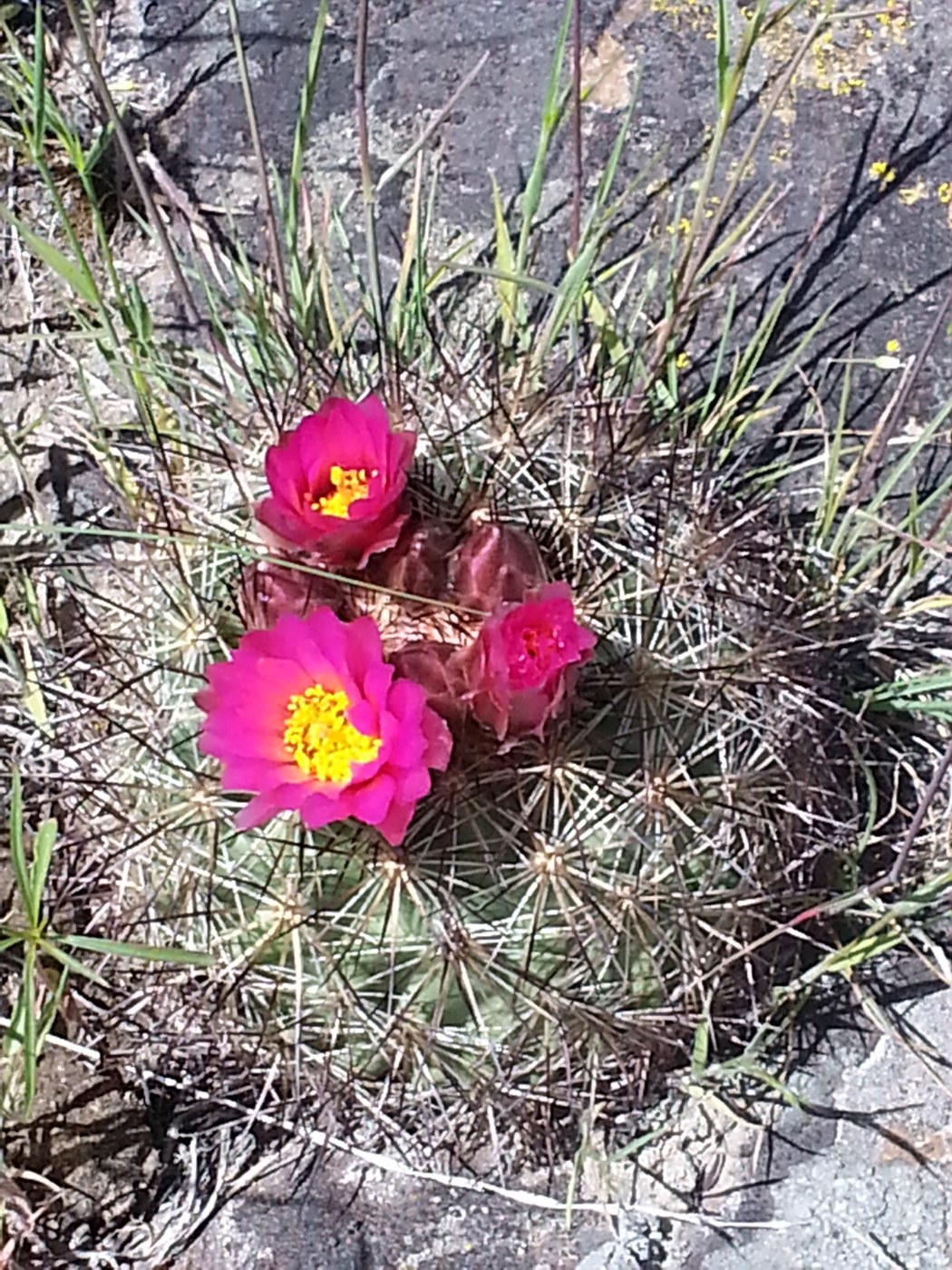
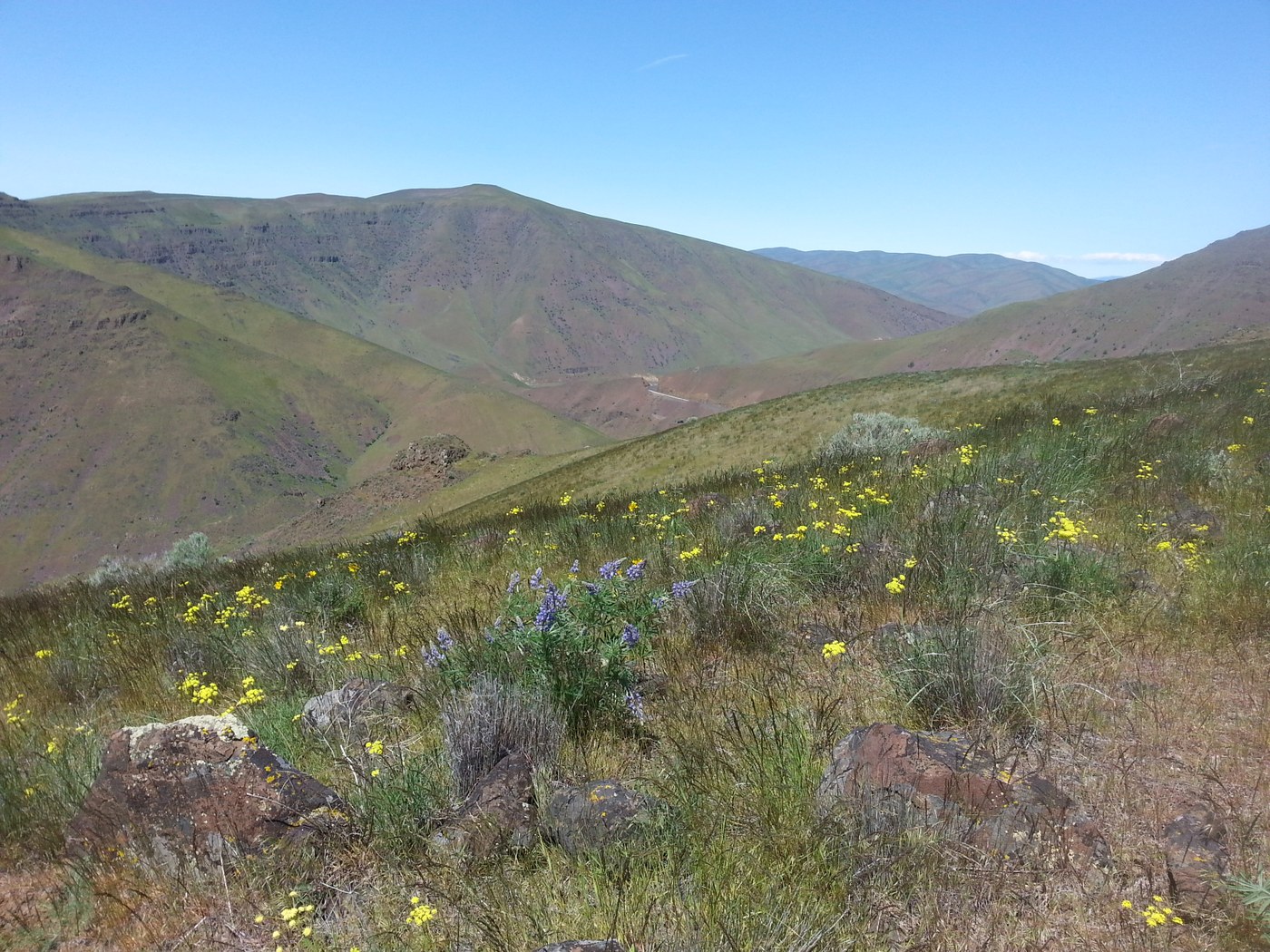
To do this trail, drive the Yakima River Canyon north from Selah to just past mile marker 4. A small parking area on the right is where you start. My GPS tracked it at less than 1.5 miles to the top with topo map saying 1600 ft gain. This is a STEEP trail. So steep in places that coming down, it is very easy to lose your footing with gravel and rocks rolling out from underfoot. Much steeper trail tread than that of Yakima Skyline trail, seen across the river from this one.
Grasses are green, no snakes for now, many wildflowers. Lots of wind today. Once at the top, views to the west include Mt Adams, Mt Rainier and the Stuarts to the north. Plus of course the river below, running high with flood waters.
Flowers: Hedgehog Cactus, death camas, wallflower, parleys, fiddleneck, balsamroot, lupine, larkspur, milkvetch, buckwheat, prairie stars, phlox, sagebrush violets, mustard, threadleaf phacelia
Comments