

The gate was open and I hit the trailhead at about 11am. The road to the trailhead is a 15 mile dirt road that's in pretty good condition and takes you up to 5,000 feet with some spectacular views of Rainier before you even get out of the car. Before arriving at the trailhead you have to stop and pay a $25 fee at a check point - the Northwest Forest Pass doesn't cover you.
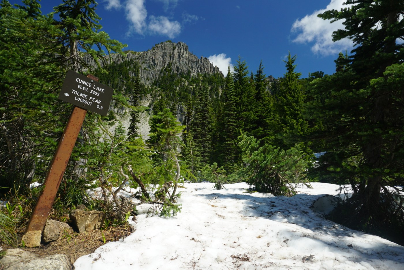
The trail was in great shape today, and not too crowded when I set off. I started by following the path along Mowich Lake which then veers left and heads over to Eunice Lake. The trail around Eunice Lake was still covered in slushy snow, but the microspikes stayed in my pack and I didn't need to use them.
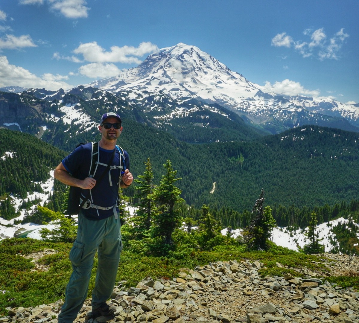
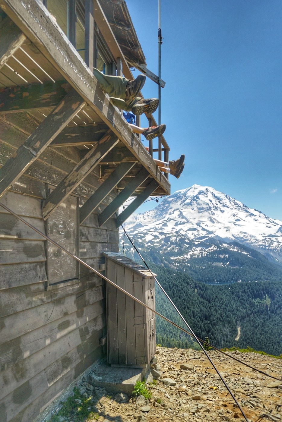
The ascent from Eunice Lake up to the Tolmie Peak Lookout which sits at an elevation of 5,900 feet was snow free and easy, and featured a couple switchbacks followed by a final jaunt up the ridge, affording amazing views of Rainier and Mount St. Helens on one side of the ridge, and northward toward civilization on the other side, though this side was covered by a low cloud blanket as I made the trek.
There were about a dozen people at the top when I got there, and another dozen or so joined by the time I left a half an hour later. It's a great spot up at the top - be sure to bring a camera. I bumped into three other hikers who had the same camera as me - a Sony a6000, which is a relatively compact mirrorless camera that is ideal for hiking and backpacking.
Trip stats from Strava (link below): Distance - 6.6 miles, Moving time - 2:02:32, Elapsed time - 3:03:05, Elevation gain - 1,754, Pace - 18:24/mi, Calories burned - 1,165.
Comments