Copper Ridge Loop, Whatcom Pass — Aug. 10, 2019

![]() 8 people found this report helpful
8 people found this report helpful
Just finished a 3 day backpacking trip (Saturday through Monday) through the rain and clouds of this weekend! All in all, it was a great trip, but it was definitely more about the mileage than the views.
No notes on the trail - it's all in good condition and all easy to follow. Only minor issue is that the cable car is closed for repair for at least another month, which means you have to ford the Chilliwack twice (once by US Camp, once by Indian Camp).
Overall, we did 44 miles and 12,700 ft of gain, all in 24 hrs of hiking (over 2.5 days).
We started at noon on Saturday and blasted up to Tapto Lakes for sunset. We expected heavy rain, but didn't get any (and even got some sun) though the clouds stayed low and kept views to a minimum.
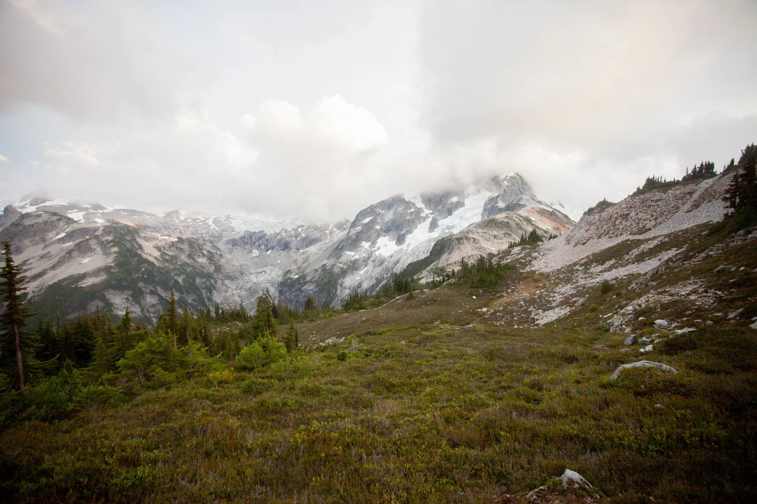

Tapto Lakes in the clouds
The next day we headed back down to the Chilliwack valley, through the clouds.

Hiking into the clouds

Finally some sun (which disappeared 5 minutes later)
The climb up from Indian Camp to Copper Lake takes forever.

Copper Lake
Once you're at Copper Lake, the rest of the ridge is all fun, though with more views I bet it would be even better.
Copper Ridge Loop, Hannegan Pass and Peak — Aug. 3, 2019

![]() 20 people found this report helpful
20 people found this report helpful
We arrived at the Hannegan Pass trailhead at 4:00am Saturday morning. There were a couple dozen vehicles at the road's end, with plenty of room to park the car. The road leading to the trailhead from Highway 542 is well marked and well maintained and is fine for any vehicle.
Our plan for the day was to complete the Copper Ridge Loop in one long day, and leave some room for a potential detour or two. In our case, our detour was the trail up to Hannegan Peak. The first few miles required our headlamps, but we could see the sun slowly illuminating the peaks to our right. Once reaching the pass, we got an incredible view of Ruth Mountain as the sun was coming up. Since it was approaching golden hour, we opted to take the 1 mile trail up to Hannegan Peak. We were rewarded with incredible panoramic views of Ruth Mountain, Shuksan, Baker, and the many peaks that would be more clearly viewed later in the day.
Shortly after our descent from Hannegan Peak, the loop trail begins. We opted to take the clockwise route and experience the ridge and more exposed areas earlier in the day to beat the heat. The first couple of miles are a steady climb upward, but quickly opened up to wonderful scenery and peaks in all directions. The trail rarely gives you flat sections, but most of the elevation that is lost or gained is typically very gentle and usually not noticed due to the beautiful views. After roughly 5 miles on the loop trail, we made a push up to the fire lookout. Spectacular views from up here. From this point, we began descending toward Copper Lake, roughly 1.3 miles from the lookout. For anyone interested in camping up here, this seemed like a superb spot with a good water source and protection from sun or wind.
After a few more miles of scenic ridge hiking, the trail becomes more shaded and starts to descend for quite some time. After a set of switchbacks, you will shortly have to ford the Chilliwack River and Indian Creek respectively. For us, this just meant removing shoes and socks but the current may be more rapid earlier in the summer. Look for the pink flagging tape that will help guide you across the water and take you toward Indian Creek camp. Now the trail turns into quiet forest floor hiking for nearly the entire remainder of the southern loop. There is a bridge to get you across Brush Creek, but the cable car that takes you across the Chilliwack River shortly after appears to be out of service. The river is simple to cross with no shoes and was refreshing to have icy water on hot feet after clocking 25 miles by this point. From here, we had about 5-6 more miles of forested trail until reaching the boundary camp to close the loop. Along the way, there are plenty of places to fill up for water and a variety of nice camping spots above the river.
Once reaching the boundary camp where the loop meets back up, we had roughly 5 more miles of trail ahead of us until reaching the car. Thankfully, much of the final stretch of trail was both scenic and easy on the knees. As the sun began to set, we were able to get great views of Ruth Mountain and the Ruth Creek valley. We reached the car at 9pm, completing our 17 hour, 37.5 mile day.
Ultimately, this was an incredible area of the cascades and a wonderful trip overall. For us, it checked all the boxes - a well maintained road and trail, plenty of water sources, ridgeline trails, peaks, wild flowers, and untouched forest floors.
Hannegan Pass and Peak, Copper Ridge Loop — Aug. 1, 2019

![]() 12 people found this report helpful
12 people found this report helpful
Did a 3-night, mid-week trip with my 73 year-old dad and 14 year-old son. We got lucky and got a permit for 3 nights at Boundary Camp (backup plan was to stay at Hannegan Camp). Boundary Camp was lovely, quiet and largely free of obnoxious insects. Water was ice-cold and delicious!
Day 1: TH to Boundary Camp (5 mi)
This trail was a little more effort than the vert and description indicate due to loose rock and gravel in places. Biting flies kept us moving! Hannegan Pass isn't much to speak of, but the wildflowers on the descent to Boundary Camp were amazing. Saw a sooty grouse and her chicks hanging out in the wildflowers.
Day 2: Day hike from Boundary Camp to Copper Ridge Lookout (11 mi, RT)
Such an amazing hike! Views, views, and more views! Wildflowers! Birds! Again, the vert on this hike was harder than the description indicated because so much of it was loose rock and gravel. It's hot and exposed up on the ridge, so bring enough water. On our way down saw a couple of fully-loaded groups on their way up looking pretty wiped out. We were glad to do it without a fully loaded pack.
Day 3: Day hike from Boundary Camp to Hannegan Peak (4 mi, RT)
From the pass to the peak it's steep and slippery in places. Saw a ptarmigan and 4 chicks wandering around completely unbothered by our presence. WOW, what a view! Since our hike was relatively short, we hung out up top for about 3 hours soaking it all in. Saw a few other groups, but largely had the place to ourselves.
Day 4: Boundary Camp to TH (5 mi)
Started raining overnight and poured all morning. It stopped about the time we got to the car (sheesh). The hike out was actually a little easier than expected because the wet trail was more grippy than the dry trail. Bear scat on the trail in a few places, but we didn't see a bear.
Overall a great itinerary for amazing views and minimal pack schlepping!
Reminder: Stay on the already-disturbed areas at the peaks. We saw people trampling all over what little meadow remains at Hannegan Peak. There's so much 'trail' up there already that there's no need to smash the struggling plants. And remind your kids not to chase the pikas!
Copper Ridge Loop — Jul. 31, 2019

![]() 11 people found this report helpful
11 people found this report helpful
Two friends and I hiked the loop counter-clockwise in 3 days. We got to the Glacier Visitor Center right after 8 a.m. when they opened, but had to wait in a long line. We ended up borrowing bear canisters, as not all camps have poles/lockers. (Spoiler: we did not see any bears)
Day 1: Trailhead to Indian Creek camp, 15 miles, ~3,000' elevation gain
The trail had views, even from the beginning, but they really opened up 5 miles in at Boundary Camp. Most of the elevation gain was to Hannegan Pass, but the hike down through the valley had plenty of ups and downs, too. The bugs weren't terrible, thanks to our liberal use of deet. The wildflowers and berries abounded: Salmonberries, Thimbleberries (not quite ripe yet), Glacier Lily, Lupines, Columbines, Cascade Stonecrop, and more. There were also dozens of varieties of mushrooms at every glance. After Boundary Camp, there was increasingly more and more brush, and I was so grateful I had just bought short gaiters (Kahtoola's instagaiters) to keep all the debris from sneaking in between my ankles and my boots. Shortly after Boundary Camp, there was a lovely stream that we soaked our feet in and admired the view.
Still several miles from camp, but excited to try something novel, we learned that the cable car has been taken down for repairs. In fact, we just missed it by one day! So we forded the river where the horses do, and the water came up to low- to mid-calf. We kept our boots on for traction (and because we had a terrifying river crossing last year). It was cold, but not hard to cross. The trail was shaded off and on, so it was never too hot to be comfortable. Indian Creek camp is beautiful, with a well-marked trail to the water.
Day 2: Indian Creek camp to Copper Lake camp, 8 miles, ~3,900' gain
We set off from camp in our still-damp boots and were pleasantly surprised with how shallow the Indian Creek and Chilliwack River crossings were. We took off our boots and crossed in bare feet. We set off for the long steady ascent that led to incredible ridge views! We stopped for lunch with expansive views of Mount Redoubt, Bear Mountain, and the peaks and lakes in Canada off in the distance. As we continued up, Whatcom Peak, Easy Peak, and Mineral Mountain loomed large. We arrived at Copper Lake just before the sun was going down, so we decided not to swim in its frigid waters. The campsite has a composting toilet, which only allows poop and t.p. (that's right--not even pee is allowed!), but it had the most incredible views of the North Cascades! The mosquitos were really bad, even with deet, so we got into the safety of our tent after a quick dinner.
Day 3: Copper Lake camp to the TH, 11.5 miles, ~2,500' gain
We were up all night to the sound of strong rain and winds. Our packs were in the vestibules of the tent, but they still got wet on the sides and bottom. Luckily, we stayed dry and postponed our departure time by 30 minutes hoping the rain would let up. It let up slightly and we packed up and set off. Our entire trek up to the Copper Ridge Lookout was in rain, and we could see nothing but clouds for several hours. The lookout was locked, too. As we hiked down the ridge, the clouds cleared a little and we got a few nice rainbows as well as more rain. We booked it past Egg Lake and Silesia Camp, and by the time we got to Boundary Camp again the rain had stopped. We hiked back up to Hannegan Pass and down to the trailhead with plenty of new waterfalls coming down the peaks across the valley.
Copper Ridge Loop — Jul. 21, 2019

![]() 14 people found this report helpful
14 people found this report helpful
Did the Copper Ridge Loop clockwise from 7/21-7/23. This trail is in great condition with a little bit of overgrowth along the Chilliwack River section, but nothing that is difficult to pass through. Despite a few spots of snow near the lookout, there aren't any fields to cross to stay on the trail and I wouldn't be surprised if even that snow is melted out within the next few days.
More details about each day of the trip:
Day 1: Hannegan Pass TH to Copper Lake Camp
There are ample streams to get water on the way up to Hannegan Pass. After that, your water sources are an unmarked but robust stream on the other side of Hannegan Pass (after the switchbacks into the basin in the exposed, rocky area) or at Boundary Camp until you reach Egg Lake. The climb up to Silesia Camp and the lookout is quite exposed and hot, which can make the climbing slow going in the heat of midday.
The views from the lookout are killer and we spent a good chunk of time here before the quick descent to Copper Lake. There is a composting toilet and a bear bin at Copper Lake. After Copper Lake, the water sources become frequent and reliable again for the rest of the loop.
Day 2: Copper Lake to Copper Creek Camp
The Chilliwack River fords are fairly low (nothing more than mid-calf) and easy. There is an amazing little riverside beach at the second ford (near the Indian Creek Camp side) where you can sit in the sun, eat some food, and rest your feet in the cold water. The trail is mostly flat to U.S. Cabin camp from the river fords and the miles went by quickly.
At Copper Creek Camp there is a surprisingly clean pit toilet and plenty of trees for hanging food. I left some clothes outside the tent at night to dry and a critter ate some holes in my shirt--careful with your belongings!
Day 3: Copper Creek Camp to Hannegan Pass TH
After a gentle ascent into Boundary Camp from Copper Creek, this day was spent mostly retracing our steps back to Hannegan Pass and the TH. Not much new to note here except that we spotted a brown bear on the hillside about a mile after crossing Hannegan Pass.