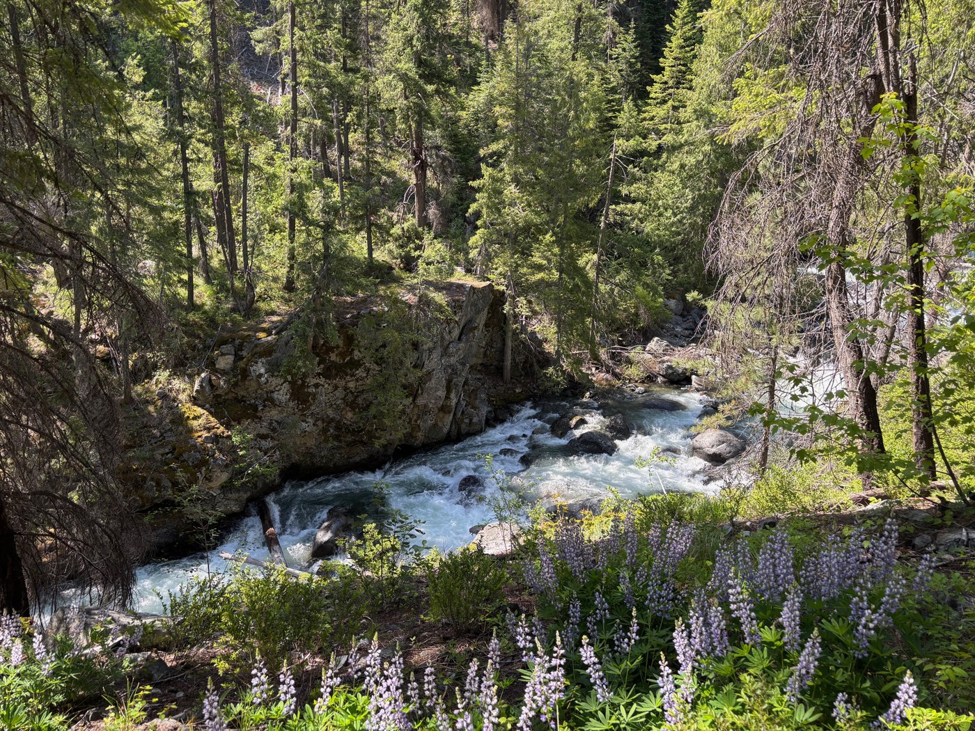
Ingalls Creek
Backcountry Response Team
 Thu Jun 11, 2026 8:30 AM — Mon Jun 15, 2026 3:30 PM
 Sign in to My Backpack
 Region
Central Cascades — Blewett Pass
Features: Earn Northwest Forest Pass
Crew Leader: Melissa Davis
Overview
The Ingalls Creek trail features all the classic scenery of the Cascades: big pines, boulder fields, granite cliffs, old-growth and occasional views of the mighty Stuart Range. This crew will be completing as much annual maintenance as possible, preparing the trail for horses and summer backpackers. If you want trail work with a little bit of everything, this trip is for you!
About the Area
The Ingalls Creek Valley lies at the base of the mighty Stuart Range in the Alpine Lakes Wilderness. From its eastern end near Blewett Pass, the Ingalls Creek Trail provides a backcountry route connecting trails all the way to the popular Ingalls Lake.
Along the way, it connects to several trails, including the Beverly Turnpike and Longs Pass, which access the beautiful Teanaway Valley to the south, via a steep climb.
What to Expect
We'll have fun, work hard and make a difference!
Project Description
This crew will compelte a variety of annual maintenance tasks including cutting back overgrown brush, repairing the walking surface, and digging drainage channels. The crew may also use crosscut saws, hand saws, and axes to clear fallen logs from the trail. No experience with these tools is required. One of our certified Assistant Crew Leaders will teach you how to use them safely.
Camping and Hiking Information
- Type: Through travel to multiple backcountry camps
- Location: Various locations along Ingalls Creek
- Weather: Be prepared for variable conditions including heat, cold, wind and rain
- Initial hike to camp: 5.5 miles with 1100 feet of gain at a moderate pace while carrying your backpack fully loaded with all provisions including camping gear and food, plus WTA-provided tools
- Expected daily hike: up to 5 miles miles with up to 1000 feet of gain at a moderate pace while carrying your backpack fully loaded with all provisions plus tools
- Total distance to Stuart Pass - 16 miles, 4400 feet of elevation gain.
Schedule
- Day 1: Meet the crew rain or shine, then hike in, begin work on the project and set up camp
- Day 2+: Make a lunch and pack up camp before heading out on trail with the crew by 8:00 AM. Work at your own pace, take plenty of breaks and enjoy lunch on the trail. Reach camp by 4:00 or 5:00 PM for a relaxing evening. Set up, prepare your own dinner and swap stories with the crew.
- Final Day: Break down camp, finish trail project, hike out and say goodbye to the crew at the trailhead
For safety reasons, arriving late or leaving early is not allowed.
Planning Information
Get ready for a challenging backcountry adventure!
What it Takes to Do This Work Party
- A great attitude for working with a team! WTA provides the training and tools you need for the project
- Backpacking gear and food for multiple nights on the trail
- Good physical condition to hike with a fully-loaded backpack and be physically active for about 8-9 hours daily on uneven terrain
- Backpacking experience including ability to run your own camp following Leave No Trace principles
- Day work party experience recommended
- Flexibility to adapt to changes due to unpredictable weather or land manager requests
- Minimum age: 18
What to Bring
Required:
- Sturdy closed-toe shoes
- Work gloves
- Eye protection (glasses, sunglasses, or safety glasses)
- Long pants
Recommended:
- Sturdy work or hiking boots (required for crosscut use) –review our Logout Boot Guide for more details.
- Long sleeved shirt (required for crosscut use)
A hard hat will be provided by WTA. Additionally, work gloves and eye protection will be provided by WTA if you do not have your own, but when possible we recommend bringing your own. For safety reasons, certain tasks may be assigned based on the safety level of your footwear. Volunteers who do not have long pants and/or sturdy closed toed shoes, will not be able to participate in the work party.
Backpacking gear
- Backpack to carry all of your gear
- Tent, sleeping bag and sleeping pad
- Cooking gear and enough food (plus a little extra) for the entire trip
- At least two 1-liter water bottles and a way to purify your water
- Rain jacket and rain pants
- Extra warm clothing
- Camp clothing such as shorts, shirt and sandals
- Sun and bug protection
- Headlamp and extra batteries
- Personal items such as medication, hand sanitizer and toiletries
- First aid kit
- A sense of fun and adventure for learning new skills and meeting great people!
Trail work gear
- Boots
- Long pants
- Work gloves
- Long-sleeved shirt recommended
- Eye protection recommended such as safety glasses
- WTA hard hat (provided, unless you have one)
For safety reasons, shorts and sneakers are not allowed while working. Firearms and weapons are not allowed.
More Information
- What to Pack for a Backcountry Response Team
- Frequently Asked Questions
- WTA's Trail Work Guide introduces the type of work you may do
- Contact us at volunteer@wta.org or 206.625.1367
From the Hiking Guide
See what WTA's hiking guide and trip reports say about this area.
This is a preview. Registration will open soon.
Partners
Directions
From Cle Elum take Hwy 970 east for 7 miles to Hwy 97. Go north topping Blewett Pass. At milepost 178, turn left onto Ingalls Creek Road. Immediately cross Peshastin Creek, then bear left. The trailhead is at the road's end.
From Leavenworth, take Highway 2 east for 4 miles, then take a right onto Highway 97S and proceed for 7 miles before taking a right onto Ingalls Creek Road. Immediately cross Peshastin Creek, then bear left. The trailhead is at the road's end.
Note: Please follow the written directions above instead of using a GPS device. This will ensure that you get to the correct meeting location for this work party. The location of the pinpoint below is only approximate.
Getting to WTA work parties can involve travel on rough, unpaved roads in areas without cellular service and without street addresses that can be accurately used by navigation devices. Unless specifically noted otherwise, routes can generally be traveled by all types of vehicles. Volunteers with limited experience driving on unpaved mountain roads may want to allow extra time, beyond what is recommended in the directions above, to get to the meeting location.
You must be part of this crew and have a My Backpack account to see the Crew Corner.
Sign in to My BackpackWhat is Crew Corner?
Crew Message Board
Stay on top of this work party’s messages.
Carpool
Find a ride, give a ride with people who also want to carpool.