

Parking: I parked halfway on the dirt road to Annette Lake Trailhead. The road is still in bad shape, potholed and hard snow-covered. No cars made to the parking lot when I started at 9AM, but when I came back before 6PM I found a lone high-clearance vehicle there.
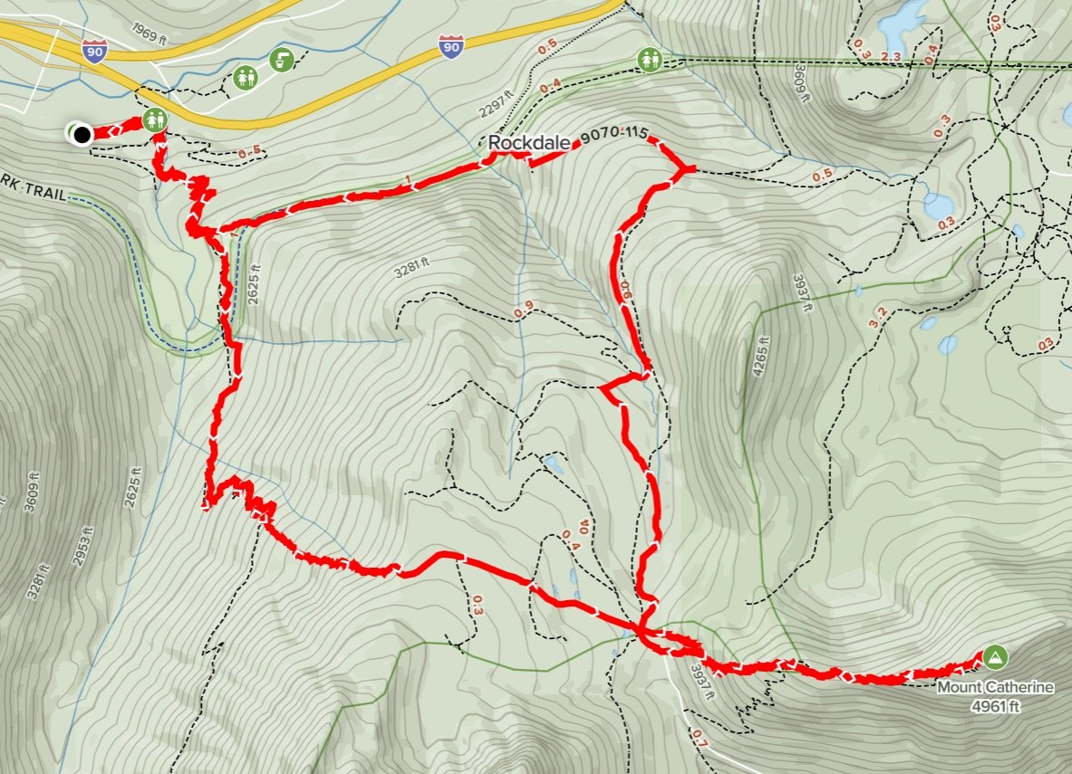
Route: My route to Mount Catherine always starts from Annette Lake TH. I especially like it because I can do a loop instead of a monotonous in-and-out. In snow season, I go off trail right after the switchback section and just climb due east. Interestingly there were 2 ski groups who planned to ski down from the bowl under Silver Peak. They opted to go off, with their skis on, before the switchback. I am curious if they were successful or not because I did not see them when I stepped on Olallie Meadow XC area. I did not follow the summer trail to Catherine which is actually a much steeper climb in deep snow condition. The GPS map clearly shows that a direct climb off the XC road to gain the ridge is not only shorter but less inclined. Still it was a touch climb with snowshoes. I wished I had two ice axes with me. On the ridge there was a different problem, the raining "snow bombs". Often times I had to stop and looked up first, then walked gingerly in a center line between trees.
I finally topped the rocky outcrop at 2PM, one-way mileage 5.75. My return route was to follow PCT then to the Iron Horse State Park trail which eventually intersects with Annette Lake Trail.
Snow Condition: Annette Lake trail is snow-covered but packed down well. There were a few bare spots in the first half mile but I put on microspikes from the start. It was an epic snow season for sure. I switched to snowshoes when I went off the trail, and I did not take them off until I came down from Mount Catherine. In the warm afternoon, snow became slushy yet still deep and made my return trip almost as hard as climb. Snowshoes kept sliding me down the tracks I opened early. By the time I reached Olallie Meadow I was so exhausted with snowshoes that I switched back to microspikes. PCT was deep under snow and I had zero interest to open a fresh track on it with snowshoes. I just walked on the flat XC ski road.
Navigation: I used both GPS and compass. GPS is decisively useful on snow fields when I need to identify where exactly I am relative to a main trail. Then I use compass to guide me to close in on the trail.
Gear: I also packed crampons in my bag but never used them. Snowshoes and ice axe did most walking and climbing. I usually don't pack hiking poles with me if I carry ice axe. Also, I had waterproof shoes, pants and gloves, in addition to gaiters.

Comments