I've had February 23, 2025 circled on my calendar since my first visit to the area, when I realized I'd have the opportunity to visit the Tiger Mountain train wreck on its 100th anniversary. Once I woke up and checked the general weather forecast, I knew I'd have no regrets about that decision.
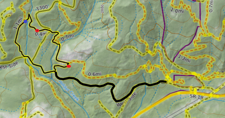
To avoid the Iverson Railroad Trail closure, I walked along the West Side road until I reached the Tiger Mountain Trail Connector. I turned right and walked uphill through running water to reach the site of the crash. This segment of trail vindicated my decision to wear, basically, rainboots.
On my way out, I continued past the train wreck, toward the spur road labeled 1300 on Caltopo, and found that segment of trail much better drained. So if you go today (there's still time!) or in the near future, and want to keep your feet dry, you can go the other way instead.
I've included a map of my route below. Caltopo puts the whole thing at 4.65 miles. I only encountered two blowdowns all day, and they were both fairly easy to bypass. I marked the approximate location of both on my map below. The one that is more northwest was easily navigable with the help of some pink flagging. The one more southeast has plenty of space to duck under.


Comments
I thought I was the only one who went there today. I too, had been looking at that dated sign for years.
Posted by:
HikerJim on Feb 23, 2025 07:25 PM
I was half expecting to find a vigil.
Posted by:
greymstreet on Feb 24, 2025 12:57 AM