
On the Mountain Loop highway, there is some bridge painting work going on, I believe it is 18ish miles from Granite Falls along the highway, and the road is reduced to 1 lane, so you might hit a slight delay here.
When I got to the trailhead, the toilet at the parking lot had not toilet paper. However, when I returned after the hike, it was fully stocked.
You have to walk down a gravel road past the gate to the actual trailhead, but it poses no issues.
The early part of the actual trail is fairly flat for a good while and is a bit over grown in places. If plants brushing up against your legs bother you (especially if they are dewy in the morning), you might want to wear long pants or at least convertible pants that you can transition to shorts later.
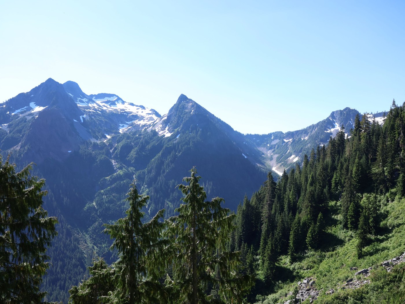
After you do the first creek crossing, the climbing starts and doesn't not really let up until you get to the top.
In this forest climb section, there is one tricky blow down that you have to navigate around and is made tricker by having many of its limbs getting in your way, but it is doable.
There were a few other blow downs along the way past this, but nothing particularly troublesome.
The creeks along the way are all flowing well, so there is opportunity to filter and fill up water if you want to minimize how much you're carrying. You'll of course also have an opportunity to fill up at the lakes.
I won't comment much about the climb because I think it's understood that it is hard. I did find that this trail was great at giving me false hope of getting to the end only to be presented with another climb, so try to keep your spirits up.
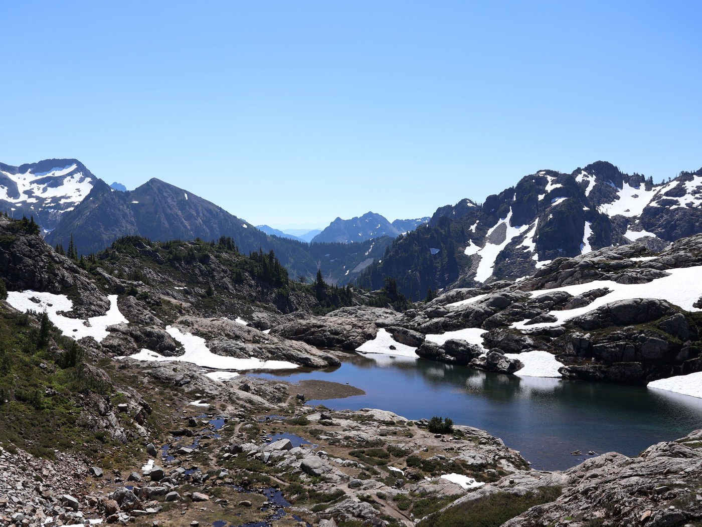
You do have to get around a snow field to get over the crest to the first lake. Folks seems to have cut a trail to the right along a ledge above the snow field, or you can try to make your way along the edge it, but the vegetation here hasn't been damaged much yet, so you risk damaging it, if that is a concern.
The first lake is snow free and has great views.
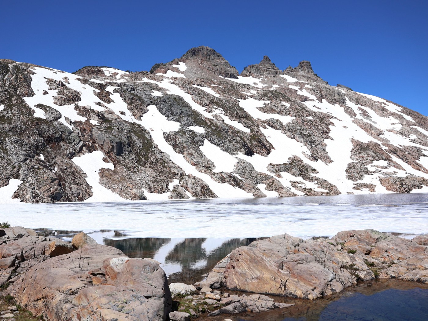
The hike to the next lake has more scrambling over the granite and more snow fields that made route finding a bit more tricky. There are small flags along the way to guide you along the trail, but I found these hard to spot sometimes. It was worse on the way down, and often just resorted to but scooting down.
The second lake still has ice, so that quashed my aspirations to take a dip in it when I got to the top, but maybe you're braver than me.
The hike down was similarly tough, having to watch footing as you descend those many steep sections. The long flat section through the forest and then on the gravel road were also a bit tiring.
This was a fun & challenging hike to do and had great views along the way, and I'm always a fan of hikes to alpine lakes.

Comments