Alpine Lakes High Route, counterclockwise. Amazing hike, just be careful of daylight and water supply. Road in and trailhead toilets are all good.
West Fork Foss Trailhead to Big Heart Lake: Started at West Fork Foss Trailhead at 7, made Trout Lake by 7:30 and Copper by 8:30. Low hanging clouds and fog in the morning made for cool and damp conditions, especially with the brush going up to Copper Lake. There are some blowdowns in this section, some quite large, but all easy to navigate. Slowed a little on descending into Big Heart Lake, made it there by 9:30. Pretty easy terrain on this section, some bits are rocky but overall smooth sailing.
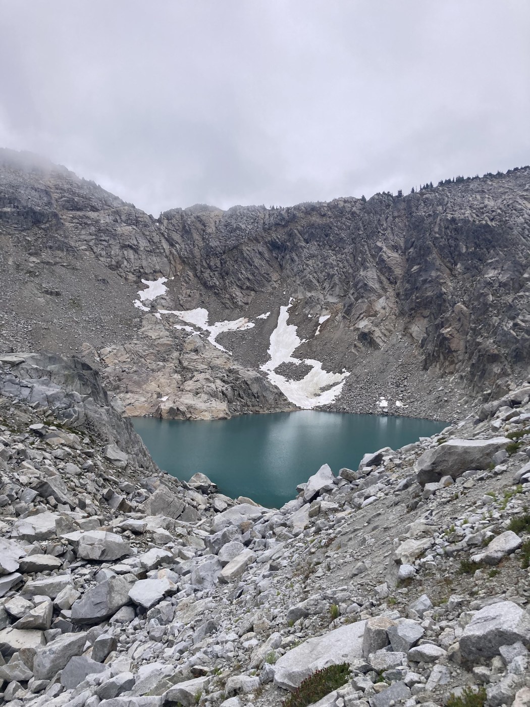
Big Heart Lake to Tank Lakes: Start by moving up to the ridge between Big Heart and Angeline Lakes. Apparently the trail here is harder to find than I imagined, I accidentally ended up just below the summit of Atrium Peak and had to backtrack a little to stay on the safer shoulder. The clouds had started to lift, and I was able to look down onto both lakes as well as the ridge where I was headed. With all the elevation gained and lost, definitely was moving slower on this section. Strava activity shows the pace for each mile well. Stopped at Chetwoot Lake and filtered water, was nice and cool. Leaving Chetwoot, the trail quickly becomes boulder field more than anything. This goes on for a little over three miles, around the shoulder of Iron Cap, through Iron Cap Lake basin (beautiful), before dropping down and immediately back up to Iron Cap Gap. The occasional cairns are helpful, but Gaia is more so. There are sections where it is simultaneously steep, the trail consists of large boulders, no trail marking, and close to a cliff. Definitely benefited from having a hiking pole and trail runners with good cushioning. If it had been sunny out, this entire three miles would have been incredibly exposed and baking on the rocks as well. As it is a rock field, there are many, many pikas. From Iron Cap Gap, the trail is much easier to follow and leads the final bit of elevation up to Tank Lakes. Made it to lunch at Tank Lakes by 1:30 and ran into my parents (they moved the car to East Fork TH and hiked in).
Tank Lakes to East Fork Foss Trailhead: Just a tiny bit more rock terrain is easy after Iron Cap. Descend along the ridge and then down into the valley, where it takes a little over a mile from the lake to get back to easy to follow trail. Drop down 2000 more feet in short order before taking the Necklace Valley river trail out to the trailhead. The last five miles are by far the nicest, easiest, most relaxing section of trail. For this reason I would recommend doing the high route in one day counterclockwise, to finish with this. For multi-day it probably matters a little less.
Garmin logged 27.5 miles and 8700 feet of elevation gain (2 of these miles were backtracking to carry my parents packs). 10 hours of moving time, 11 hours elapsed time. The elevation is no joke, especially when lots of it is done over rocky terrain. Only ever saw bugs when stopped, a couple at Chetwoot and some more at Tank Lakes. Lots of pikas all over the rocks, some marmots up at Tank Lakes, many birds, butterflies, and frogs across the rest of the trail. Wildflowers all over and some blueberries over by Big Heart Lake and Atrium Peak. Definitely want to go back when it is sunnier. Good amount of people out, but never felt crowded. It's always nice to run into friendly people on the trial (shoutout the three trail runners).


Comments
Mountain Goats on West Fork Foss River and Lakes, Tank Lakes, East Fork Foss - Necklace Valley, Atrium Peak, Chetwoot Lake
Jesus man you’re a machine. Great report!
Posted by:
Mountain Goats on Aug 05, 2025 04:18 PM
Maddy on West Fork Foss River and Lakes, Tank Lakes, East Fork Foss - Necklace Valley, Atrium Peak, Chetwoot Lake
I second that!
Posted by:
Maddy on Aug 05, 2025 04:34 PM
Peter Lie on West Fork Foss River and Lakes, Tank Lakes, East Fork Foss - Necklace Valley, Atrium Peak, Chetwoot Lake
Haha thanks guys!
Posted by:
Peter Lie on Aug 05, 2025 07:20 PM