
Consider this more of a road access report than a trip report, since people will be curious about the area.
Obviously, the closure of the Fairfax bridge is a bit of a problem for accessing this trail. However, technically there is backdoor access from Wilkeson. Essentially taking forest roads by turning right at the Sunset Lake Camp up the dirt road. What you’re looking to access is Forest Road 7710.
* Most* of 7710 is in decent enough shape. There is one spot where the entire right side of the road is just gone, a few potholes here and there but generally nothing terrible. You’d want some clearance and I wouldn’t take a Civic or something, but my Passport was ok.
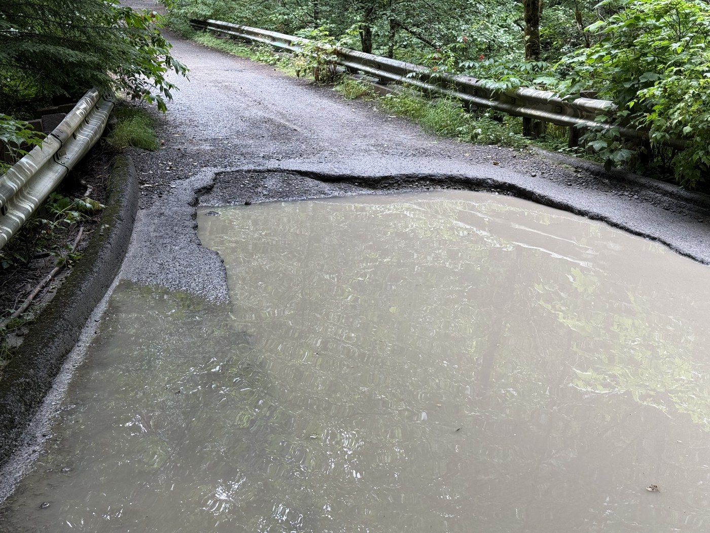
Where the real problem is at the East Fork South Prarie Creek (about 10 miles from where you turn off the paved road) where there is a huge drop right before the bridge. Hard to estimate but at least one wheel would be doing a bigger drop than coming off of a sidewalk. See attached photo. My main concern is that getting up wouldn’t be an issue, but the return trip would have the underbody take quite a hit.
This does get within 1 mile of the first bit of marked trail, although that section of the Clearwater Trail climbs 1000 feet in 2/3 of a mile so. Have fun.
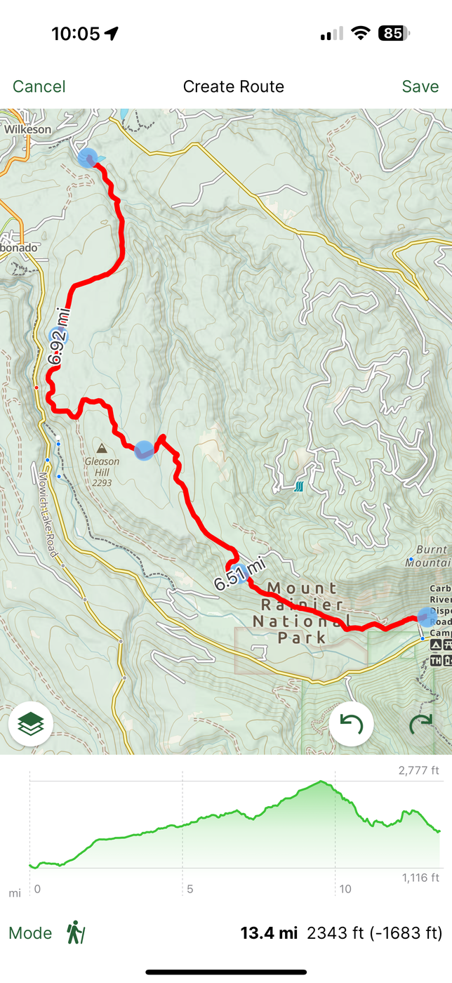
if you had the clearance (8 was at a cusp, 10 probably more than fine), or brought a sturdy board as a ramp, 7710 continues about 4 miles past this bridge. Didn’t make it on this journey, but my impression is that the road deteriorates fast once at the end of that. In any case the goal is to access the Clearwater Trail (photo 2).
Also wanted to see what road access to Gleason Hill to access the Carbon River area. Signs seem to indicate that the road itself is private property and gates can shut at any time (hypothetical route marked on map in pic 3— would spit you out at Cayada Creek Road). Disappointing because that means the easiest access to that area is near 12 mile hike starting near Carbonado (and they don’t allow overnight parking there). I do know plenty of people seem to bike this outlined route however, judging by all the activity on Strava I see. I do however question the legality of that, and wouldn’t endorse anyone to do so without clarification.
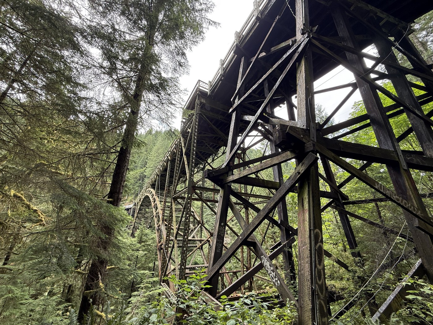
So with all that said, did end up driving to Carbonado and parked right before the road closure to walk the trail to the bridge. Very depressing walk the had me contemplating my favorite places in the entire state and how I can’t access them. The Carbon River road trail was a place I’d go to probably 6-7 times a year if I ever needed to clear my head.
Do note that not only can you not go onto the bridge, the road itself is flagged no trespassing for pedestrians. This is not immediately obvious if you take the dirt trail and thought to road walk back to the car, as you’d end up bypassing any signs telling you not to do that on the way in. On the plus side the dirt trail is in lovely condition, although the first mile has an alarming number of blackberries.
I am considering maybe making a backpacking trip to this area in a week or two, using the Melmont Ghost Town trail as access.

Comments
FS 7710 used to be my stomping ground for target shooting, picking up trash from other shooters, and just general exploring.
I know the bridge and large pothole you are describing well. It's been slowly growing for many years.
In your second photo that shows the bridge, and then a short while later the hairpin turn where the *rough* trail starts....I know that corner, Didn't know there was a trail there. I've driven all the way to the end of the yellow marked road in that photo. And also explored each of the rougher legs of it that fork off from there. If you take the right path you can get on a ridge that overlooks Cedar lake. At the end of it is a pretty well defined trail(as of 10 years ago) that connects into celery meadows. The last bit of road was very rough. I made it most of the way in a pickup once (couldn't make it the last 200 yds without 4wd). Rode dual sport motorcycles up there a couple times. That was the smoothest and fastest way to get up there.
I heard that after the Muckleshoot tribe bought a bunch of land, they may have closed off access to that upper section of road. I haven't been up there recently to confirm.
Posted by:
hikerdavid on Aug 18, 2025 08:47 AM
I'm not sure this link will work. On the Wilkeson and carbonado community facebook page there is some discussion about this area. It's where I got some info about the trails/roads. It might be helpful.
https://www.facebook.com/groups/789838571110238/permalink/9672232682870738
If the link doesn't work - find it by going to the group page and search for Ian Canaan's post from April 26.
Posted by:
jimclass on Aug 18, 2025 11:05 AM
This is fantastic and perfect timing as I'm looking to explore Clearwater Wilderness within the next couple weeks. Thank you for taking the time!
Posted by:
Allan D on Sep 01, 2025 11:49 PM