
A leisurely hike along an old logging road to a massive bridge and a left turn straight up through dense brush, boulder jumping, more dense brush to your own private lake.
Taylor River to Big Creek
Park at the Snoqualmie Lake Trailhead and prepare for a relaxing 5.5 miles of logging road. The road is rocky, with perhaps 700 feet of elevation gain. You are quickly in dense forest surrounded by mountains that help keep the area cool and shady and damp. The trail features a lot of drainage points, some large culverts, repaired washouts, which is evidence of substantial maintenance and also frequent water. But today, in late September the trail was dry save for a couple of small stream crossings. We camped near the massive bridge over Big Creek. The Big Creek falls were really tame, which was perfect for our plans the next day.
Dream Lake
The hike to Dream Lake is a different kind of challenge. There is some boot path, substantial in-stream bouldering, and a ton of bushwhacking.
Forest Boot Path
We entered the forest just east of the Big Creek bridge and quickly noted a faint boot path. We followed this up the steep terrain with evidence here and there of previous hikers. At one point, we noted a defined trail to the left closer to Big Creek, that seemed to be veering over for a look at the falls. It turns out that this was the primary trail. Our path followed boots, but would disappear and reappear with tree falls to bypass, vegetation to get through. It was slow going at times. We eventually rejoined the trail about 0.4 miles up this hill and discovered a campsite next to Big Creek.
N 47° 35.440' W 121° 26.974'
Here we saw some pink flags that someone had tied to tell us we were on the right path. We noted flags down over the creek and chose to proceed down to the creek bed.
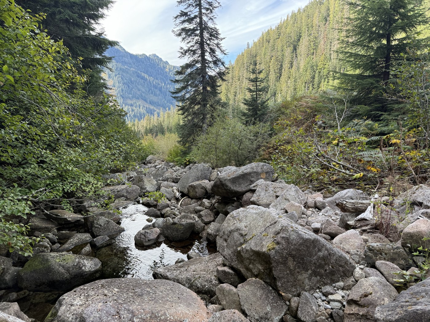
Creek Bouldering
Climbing down into the creek was challenging with the steep banks, but we managed it and found ourselves in a playground of large rock. We did have to scurry up the left bank a bit to get around vegetation, but were quickly back into the channel. Most of it was solid and dry. Every once in a while a rock would shift or we would find that something that looked fine was very slippery. Every once and while we would slip and splash in the creek, but this was rare and we had a lot of fun in this section. I think this would be a lot more challenging in different weather, but on this dry fall day, we had stretches where the flow was completely below the rocks. From other trip reports, we knew that there is a large waterfall to get around and noted that the creek banks were getting steeper, so we opted to hop out of the creek on the right bank again and resume our bushwhacking to avoid that hazard.
N 47° 35.690' W 121° 26.739'
Bushwhack
There was some evidence of a trail here and there as we made our way the remaining 0.8 miles to the lake. And there were sections of substantial bushwhacking. It was pretty amazing to see how nature has taken back whatever trail might have been here. Patches of devil's club, sections of salmonberry, some amazing sections of ferns that seem to die back year after year. Sections where new hemlock trees seemed to grow 24" on center. We found that some of the best going was along areas where the boulders cropped up and we would find some sections of boot path to follow.
Trail?
About 0.2 miles from the lake we finally came across a well established boot pack that was a relief as we proceeded with some confidence, knowing that our sight of the sparkling lake would come around the next bend.
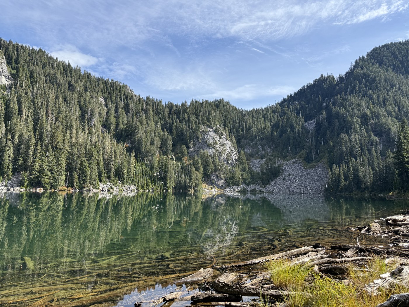
Lake
The lake has some great camping near the end of the trail. Lots of fallen trees racked up on the beginning of Big Creek made for a nice bridge over to the campsite. Having made this trek once, I can imagine coming back to enjoy a very private lake experience, some swimming and fishing, with the knowledge that the price of admission is high enough that we wouldn't be disturbed.
Return
We hiked out the way we came. Well, we quickly lost the trail near the lake and for the most part found ourselves bushwhacking down through new areas with new challenges. In the last stretch near the bottom, we found more of the pink flags that told us we were on the "right trail", so next time we'll try to hug a little closer to the creek in the lower section.
It was about 4 hours up and 3 hours down for us, from the bridge. We were happy to take our rest for a second night next to Big Creek. It gave us time to visit Otter Falls and just enjoy the serenity in this wilderness far from cell phone range.
Comments