
See more photo here: https://www.hippohamster.com/posts/north_cascades/big_craggy_west_craggy/
Day 1
We left home around 8:30 am on Saturday, stopped for lunch in Winthrop, and arrived at the trailhead around 2:30 pm. It was a long drive. To our surprise, about twenty cars were already there. We had expected fewer people given the remote location, but Copper Glance is apparently a semi-popular hike, especially during larch season.
The entire trail passes through a burn area, but the trail is in great shape. We went off-trail before a tarn following our GPS track. The route we took on the way up wasn’t ideal, but on the descent we found a better way that stays on the left side of the creek—definitely the preferred option. At 6400 ft, we stopped to cook dinner since we didn’t want to carry extra water to camp for ramen. Keep in mind there is no water beyond this point.
As we reached camp, snow started falling. That was unexpected since none of the weather models on Windy had forecasted it. The snow became heavy at times, so we quickly set up our tent at 6600 ft and retreated inside for the evening.
It took about 3 hours to reach camp with 2800 ft of elevation gain.
Day 2
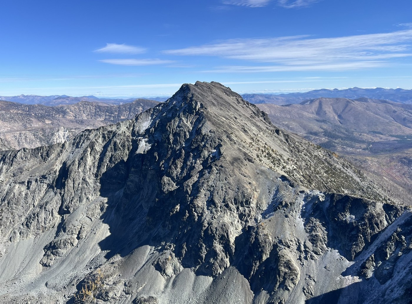
The night was cold, dropping to about 28 degrees. We had planned to start hiking before sunrise but didn’t get going until about 30 minutes after. A thin layer of snow covered the slopes near the saddle and big craggy, making the west ridge of Big Craggy a little slippery. Thankfully, the climb was still straightforward and the slick rock only slowed us down slightly.
After summiting Big Craggy, we returned to the saddle and traversed the ridge toward West Craggy. This route is less direct though snow free. We aimed for a notch, crossed two bowls, and reached easier terrain on the far side. For the descent, we decided to drop straight down from the 8000 ft point on the ridge. At first we couldn’t see the route, but since many others had descended that way, we gave it a try. It turned out to involve some class 3 downclimbing through a cliff band with some exposure. A fun variation, though not necessarily faster. If you prefer to keep the trip at class 2, retracing your route is the better choice.
The day took 10.5 hours total back to the car, with 2800 ft of gain and 5600 ft of descent.


Comments
Was the tarn at the 6,600 camp fully dry??! We camped there next to that big rock too at the 6,600 tarn/camp. Back in July for West Craggy and it the tarn was quite deep. Although the rocks, river path that was near the outlet had started to dry out. Nice route - the 3d image is helpful.
Since we weren't doing Big Craggy, we went further up the basin to where the rib/arm comes down near the col between Big and West. Then we scrambled up and down that section - on the west side. It completely avoided the cliff bands and was a nice route!
On the cold/snowy Sat night - We were further over at Cathedral/Amphitheater and had the same snow fall on us too. In the morning, it took a few hours for the clouds to burn off and then the snow melted.
Posted by:
LaurelHikes on Oct 22, 2025 06:26 PM
Looks like the tarn dried up sometime in September, thanks for other people report that we know the tarn dried up.
Agree, the west side of rib should be pretty nice! We had someone’s track that goes up and down by that route.
Posted by:
siyisauce on Oct 23, 2025 12:13 PM