Trip Report
Sheep Lake to Sourdough Gap — Thursday, Oct. 16, 2014
 Mount Rainier Area > Chinook Pass - Hwy 410

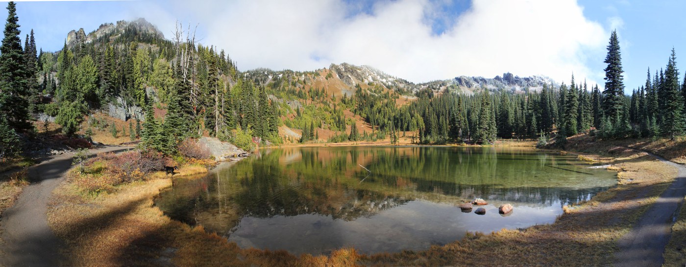
This is a scenic and easy hike just outside of Mt Rainier National Park. It's a great choice if you want to hike with your dog since the National Park is off limits to dogs. The trailhead is just beyond Chinook Pass. The first 1.25 mi are flat and parallel the highway. The trail then makes a turn North and away from the highway. Gentle climbing switchbacks take you to Sheep Lake at 2 mi. The grade steepens slightly but is very easy all the way to sourdough gap at 3.1 mi. From here there is a view down to Placer Lake and Morse Creek. To get a nice view of Crystal Lake and Mount Rainier you have 2 choices. Just beyond Sourdough Gap there is a steep way path on the left that takes you up to peak 6708 (just west of the gap). It gains 500 feet in 0.2mi. There is an impressive cliff on the west side of the peak that gives you a dizzying view down to Crystal Lake with Mount Rainier in the background. There is a nice 360 degree view from the peak.
A much easier alternative is to continue on the PCT beyond Sourdough Gap about 0.2 mi to an obvious easy trail that leads left to a pass that gives access to the Crystal Lakes basin. You have to walk another 0.1 mi beyond the pass to get a view of Crystal Lake. The Crystal Lake basin is in Mount Rainier National Park so technically the dog cannot go beyond this pass. The trail continues down to Crystal Lakes but I didn't take it.
The fall color is definitely beyond prime now but the area is still beautiful. I only saw one other hiker with his dog.
Drive to trailhead from Bellevue: 1:45. Round trip including peak 6708 and a short wandering into Crystal Basin: 7.8 mi and 1400ft elevation gain.
Photo tips:
The view of Crystal Lake and Mt Rainier is best in the mid morning until about noon. The south facing Sheep Lake valley is beautifully illuminated all day but best in late morning. If you are trying to get Mt Rainier and the Crystal Lake Basin in the same shot you will need to do a wide angle pano. Also Mt Rainier is many times brighter than the lake basin so I had to use a fade filter and also reduce lighting of the highlights on photoshop to make it so that Rainier wasn't totally washed out.
If you use the My Tracks hyperlink below, be sure to click on the Maps tab and turn on Terrain for a nice shaded topo map. This is the best way to understand the lay of the land.


Comments
Thanks
Thanks, the dog and I will go there tomorrow (18Oct14). The write up and KML are real helpful.
Posted by:
AndreH on Oct 17, 2014 11:15 PM
Thanks, Lost & Found
Thanks for the info on the side trail up to the ridgeline. I found a camera filter, and judging by your photos, you had a nice camera up there. If you're missing one, let me know.
Posted by:
EasternImport on Oct 19, 2014 03:16 PM