
We made a big figure 8 using some trails on the park map, some trails on our paper map and occasionally our GPS... Not all of the trails are listed here, nor were all of them on any one of our resources.
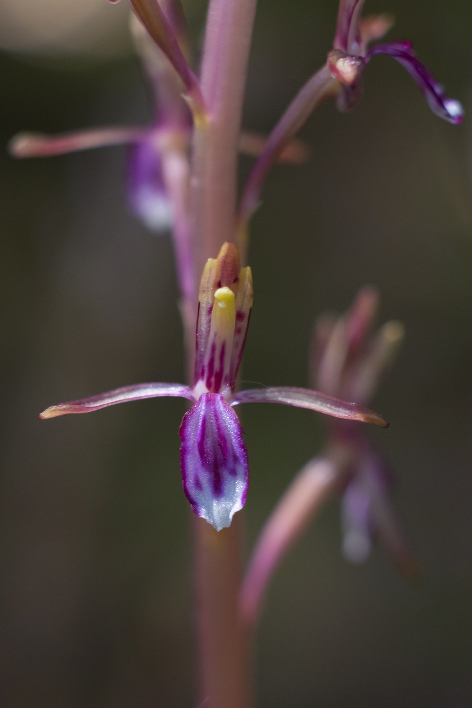
We started at the Fragrance lake trailhead and took off up the access road. It was surprisingly not overly crowded - as this area is popular and the day was nice we expected more people. We turned off onto the South Lost Lake trail and hit the lake for lunch - there's a great little spot just before you reach the very north end of the lake shore that has a dense old cedar grove - there were tons - really tons of orchids - Pacific Coralroot - just starting to bloom there.
From there we took off on the East Lost Lake trail - which does not appear on the park kiosks and is perhaps not officially maintained, but none the less clear and easy to follow. When we reached the T intersection we turned right onto an old roadbed that soon turned into single track that climbed steadily, reaching an old clear cut, finally popping out onto the very end of a logging road. This is listed on my paper map as the "Overlander" trail, that is not in use because of active logging - but it was clear that no logging had been going on there for quite some time and the trail and roads appeared to be well used by mt bikers and horse back riders. It is however not signed - so we consulted the GPS to be sure of our location - down the road to another T- take a right then not very far along you'll see a trail take off of the right side of the road - this will take you back to the South Lost Lake trail. We went back down, but rather than turn right toward the lake this time we hit the Rock Trail - which is too new to appear on our printed map.
The Rock trail - due to the proximity of a parking area, was the one crowded area on the hike. The formations are pretty cool though. The trail builders didn't pull any punches - the trail climbs fast and furious, with several sets of well constructed wooden stairs to get you up slopes that would be far too steep otherwise. From there we decided to head back down Double Diamond.
Note that while Double Diamond is listed on *every* map, my paper one and the park kiosks as a multi-user trail for both hikers and mt bikers, the downhillers clearly do not expect hikers to be on this trail - and we did find that in at least one point that there were *two* Double Diamond Trails, with a small paper sign (only facing uphill... and only at the lowest point, which doesn't help when you are going down...) indicating one side was to be used for bikes and the other for feet. There is absolutely no signage at the top where we entered the trail to indicate an alternative route - so I'm not sure how far the trails are separated and where one enters. If you do find yourself on the top part listen very carefully and be prepared to step off of the trail quickly. About 1/3rd of the way down, you will find a fork in the trail with the left side being the foot side (we guessed correctly as it appeared less worn). At the end of this is the small sign paper sign and below there the trail is definitely shared until you get back to the Fragrance Lake Road.
Total distance right around 11 miles - elevation ? the GPS had low batteries, so we didn't leave it on all day... but there were several good climbs.

Comments