Let me start by saying that of all the parks I've visited in a dozen or so states, none have ever failed at trail markers and signage to such a magnitude as Larrabee. More on that later.
Arrived to practically empty lot at 8:25am on a partly cloudy Sunday and left at 12:45pm to a practically full lot. I started at the Lost Lake parking lot with the intention of hiking to either Fragrance Lake or Lost Lake, depending on how much I felt like hiking.
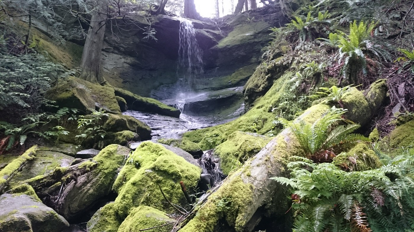
The first 2.0 miles was up Fragrance Lake Road, a gravel service road that is closed to vehicles. This was a steady uphill grade that was moderately tiring. The only thing of interest was a waterfall about halfway up. After the two miles I came to a map that was impossible to read due to years of people putting their finger on the "You Are Here" area, but I decided to go where I thought South Lost Lake Trail and Double Black Diamond Trail began.
Well I decided to take the Double Black Diamond Trail since it seemed shorter and went on to the Rock Trail. This was a mistake. Even though it was only 0.7 miles, it took me nearly an hour. It is an exhausting uphill trail that really should be a downhill mountain biking trail only. Signs saying it should be shared by hikers, bikers, and horseback were misleading. Do not hike up this trail.
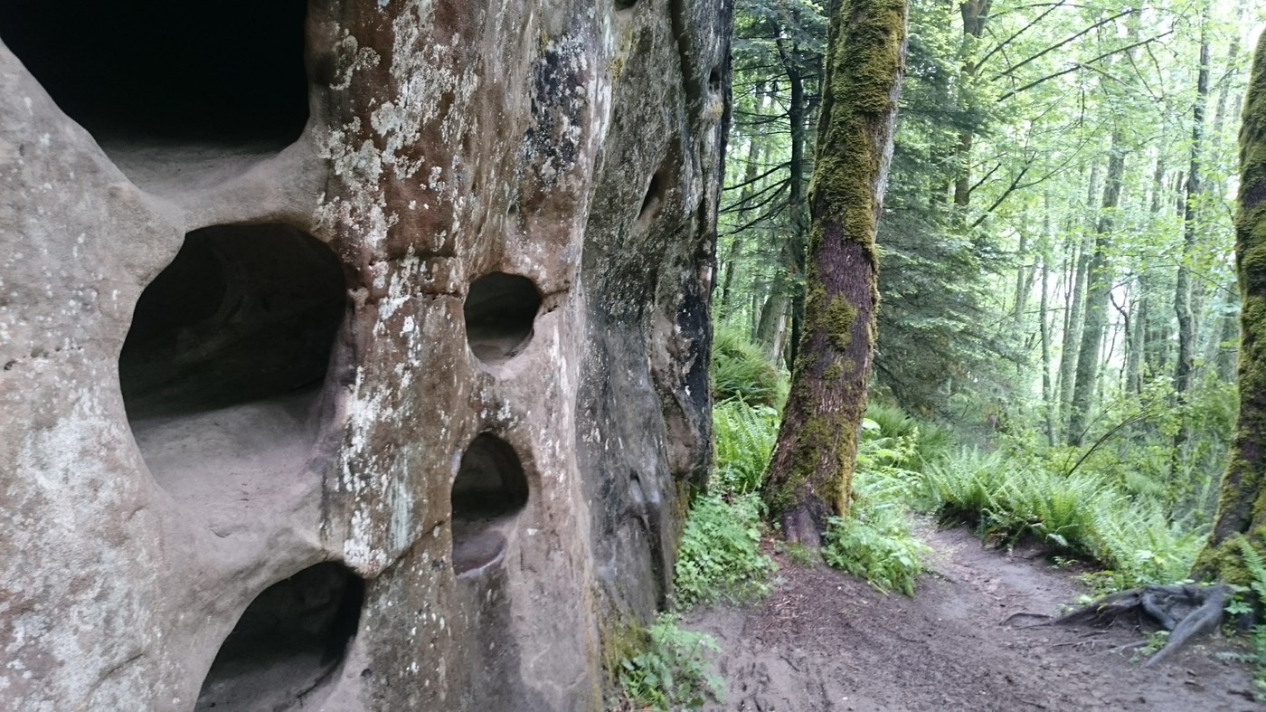
At the next intersection, there were four ways to go but only one sign pointing out that one of those ways was Rock Trail. If I had come from Rock Trail, I would have been very confused as to which of the other three routes to take. Unbelievably poor signage. Regardless, the Rock Trail was the highlight of my otherwise uneventful 4 hour trek. I got to see fascinating karst limestone formations, massive rocky cliffs above me, and a few giant mossy boulders right up against the trail. I really reminded me of similar ravines in Turkey Run State Park in Indiana and Cuyahoga National Park in Ohio. I would very much recommend this 1.2 mile trail but I can't help you figure out how to get there.
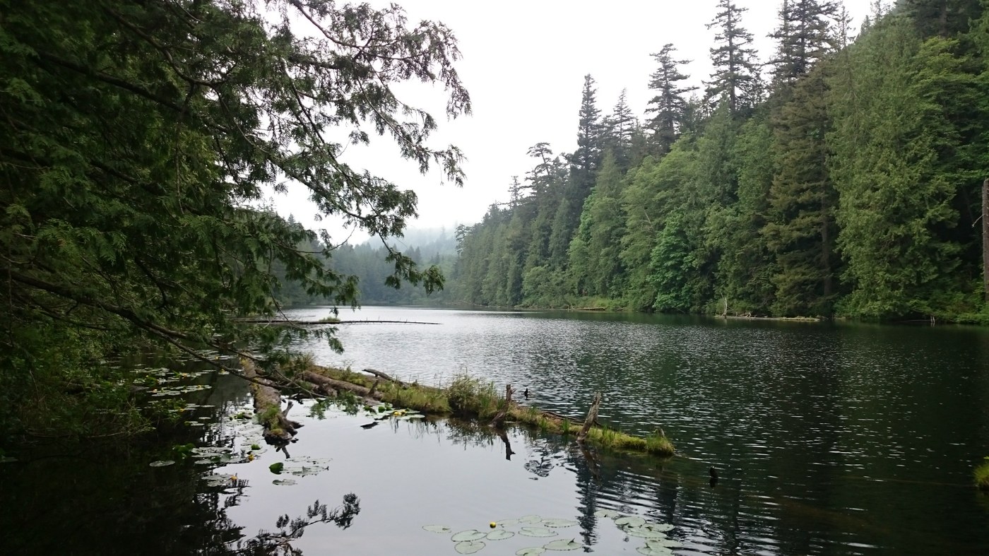
At the end of the Rock Trail it meets up with the South Lost Lake Trail, though there would be no way of knowing this if I didn't run into other hikers at the T intersection because once again, no signs. I took it north for just over 0.5 miles to get to Lost Lake. This lake is cool, but there are very few places where you can actually get to the water. There's an absolute mess of unmarked trails on the northeast end of the lake from years of confused hikers walking around. I just ate lunch and decided to head back.
The only thing different on my way back was that I took the full 3.2 miles of South Lost Lake Trail (which is less steep but kind of uneventful) to meet up with Fragrance Lake Road rather than do the steeper stuff again. I went on a hazy day which took away any views of the sound but did make the forest look spooky and meant I used less water.
Other than Rock Trail, I would not recommend any of what I hiked. And holy heck they need to address the way-finding and signage of this trail system. Most people I passed seemed to agree it was terrible. It's a shame too, because this is such a cool area, geologically.
Trip Report
Larrabee State Park - Double Diamond Trail, Larrabee State Park - Rock Trail & Larrabee State Park - South Lost Lake Trail — Sunday, May. 26, 2019
 Puget Sound and Islands > Bellingham Area

Comments