
This used to be one of my favorite, short little hikes in the area. I say used to be, because the trail, which is actually an old forest road, has been reworked by the private land owners.
So to back up, my story goes back to a couple winters ago when I heard about this trail from someone I met snowshoeing in the area. I came back the following month with a few folks and we just started up the road. It ended up not being a snowshoe trip. A ton of the snow had melted just from January to February, but it was a fun hike. The road/trail does multiple switch backs on it's way up hill, crossing over Kennedy Creek multiple times, and there's a variety of waterfalls at nearly each crossing. Further up, there was a rocky switchback that had essentially become part of the creek. The actual crossing had a bridge of large logs, but that switchback was now a secondary run for the creek, with the water then hitting these logs and rejoining the creek like water running down a storm drain. (photo 2) The best of the various waterfalls was found at the top of this switch back.
Then a bit further uphill, at essentially what was the source of Kennedy Creek, the trail was flooded. In this colder weather we were able to make our way across a few snow covered logs and such... (photo 3) then only made it about a quarter mile further before an avalanche field made the trail impassable. We stopped there for lunch before heading back.
I made two other attempts to get up to Surprise Lake for the views of Mt Rainier that were supposed to be had... both times the hike was enjoyable, but the cloud cover kept us from even seeing across the lake on one trip, let alone the mountain. But I did discover the established camp site along the lake and decided I wanted to make this a backpack destination at some point.
Last May, I finally made it up on a day where we had clear skies and got to see Rainier peeking over the trees across the lake. Then yesterday, we headed up for an overnight trip.
As noted in other recent reports, this road had been popular with 4x4 riders, but it is now closed to vehicles. I found out later from the Ranger at the Carbanado Ranger Station that this road crosses a checkerboard of private property on it's way up to the lake, and ownership of some of it recently changed hands. The Ranger I spoke to didn't know much more than that, he wasn't even aware that foot traffic was still allowed until I told him about the posted signs.
Yes, trash was always an issue along this trail, I don't want to blame the 4x4 drivers, but given that lots of the trash included things like motor oil bottles and stuff most hikers wouldn't want to bother carrying... well, suffice to say the new owners took some extreme measures.
They are also taking measures that, in my opinion, have removed the character of this hike. They have been smoothing out the grade, covering rocky sections with dirt, adding culverts so the water will not "flood" the trail. Sorry, I can't even consider it a trail any longer... so the water will not flood the road.
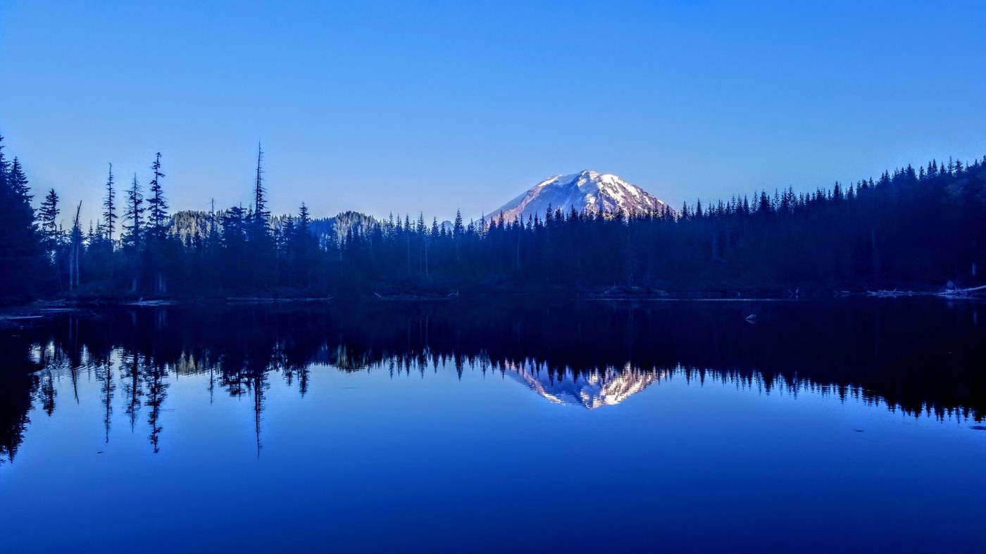
There was a backhoe parked about 1/2 or so down the trail from the lake. The campsite now has a semi-permanent encampment of a canvas tent erected on a wood platform. There was nobody there last night, so we were able to put our hammocks up, get some great views of Rainier, (photo 1) enjoy a small campfire, and enjoy our night there.
But like I said, a big part of why I kept returning to this trail was not just the views, it was the trail itself. That experience is now gone. I expect trails to evolve over time, but this one didn't evolve, it was changed. Also, trash is still a problem, and honestly, much of it seems left over from whatever groups are up there working/staying. Which, given it's "their land", I guess I can't complain too much.
I may keep this one on my list as a possible trip for a winter backpack, because of it's relative ease, but more than likely it is off my list. I'm just glad I got to enjoy it when it was at it's prime.


Comments
this sounded like a nice little hike. it is too bad about the garbage and how it has changed. I had never heard of it before. thanks for the report.
Posted by:
JackieJ on Aug 30, 2019 12:13 AM
As one of the property owners I would like to clarify a couple of things; The water running down the road was causing erosion and a direct contribution to stream siltation. This is unacceptable to salmon recovery efforts. We did not add culverts, we merely unplugged blocked culverts and stopped the degradation addressed above.
We have noticed a significant reduction in litter around the lake and along the road since closing it to unauthorized motor vehicles. Closing the road has also eliminated motor vehicles driving through the lake and degrading the shoreline.
Posted by:
Waggler on Dec 12, 2019 10:59 AM
I appreciate the feedback, and definitely appreciate the memories from previous trips. I dislike the bad behavior that led to some of the changes that had to be made. It's not that it's not still a nice hike, and a wonderful destination, for me personally it just changed a lot of what I specifically enjoyed.
Thank you for allowing others to continue to enjoy the wonderful views this lake offers.
Posted by:
McNee on Jan 30, 2020 06:37 PM
I appreciate the feedback, and definitely appreciate the memories from previous trips. I dislike the bad behavior that led to some of the changes that had to be made. It's not that it's not still a nice hike, and a wonderful destination, for me personally it just changed a lot of what I specifically enjoyed.
Thank you for allowing others to continue to enjoy the wonderful views this lake offers.
Posted by:
McNee on Jan 30, 2020 06:38 PM