
Great day for a hike. Got to trail head at 9:10 this morning . Road down to trail head was rough but not to bad. I parked in the large parking lot just below the cabins. I drove down to the trailhead and the road was rocky and I did not want to park down there and possibly get boxed in if someone got stuck so I turned around and parked in the large lot.As it was I was the only one on the hike all day.
Trail was in great shape all the way except in the burned out area going up where the vegetation was encroaching the trail a bit. Vegetation was dry so I did not get wet. Actually I needed to shed layers and was hiking in a short sleeve shirt on Nov 5th. I could of worn shorts.
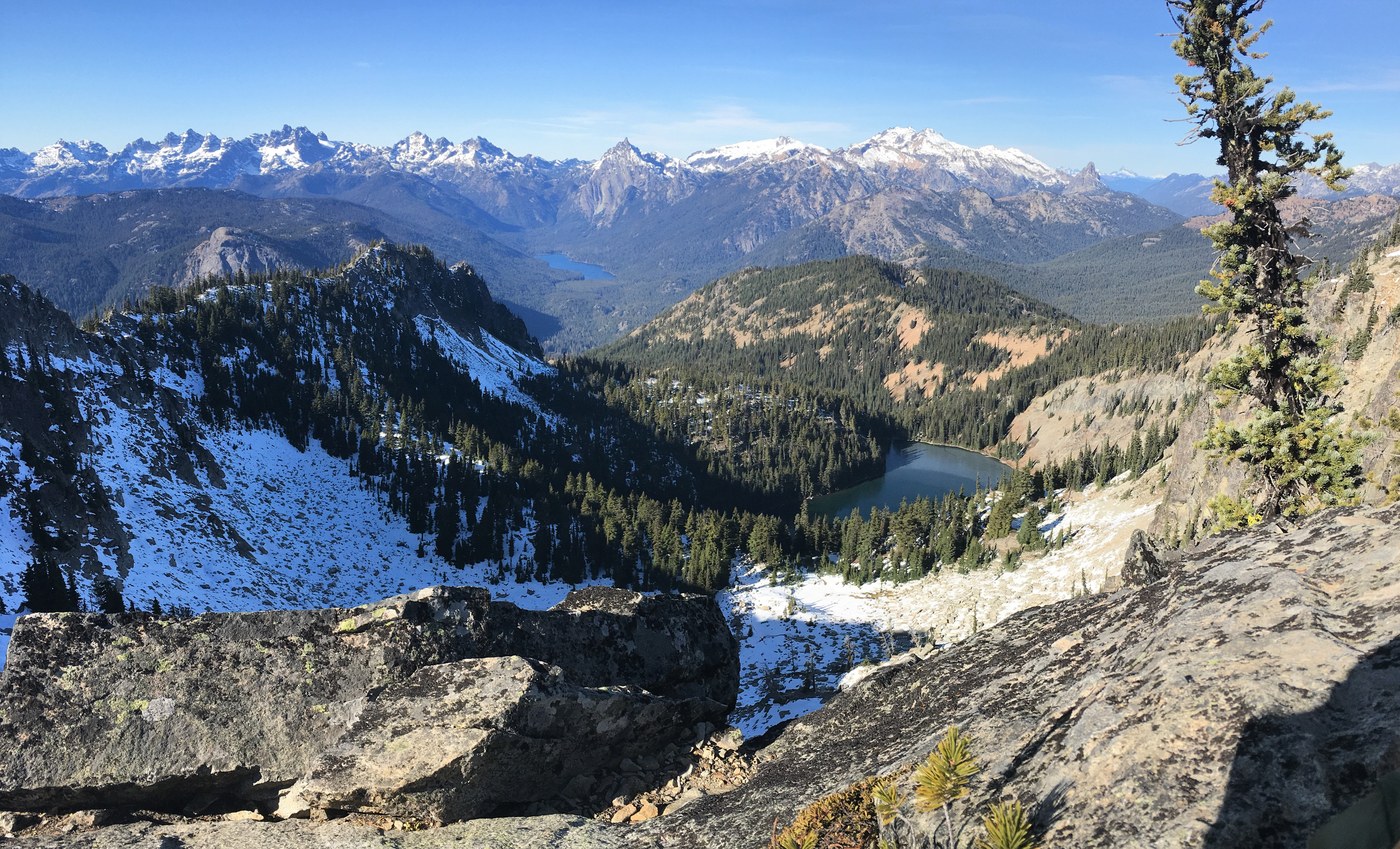
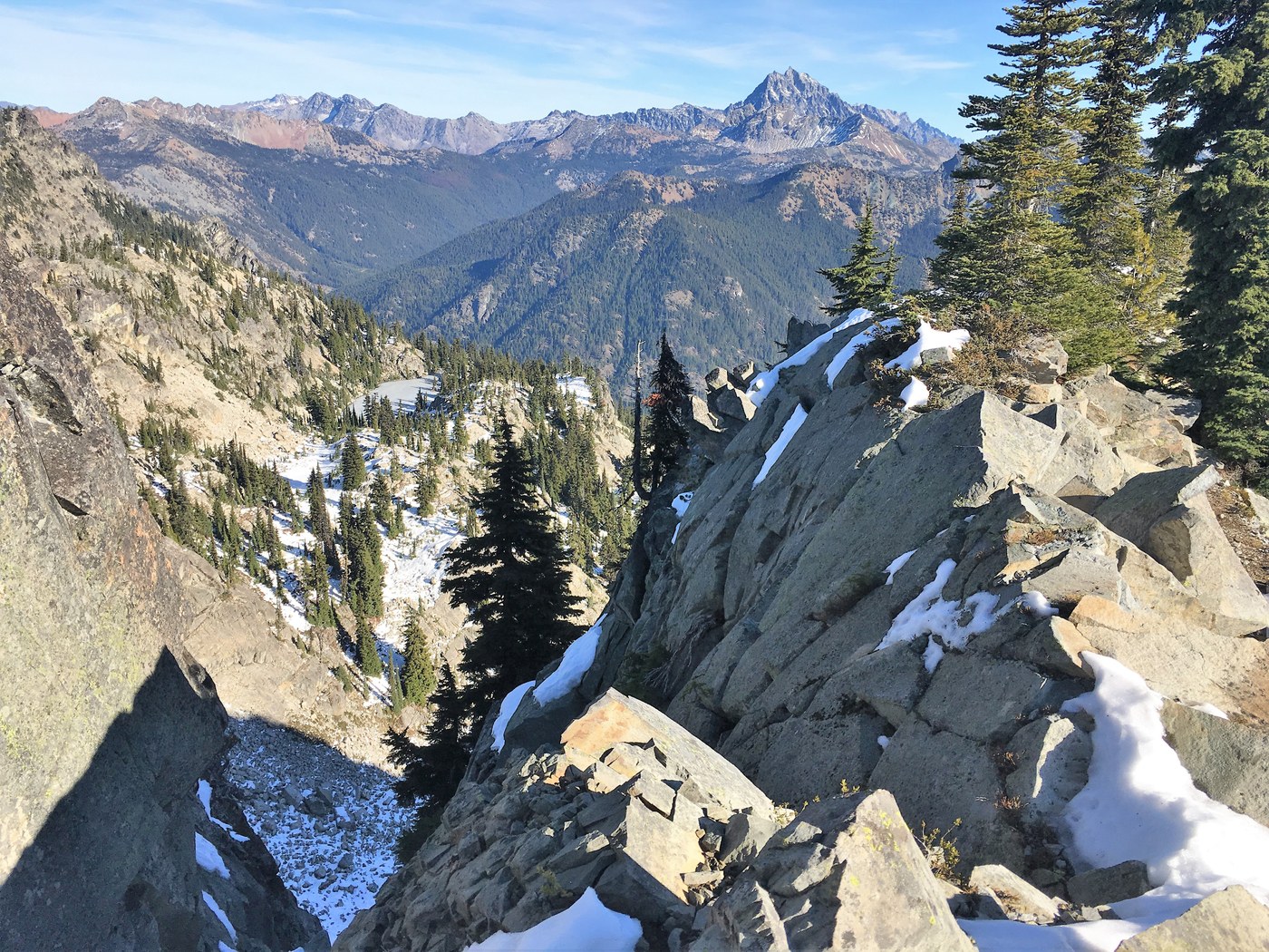
There was no snow on the trail until you came to the false summit and had to drop down into the bowl. There was intermittent snow in the shady spots. It was not to slick and I did not put on micro spikes.There were a few snow spots heading up to the lookout but not to bad.
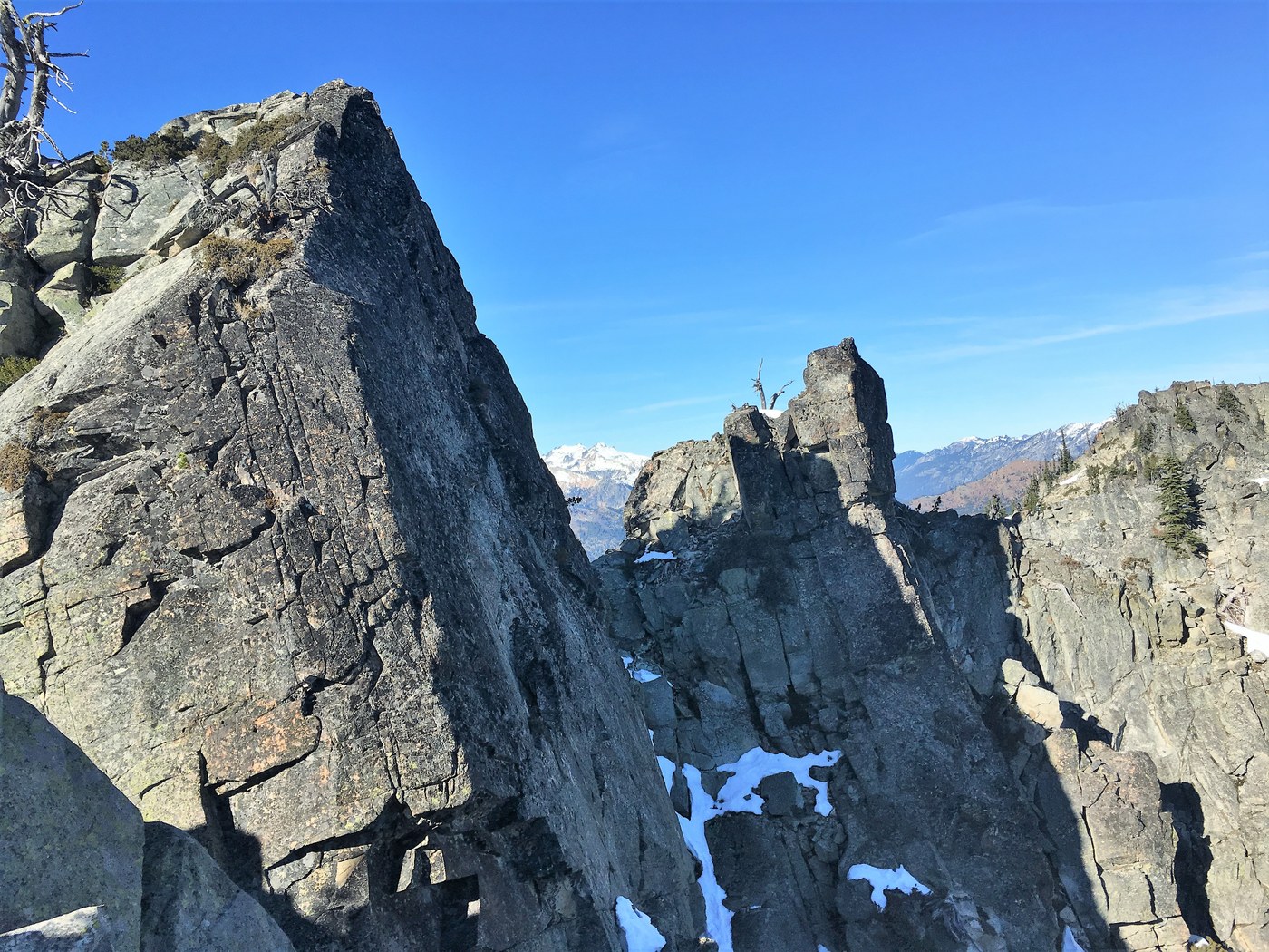
There was no snow at the lookout. Nice views here of Mt Stuart. The trail to Davis Peak did not have any snow for the easy part. When you came to the area that you need to traverse the knife edge there was no snow on the south side, but where the trail skirted the north side with some drop offs there was some snow. This got my attention because there was a couple of long steep snow run outs with exposure just a foot off the trail. You just need to focus on what your doing. There is a little bit of exposure at the summit but I just took my time. It would be good to do his hike before the next snowfall as it would get a little dicey up top with any new snow.
Views up top were amazing as were the views on the hike up. Great time of the year to do the hike as it is steep and there is no water. This one has got to be tough in the summer as it is on the south side of the mountain and in the sun all day.
Got back to the empty parking lot at 2:45 PM. The hardest part of the hike was the 100+ ft elevation climb back to the car from the bridge that crossed the river. 10.5 miles RT with 4393 elevation gain

Comments