

Kyes Peak via Blanca Lake trail. This adventure has a little bit of everything. Cruisy blanca trail, bushwhack, snowfields, scrambling, cool lakes and grand views.
Road: Really not that bad. 90% of the road is excellent. Beckler River road is really nice. The smaller road to the trailhead, FR63 is really not that bad. Some nice sized potholes but can mostly be avoided. Driving over the repaired rockslide does have some rocky road. I wouldn’t want to take old balding tires on it but most should be okay. Small stream crossing but at this point it’s very small and easy.
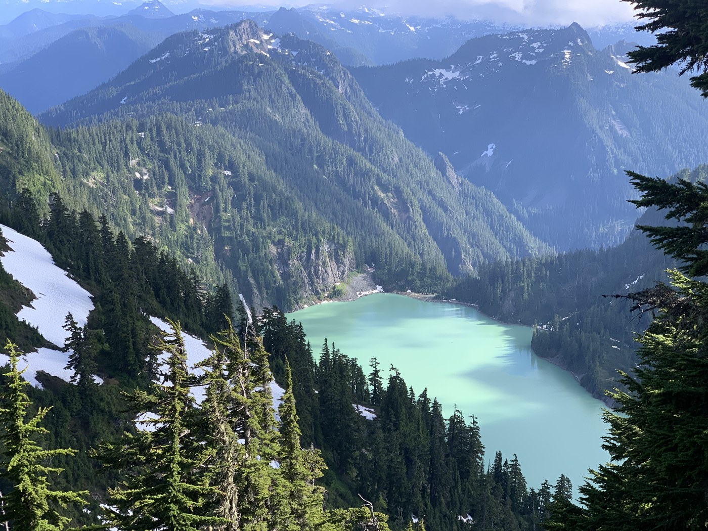
Blanca Lake trail to just after Virgin Lake:
great shape. A few blowdown but it’s nothing if you plan on summiting Kyes lol. Decent grade the whole way, just typical switchback in the forest kind of thing. Slightly on the boring side. Decent views as you approach the ridge and a number of good campsites if you want to make it an overnight adventure. Still some snow on the ridge near Virgin Lake area but it’s no prob.There’s a couple tiny streams towards the bottom of this trail, next opportunity would be Virgin Lake which looks like nice water but you would want to use a filter.
Blanca Lake to Kyes:
This is where whatever nice speed you were holding coming up will be diminished. There’s a not super obvious turn off, there’s a old tree post that’s mostly barkless which I guess is the symbol of a climbers path lol it’s just before you start to descend down to Blanca. I was going to check out Blanca but decided to pass as it was clouded in at the time. The boot path climbs steeply up the forested ridge. The path sometimes is very clear and obvious and other times non existent. I would recommend saving a GPS track on an app such as Gaia. Just turn on “public tracks”, locate one and save it to your app, it’s really easy and very helpful. Overall it was more followable than I expected. There will be a couple scrambles and steep trail spots. A moderate amount of bushwhacking. You mostly just follow the ridge largely on the right side for the first mile or so. Things get more interesting once you have to go around point 5,800. All the guides online suggested going left around it, so I did that and it was very unenjoyable lol. You drop down into a Boulder field and then head around the side of 5800 trying to stay mostly at the same elevation if possible. Back and forth of thick trees, slippery Heather bushes and slippery snowpack. Get ready to fall down a good number of times even if you’re careful. There wasn’t a clear path through here so I just made my way any way that looked safe and passable. Once around it you’ll climb steeply up the forested slope. Faint trail here helps a lot. Just take it up as far as you can go. Once you reach the top of the ridge you’ll hit the snowfields. I was really concerned about the snowfields and conditions but overall it was extremely pleasant and easy. I used microspikes/poles and that’s all that’s needed IMO. Felt more than fine without an ice axe during my snow conditions and runout is mostly not too bad. Just traverse across the snowfield like 1/4 mile. There’s almost like a flat ridge of snow so it’s not sloped the whole way, easy snow walking. After you get passed the gnarly tooth looking summit, you can head up towards the ridge kickstepping. I just went straight up to where I saw I could access the ridge. There’s two spots you could go up, but I found the lowest section after the tooth was easy to get to(47.95831, -121.33354). Once on the ridge I left my spikes and poles behind. You will do some garbage loose rock scrambling that is sure to irritate you and make the moves way harder and riskier than they need to be due to all the loose rock lol. I went to the left and found a way up.(on the return I came around the right side kind of along the snow bump that looked ready to fall off. This could maybe have been avoided if you traversed the snow field a little further northwest to the next accessible ridge but that still looked iffy as well but I think the summit post suggests the one after the one I did. Once up to the false summit this all gets a bit easier. It becomes more solid and you just take an awesome ridge walk to the base of Kyes. Climbing up Kyes looks real scary from here but as you approach it’s not bad. Some easy sometimes loose scrambling. Summit views are excellent of course. On the way down I did a combo of foot skiing and glissading.
Gear: trail runners, microspikes and poles
Bugs are pretty bad mostly on the upper half of blanca lake trail and lower half of Kyes climbers path. Especially around Virgin lakes. You don’t notice if you keep moving, I stopped to change socks on the way down and was swarmed by about 20 biting mosquitos.
I included a Gaia GPS track below, it should be public and available to download to make your travel easier. Made a couple wrong turns but mostly on track.
Summitpost has a pretty good route description. I recommend saving that on your phone as well for reference.
Stats: 13 Miles 5,800 Feet
12.5 hours including breaks and naps. Moving time was 8 hours.
YouTube video: https://youtu.be/IuXCy6ExPa0


Comments
I've been thinking about this one. Thanks for the detailed report.
Posted by:
Hiker33 on Jul 23, 2022 09:23 PM
You’re welcome! It’s a cool adventure. Good luck if you give it a shot!
Posted by:
M&M Outdoors on Jul 24, 2022 07:24 PM