
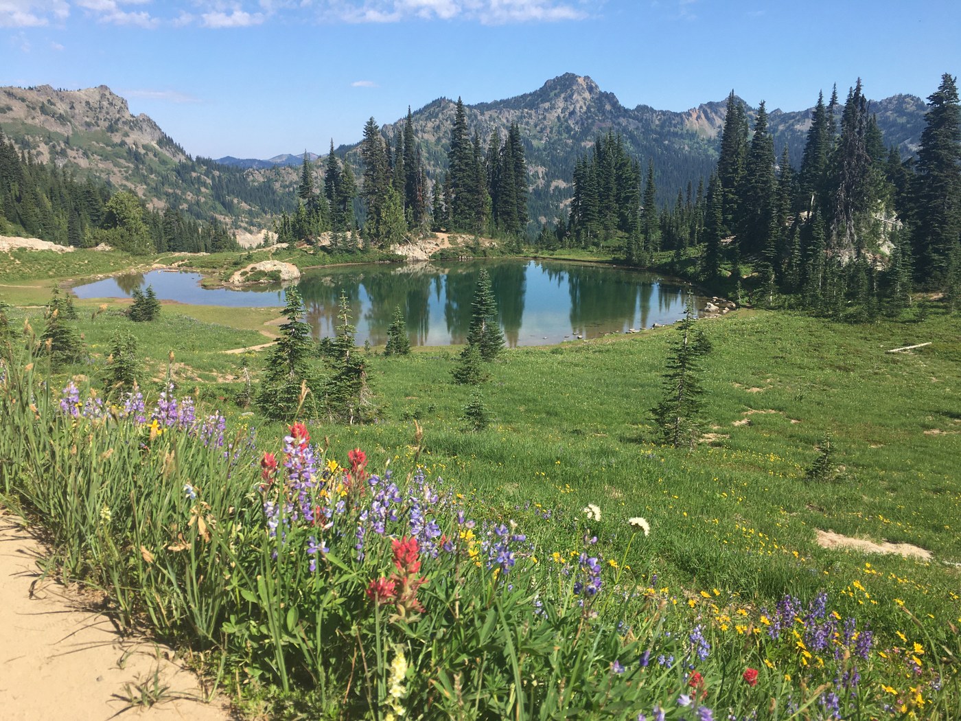
Just a beautiful morning on the Naches Peak Loop trail as there were so many wildflowers in full bloom. Ngie and I started at 7:05 am from the bridge over the Chinook Pass road. We took the loop trail clockwise as our objective was Tahtlum Peak. We were pretty much the first hikers to do the loop, but we saw numerous thru hikers on the PCT going northbound. So many wildflowers were out on this section!! Wow!! We where hiking into the sun in the early morning, so if doing this hike early, remember to turn around to get the most vibrant view and photos!!!
We had done some research and knew there was a trail that headed over to Tahtlum Peak just before the crest of the PCT where it drops down to Dewey Lakes. We saw a faint trail and took it. It worked but on the way back we found a better trail to the south which was much better and avoided the down scrambling that we had to do. This trail was quite nice at times, but there were a few times that the trail disappeared in some slide areas. This climbers trail has a few ups and downs before getting to the base of the peak. Then it is pretty much a straight up shot 800 vertical ft to the summit. Nothing to crazy to get up there, but there are some loose rocky sections that are like Red Mt by Snoqualmie Pass and steep scree that are like going up Earl Peak in the Teanaway. The summit of Tahtlum Peak has some great 360 degree views!
Once we got back to the PCT we took the loop counterclockwise back toward where we were parked. By now there were many other hikers enjoying the fantastic views going clockwise. We waited quite a bit for them to pass, but we didn't mind, as it gave us time to take more flower shots. Make sure you have storage space on your phone or camera, as you are going to take a lot of pictures!!!
Once back near the bridge we took the climbers trail up to Naches Peak. If you decide to head up to the summit, beware that this is a climbers trail and can be difficult to follow at times. There are a couple of forks that head of to the left that you need to take. There are sections that are also severely overgrown. There are also some scramble sections and one section that has a bad runout to a cliff below. The views are really not any better than the regular loop trail until you get up toward the top. The very top is only for scramblers that are used to extreme exposure as there are drop offs on both sides. I stopped at 6377 ft, 75 vertical ft from the summit, as I did not want to deal with the exposure. Ngie went ahead and got to the summit! Remember also, that down scrambling is harder than going up. A few previous reports have also had parties bringing a rope and anchors for protection.
We finished at 12:15 pm 7 miles with 2670 ft gain


Comments
Beautiful! Were the bugs out in force or did you just need to swat away the occasional fly?
Posted by:
almondine3 on Aug 14, 2022 08:11 AM
I didn't really notice them in the early morning on our way out, but by late morning I had to re apply more repellant as they were getting more bothersome. Still, not even as bad as they have been in other parts of the state!!
Posted by:
kidz won't hike on Aug 14, 2022 10:21 AM