Group of 3 summited Goode on 8/13-15. Ascent via NE buttress, and descent via NW couloir. 38.7mi, 9,200ft gain.
Gpx: https://caltopo.com/m/224VP
Group gear: 70m rope, a small rack + single & double runners, 1 picket, water filter, ursack.
Personal gear: approach shoes/trail runners, ax, harness and glacier + rock climb + rappel gear, helmet, extra bottles to carry water. Optional: mountaineering boots.
Day 1:
Got a walk-up permit for the Goode XC zone at the Marblemount ranger station at the opening time (7am).
Bridge creek trailhead > PCT > North fork bridge creek trail > 5,500ft bivy spot and camped. 14.9mi, 3,100ft ascent, 2,200ft descent in 9h.
Water sources / water crossings:
- 1.7mi into PCT: a few shallow creeks. Rock hopping.
- 8mi into PCT: waterfalls. Careful rock hopping, fording or via foot bridge.
- Halfway between north fork and walker park: small stream
- Grizzly creek: a series of logs
- North fork bridge creek: fording. Find a shallower / slower-flowing spot.
- Creek at the 5,400-5500ft bivy spot. Rock hopping.
Encountered one bear on trail near the Hideaway camp. Lots of overgrown in mile 13-14. The slabs near the waterfall was mostly straightforward and featured, with a few exposed bouldering moves. Topped out of the slabs at 4,300ft onto some slider alder / bushwhacking for 300ft until an obvious dirt path again. Found some a nice bivy spot with rock walls at 5,500ft with easy access to creek. Make sure to put your food away in ursack.
Day 2:
5,500ft bivy spot > Goode glacier > NE buttress > summit and camped. 1.5mi, 3,400ft ascent in 11h.
Water sources:
- Creek at the 5,900 bivy spot. Last running water. Make sure to fill up for the summit push (and summit overnight stay if chosen), basically enough until you descend to 7,700ft on the NW side. We each carried 4-5L with extra (collapsible) bottles.
- (Unreliable) Small snow patch just beyond the 8,700ft bivy spot, and near 9k bivy spot.
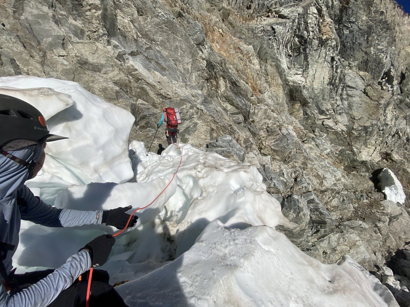
Crossed the glacier in just under 2h. Entry to the glacier had pure ice. Some narrow snow bridges at the beginning. Transition from glacier to rock on a moat and narrow snow bridge (looked broken up and sketchy, but was holding fine and firm when we crossed at 8am. We prusik belayed (with a vertical mid-clip picket half buried due to firm snow condition) the first person out, who then belayed the rest of us.
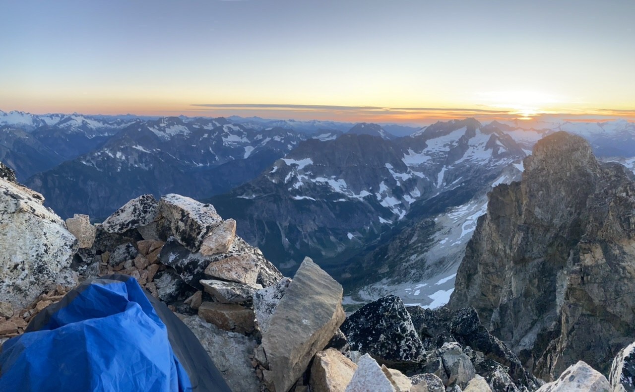
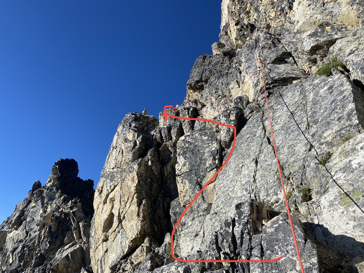
Climbed the NE buttress in just over 9h. Simul-climbed as soon as we got onto the rock, and had the middle person lead the other two at the rope ends. Simul-climbed most of the buttress, with some belaying in the steeper section and the exposed traverse. The summit bivy hype was real!
Day 3:
Summit > black tooth notch > NW couloir > park creek trail > Stehekin valley > PCT > bridge creek TH. 21.8mi, 3,300ft ascent, 7,800ft descent in 18h.
Downclimbed 10ft from the summit to the first rappel station. 3 rappels (2nd one being sideway), protected traverse to the black tooth notch (marked by a carin, look up and left at the end of your 3rd rappel), and another 3 rappels (in more loose terrain and more rockfall hazards) to the SW couloir. All 6 rappels had well established rappel station. Carefully downclimbed the loose NW couloir while avoiding kicking down rocks. Exited the couloir onto a small and low angled snowfield with varying snow condition where we plunged stepped / glissaded. Entered the heather meadow at 7,700ft and found first running water on the descent. The heather meadow was pretty slippery and had a few stream crossings. Avoided the cliff by going to the (skier's) left. Entered the burn zone at 6,000ft. Many burndowns basically until the park creek trail, but you can generally count on an obvious sandy path with some log crossings, until the last 100-200ft. Horseflies were annoying in the burn zone. Felt the heat here with the dust and no shade. Such a relief when we got to the park creek trail, knowing it's only easy terrain from there. Just a 18mi slog to go ...
Water sources:
- 7,700ft small streams from snowmelt at the beginning of of heather meadow
- 4,000ft park creek (shortly after turning left onto the park creek trail)
- Park creek access again at the beginning of Stehekin valley road, under the bridge.
- The same two spots on PCT


Comments