
The bestie and I wandered a few hours and roughly 3 miles on the less traveled trails in the regional park today and if I had realized it wouldn't be as well documented online or on the park map I would have ran a track! GAIA did okay but once home, Caltopo has better mapping (but not completely).
We parked at the Hantwick Trailhead after assessing that the other main parking lots had their share of cars, there were less than 5 at Hantwick. We started out on the pavement heading down to the bridge like anyone else but after crossing we took a right and found dirt and mud to follow. E says this trail is ultimately designed for bikes and that was obvious but we didn't see any of those and only 3 other people.
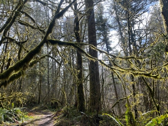
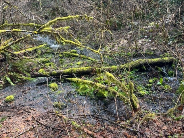
The trail was mostly forested and ran along a creek that flows down from Bells Mountain and eventually meets the East Fork Lewis River. It was a mix of new trail and old road, new deciduous trees and gnarled, older growth. There was quite a bit of mud, made even more slippery with the clay content of the soil. Being in the regional park, there were also section that looked like someone had raked off winter's debris, there were no logs to step over or under. And evidenced by one of the pictures below, I am guessing they like to have fun while picking up the park.
After a mile in, it begins to cross usable logging road and we took a little loop that brought us back to make a lollipop. The trail gets close to 1000ft in elevation so there was some snow on the sides of the trail and open meadow where the trees were sparse.
Having a map ahead of time would be helpful as the logging roads make it a bit confusing as they intersect the trails. E has hiked in here many times as it is just down the road from her house so that is how we knew which direction to turn when we met a road. It was clear that there have been some slides and reconstructing of the logging road (BG-3000).
When we took the last turn from the road to head back on the loop, there was a trail on the other side of BG-3000 that is not on GAIA or Caltopo that looked to head up towards Bells Mountain (different than the official Bells Mountain Trail that runs below it). At the very least, maybe it intersect the logging roads that do go to the summit. Hmmm...I told E she would have to come back and see where it goes!


Comments