Trip Report
Kyes Peak - Virgin Lake Route — Sunday, Aug. 31, 2008

For those looking to climb Kyes Peak via Virgin Lake, beware! This climber's route is indistinct, cliffy, slow, loose, and poorly marked. And on top of all that, it's a monster LONG traverse. Smoot's book underestimates this approach, Beckey's book greatly underestimates it.
Note: To get to the Blanca Lake trailhead, the road from Index is still washed out big-time. The river is running down the roadbed! It'll probably take years to fix. You have to take Beckler River road from Skykomish over Jack Pass. A couple of smaller washouts on the Blanca Lake road have recently been repaired, so from Jack Pass you can drive all the way to the trailhead.
There's a box toilet at the Blanca Lake trailhead. About 75 feet back into the parking lot from the signboard, a small trail leaves from the edge of the parking lot.
Except for about six blowdowns in the first mile, the Blanca Lake trail is in great shape, snow-free and mud-free.
There's a box toilet at Virgin Lake, east of the campsite at the northeast corner of the lake.
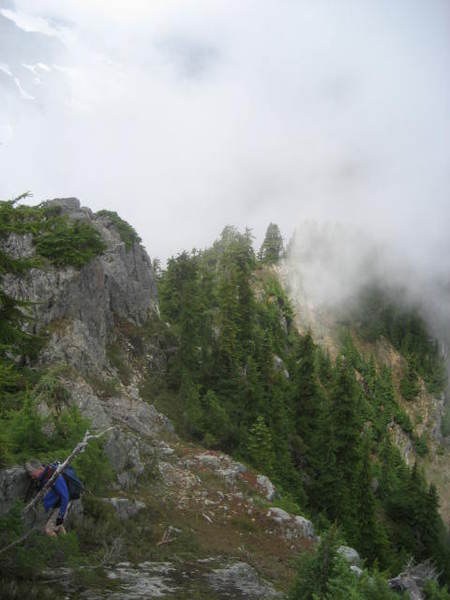
The Kyes peak climber's route leaves the trail just beyond the lake at a snag with blazes. Be smart and turn around here! The route is indistinct at first, but follows the ridge. At 4970 ft, the route drops off the right side to skirt cliffs, then you make your way back up using steep, tree-clogged gullies. At 5490 ft, an arrow made of sticks and rocks points to the crossing to the west side. We dropped down to the bench with open rockslides, but the route fades to become invisible. We traversed northward along this bench. The bench becomes steeper, so we angled up and to the right to the saddle at 5400 feet.
Just to get to the saddle took us about six hours from the car! And Kyes peak is much farther from there. Overall, there are hardly any continuous, distinct trails, and no markings to speak of anywhere along the route. In particular, the steep tree-clogged gullies are difficult to find on the return trip.
We had tried this Virgin Lake route to Kyes several years ago, and concluded that from the distance and complexity that it wasn't feasible. The following year we approached via Blanca Lake and Columbia Glacier. The ""route"" from the glacier is not just steep and loose but lacks even a climber's track. We didn't make the summit that time because we ran out of time. This route is also monster long.
Since we first tried in 2001, here's the final score: Kyes Peak 4, Mark & Phil, 0. We can't really recommend this one; the approach routes are just too long, steep, and obscure. If you know the secret path that makes this a reasonable trip, please post a report. Otherwise we'd have to say that aside from the spectacular views of Blanca Lake, any number of other peaks would be a lot more fun.
Comments