Trails for everyone, forever

Home Go Hiking Hiking Guide Hannegan Pass and Peak

Hannegan Pass and Peak

North Cascades > Mount Baker Area
48.9101, -121.5927 Map & Directions
Length
10.4 miles, roundtrip
Elevation Gain
3,100 feet
Highest Point
6,200 feet
Calculated Difficulty About Calculated Difficulty
Hard
One of the many beautiful views from Hannegan Pass. Photo by LLFreeman. Full-size image
  • Mountain views
  • Wildlife
  • Established campsites
  • Ridges/passes
  • Summits
  • Dogs allowed on leash
Saved to My Backpack

The wide-open trail to Hannegan Pass and Hannegan Peak offers spectacular mountain views, glorious alpine wildflowers, waterfalls and glaciers. Choose to hike to 5050 foot Hannegan Pass (about 8 miles roundtrip) or press on to the 6200 foot summit of Hannegan Peak -- 10.6 miles roundtrip. Continue reading

Rating
4.46 out of 5

(28 votes) Log in to rate

Hiking Hannegan Pass and Peak

Begin hiking from the parking area at the end of the Hannegan Pass Road (FS 32). The first couple of miles have a very gentle grade - enjoy views of Mount Sefrit and the Nooksack Ridge, as well as the sounds of Ruth Creek running below, but beware of biting flies; they love the dense flora along the first part of the trail at least as much as hikers do.

The trail crosses several small waterfalls and dips in and out of shady glades, offering a respite from the heat of the sun. The grade increases around mile three, launching into switchbacks at Hannegan Pass camp, which continue all the way up to Hannegan Pass. Enjoy the view, drink some water and have a snack at the pass, looking up the Middle Creek drainage and into the North Cascades National Park, because you're not finished yet!

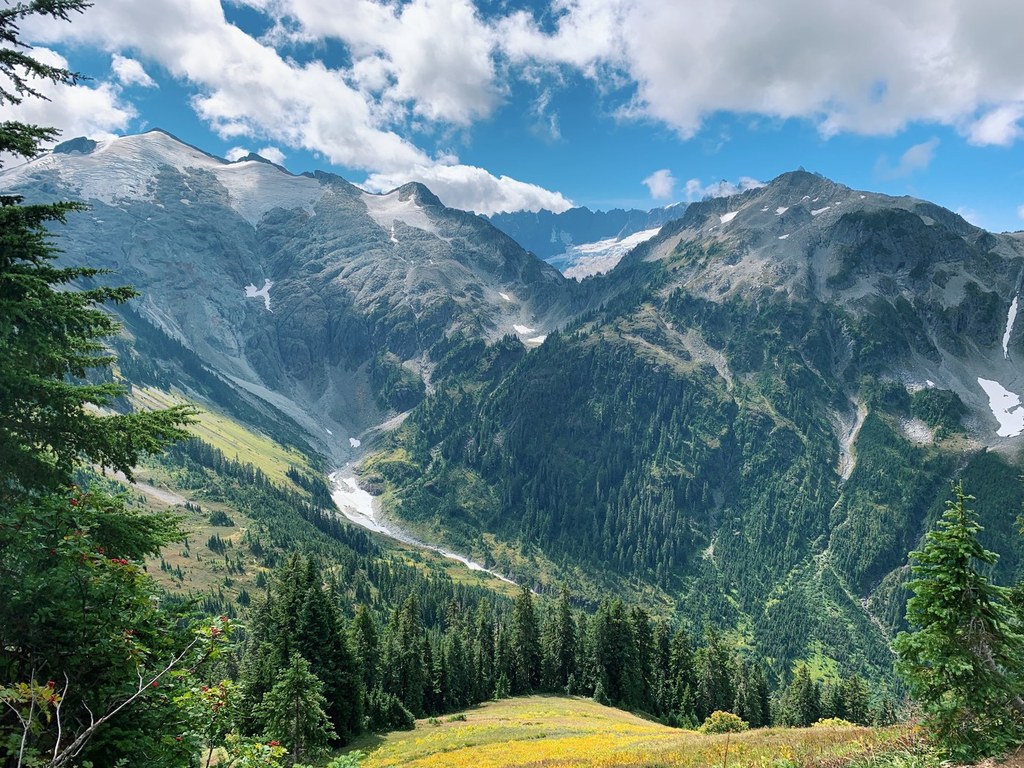
The trail up to Hannegan Peak begins with steadily graded switchbacks that weave through forest and beautiful alpine meadows with views of Ruth Mountain that improve as you climb. And climb you will - with 1,000 feet of elevation gain in just over a mile, this is by far the biggest push of the hike.

But it's so worth it. At the summit, enjoy 360 degree views of Cascade peaks, including Goat Mountain, the High Divide, and the Nooksack Ridge to the west. To the north are the peaks of British Columbia and the remote Silesia Creek valley, and to the east, Copper Ridge is visible, as well as Mount Redoubt in the distance. But the southern view is by far the most commanding, with in-your-face vistas of Mount Baker and Ruth Mountain, as well as Mount Shuksan, the East Nooksack Glacier and the Nooksack Tower.

WTA worked here in 2022, 2021, 2020, 2019, 2018, 2017, 2016, 2015, 2014, 2013, 2012, 2011 and 2010!

Hike Description Written by
Anna Roth, WTA Staff

Hannegan Pass and Peak

Map & Directions

Trailhead
Co-ordinates: 48.9101, -121.5927 Open in Google Maps

Before You Go

Wildfire: Trail closed east of Boundary camps

See weather forecast

WTA Pro Tip: Save a copy of our directions before you leave! App-based driving directions aren't always accurate and data connections may be unreliable as you drive to the trailhead.

Getting There

Drive Hwy 542 about 46 miles, to 13 miles past Glacier Public Service Center. Just before the third crossing of the Nooksack River Bridge, turn left on road No. 32. At 1.3 miles, take the left fork, Ruth Creek Road, and continue 5.4 miles to the road-end at Hannegan Campground.

More Hike Details

Trailhead

North Cascades > Mount Baker Area

Hannegan Pass (#674), Hannegan Peak (#674.1)

Mt. Baker-Snoqualmie National Forest, Mount Baker Ranger District

Guidebooks & Maps

100 Hikes in Washington's North Cascade National Park Region (Spring & Manning - Mountaineers Books)

Day Hiking: North Cascades (Romano - Mountaineers Books)

Information available at http://www.fs.fed.us/r6/mbs/recreation/activities/trails/mbrd_0674.htm.

USGS: Mt. Sefrit

Buy the Green Trails Mt. Shuksan No. 14 map

You can improve or add to this guidebook entry!

Hannegan Pass and Peak

474 Trip Reports

Hiked here recently?

Submit a trip report!
 
Trip Reports