Trails for everyone, forever

Home Go Hiking Hiking Guide Pilot Ridge

Pilot Ridge

North Cascades > Mountain Loop Highway
48.0579, -121.2882 Map & Directions
Length
11.0 miles, roundtrip
Elevation Gain
5,946 feet
Calculated Difficulty About Calculated Difficulty
Hard
  • Mountain views
  • Rivers
  • Ridges/passes

Parking Pass/Entry Fee

Northwest Forest Pass
Saved to My Backpack

A steep, infrequently maintained trail that is part of the White Pass-Pilot Ridge Loop. Continue reading

Rating
2.80 out of 5

(5 votes) Log in to rate

Hiking Pilot Ridge

A steep, infrequently maintained trail that is part of the White Pass-Pilot Ridge Loop. The beginning of this hike requires a ford of the Sauk River, which can be challenging or dangerous in the spring when the water runoff is high.

It's nearly 2 miles on the North Fork Sauk River trail to where hikers need to turn off to get to the Pilot Ridge trail. Once you cross the river, find the trail again and begin heading uphill.

It's a relentless 3 miles and 3000 feet of gain uphill to where the trail begins to traverse east/northeast along the namesake ridge. The trail stays on this ridge for 7 miles until, 10 miles from the trailhead, find a side trail to the east that climbs one mile to the 6,712-foot summit of Johnson Mountain.

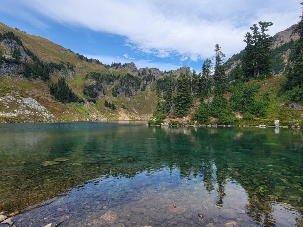
Back on the main trail you'll arrive at a junction in another half mile. The left fork leads to the cliff-walled, 22-acre Upper Blue Lake at 5,500 feet that may remain frozen until mid-August. The right fork leads to three-acre Lower Blue Lake in 0.5 miles.

The right fork is the main trail, which ends at June Mountain at a junction with the Bald Eagle Trail. Follow Bald Eagle Trail east for 2.5 miles t

Hike Description Written by
Multiple authors contributed to this report, WTA Community

Pilot Ridge

Map & Directions

Trailhead
Co-ordinates: 48.0579, -121.2882 Open in Google Maps

Before You Go

See weather forecast

Parking Pass/Entry Fee

Northwest Forest Pass

WTA Pro Tip: Save a copy of our directions before you leave! App-based driving directions aren't always accurate and data connections may be unreliable as you drive to the trailhead.

Getting There

On the Mountain Loop Highway, drive 16 miles south of Darrington or 26.2 miles east of Verlot to Forest Road 49. Turn east and proceed 6.4 miles to the sign for the North Fork Sauk parking lot.

More Hike Details

Trailhead

North Cascades > Mountain Loop Highway

Pilot Ridge (#652)

Mt. Baker-Snoqualmie National Forest, Darrington Ranger District

You can improve or add to this guidebook entry!

Pilot Ridge

71 Trip Reports

Hiked here recently?

Submit a trip report!
 
Trip Reports