Trails for everyone, forever

Home Go Hiking Hiking Guide White Bluffs - North

White Bluffs - North

Central Washington > Tri-Cities
46.6772, -119.4446 Map & Directions
Length
7.0 miles, roundtrip
Elevation Gain
500 feet
Highest Point
725 feet
Calculated Difficulty About Calculated Difficulty
Moderate
The dunes at Hanford Reach are striking. Photo by HowardC3
  • Wildflowers/Meadows
  • Mountain views
  • Wildlife
  • Rivers

Parking Pass/Entry Fee

None
Saved to My Backpack

This is a striking, gorgeous hike -- excellent year round, whether you like snow-dappled trail or high desert. If you visit in summer, bring lots of water and a hat. There's no water available here. Continue reading

Rating
3.89 out of 5

(18 votes) Log in to rate

Hiking White Bluffs - North

Also known as the Hanford Reach, this is one of the most striking areas of Washington state. High desert and rolling dunes rise away from the mighty Columbia River, and across the water are the reactors on the Hanford campus, relics of World War II. 

But views are of so much more than the historic reactors. Rolling rivers, expansive skies, desert shrub and mountains of sand: it's a beautiful area, and well worth the visit. 

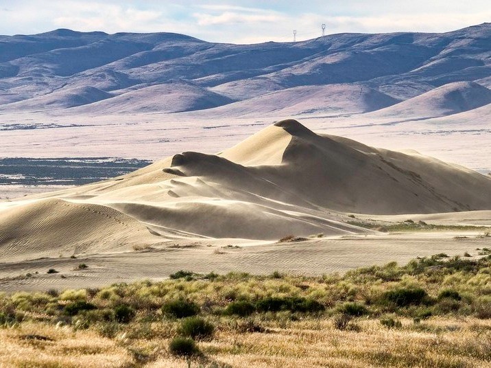
From the trailhead near the boat launch, head north on a well-worn but unsigned footpath. Follow it through shrub steppe for 2 miles to the first dune. As you hike, see how much wildlife you can notice; the wildlife in the Hanford Reach area is plentiful and diverse.

Look for bald and golden eagles, osprey, raven, heron and red winged blackbirds in the marshy areas along the reach and arid animals like lizards and small mammals in the sandy areas along and on top of the bluffs.

For rock hounds, the white bluffs are a marvel in themselves. As the Columbia cuts through the prehistoric Ringold Formation, they carved away this rock and left strikingly bright cliffs.  Tiny flecks of granite sparkle in the sand mix of the dunes.  

The first dune is reached after 2 miles. It's a great stopping spot to take in the views and listen to the wildlife around you and river below. 

There is a second dune another mile and a half along, but once up on the dunes there is no "trail". It's unlikely you will get lost, but do please keep in mind that some soils in the high desert of Washington are cryptobiotic -- a sensitive environment that take a long time to recover after being stepped on. If you decide to continue your wanderings, please watch where you step! 

Toilet Information

  • Toilet at trailhead

More information about toilets

Hike Description Written by
Multiple authors contributed to this report, WTA Community

White Bluffs - North

Map & Directions

Trailhead
Co-ordinates: 46.6772, -119.4446 Open in Google Maps

Before You Go

See weather forecast

Parking Pass/Entry Fee

None

WTA Pro Tip: Save a copy of our directions before you leave! App-based driving directions aren't always accurate and data connections may be unreliable as you drive to the trailhead.

Getting There

From the Tri Cities, drive north on Highway 240 for 29 miles to a junction and stay straight to Highway 24. Cross the Vernita Bridge and stay on Highway 24 for 19 miles, then turn right (south) onto a gravel, signed road for the wildlife refuge. Continue for 4 miles, then take a right and drive downhill a 1.3 miles to a small parking area near the boat launch. 

The parking area and trailhead are not marked but they're easy to see on the north (right) side of the road after dropping down the bluff. The trail starts next to a single fence post.  

More Hike Details

Trailhead

Central Washington > Tri-Cities

U.S. Fish and Wildlife Service

Guidebooks & Maps

Best Desert Hikes Washington (Bauer and Nelson - Mountaineers Books)

USGS Locke Island

You can improve or add to this guidebook entry!

White Bluffs - North

131 Trip Reports

Hiked here recently?

Submit a trip report!
 
Trip Reports