

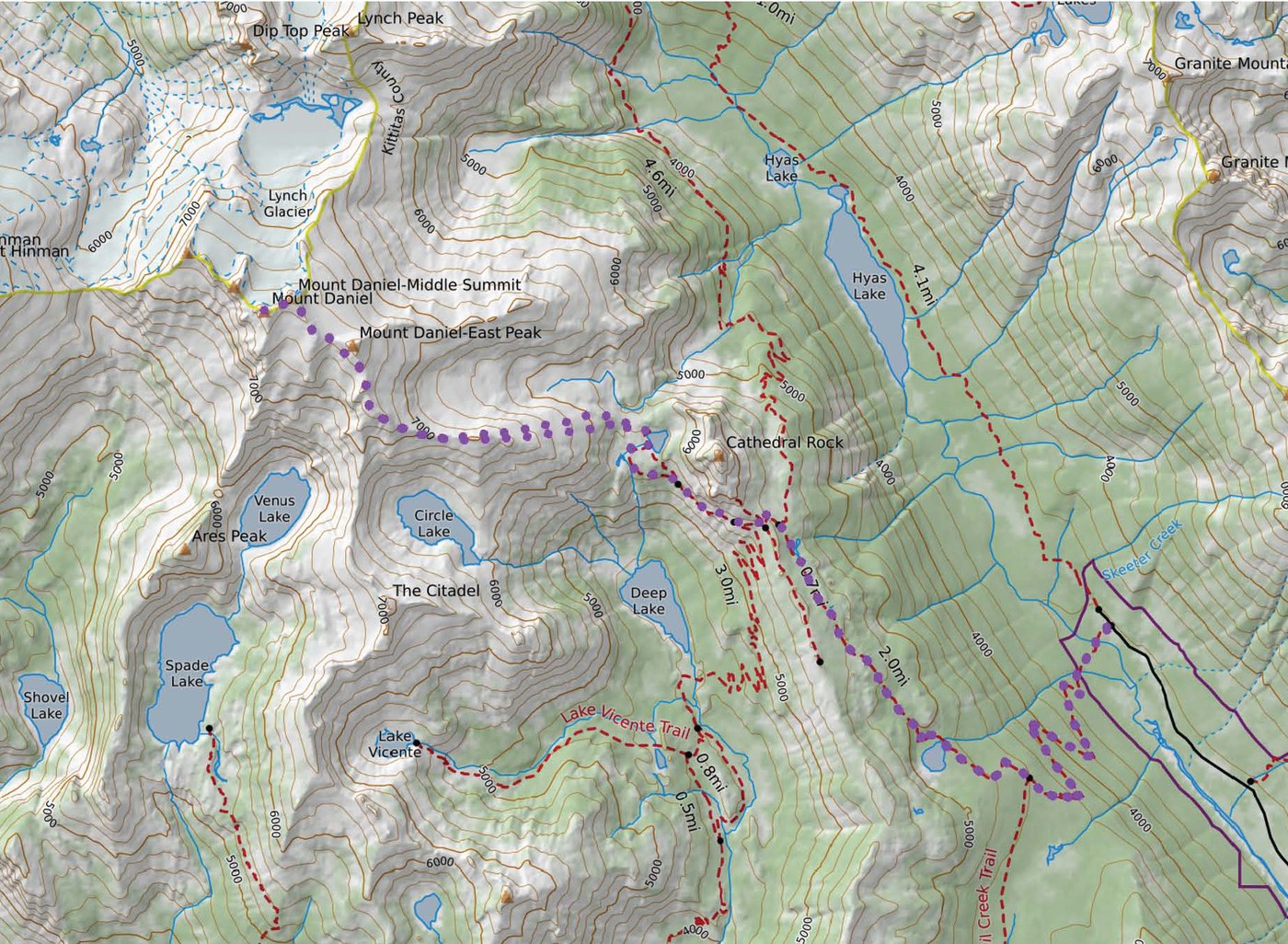
On Saturday August 12th I started out at the cathedral rock trailhead near the Tucquala meadows and headed to the true summit of Mount Daniel. Almost all snow was melted out and traction and ice ax are not required. Still pretty smoky today, so views were constrained to immediate lakes and peaks.
To start I headed up towards Squaw lake which is a moderate climb. Past Squaw lake is a very nice trail with meadows towards cathedral rock, which has only a minor incline. Once you get to the junction with the PCT, the trail becomes a little harder to recognize. The trail skirts past the west side of cathedral rock and gets a bit rough in places, with some loose footing and a steep hill on your left. As you approach Peggy’s pond there are apparently two trails. One goes directly to Peggy’s pond which I didn’t find, the other arcs to the west and passes some shallow ponds before getting to Peggy’s.
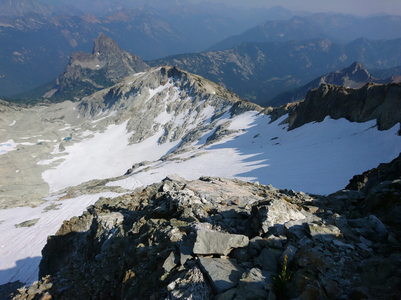
Once you reach Peggy’s pond, you will find a host of boot paths leading west up the ridge. Some paths are more direct than others, but as long as you’re heading in the right direction you’re fine. Look for and follow cairns for the remainder of your trip towards the true summit of Mount Daniel. As you near the top of this first ridge, the ridge becomes more narrow with significant exposure at some points both towards the south but especially the north. There is a little scrambling necessary, but mostly just a lot of paying attention to the route and watching your step. You will mostly be directly on the top of the ridge or just on the south side at this point. There are amazing views to the South of Deep, Circle, and Venus lakes. There also spectacular views to the North of the glacially carved basin below the East peak of Mount Daniel (not the true Mount Daniel summit). As the ridge turns towards the north there is more scrambling to be had. Again you are mostly sticking to the left side of the ridge (now west side). Except for short portion where a big rocky outcropping (there is probably a better mountaineering term for this!) forces you to the right and back directly on top of the ridge.
As you approach the East Summit, you will notice a path to the left that skirts this summit. (Do Not start to climb the east summit rocks, as your destination is the true summit) The footing on this path skirting the eats summit here is a little loose, just watch your step and again follow the cairns. The path will lead to a saddle between the East and Middle Summits. At this point the footing may still be over loose rocks but you get a relief from any exposure. You will then climb up towards the middle summit, here you again will skirt this summit going to the left head towards the true summit. There is a short and simple scramble up to the final true summit of Daniel. Here you can enjoy an amazing view of Pea Soup Lake and the surrounding peaks. Head back the way you came, again pay attention and be mindful of your footing in your fatigued state!

Comments