
Begin climbing on the Alki Crest trail after the rainforest loop at the trailhead near Carbon River Ranger Station. Climb through switchbacks heading west, and cross out of the park boundary. Don't worry, you'll be back.
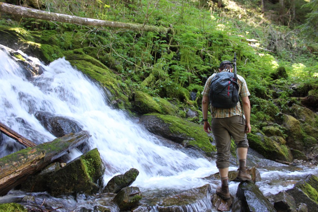
Find a waterfall a mile and a half into your hike. If you do this one early enough in the season, be aware of snow or slick water crossings, as well as snowfield traverses late into the season.
Hit the crest after a 3000 foot elevation gain, continuing on the main trail which heads down the ridge you have just reached the top of. Descend this ridge to Tolmie Creek, then head back uphill to the west side of August and Virginia Peaks. The trail continues on to Martin Peak, and then drops into Mowich Lake Road, just west of the Paul Peak Trail.
Alki Crest

The Fairfax Bridge (3 miles south of Carbonado) is closed to all vehicle and pedestrian traffic until further notice due to safety concerns. The bridge closure renders this hike inaccessible.
A long, meandering hike in Mount Rainier National Park that tours Tolmie Creek, August and Virginia Peaks, and Martin Peak.
Continue reading
Hiking Alki Crest
Map & Directions
 Trailhead
Before You Go
The Fairfax Bridge (3 miles south of Carbonado) is closed to all vehicle and pedestrian traffic until further notice due to safety concerns. The bridge closure renders this hike inaccessible.
Parking Pass/Entry Fee
National Park PassWTA Pro Tip: Save a copy of our directions before you leave! App-based driving directions aren't always accurate and data connections may be unreliable as you drive to the trailhead.


