
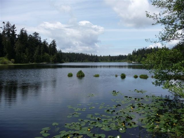
While there is not a trail all the way around the lake proper, it’s possible to do a loop hike around this lovely little lake just across the road from Mount Erie and Sugarloaf in the Anacortes Community Forest Lands. Formerly a state park, this area was transferred to the City of Anacortes in 2002, and now the trails that loop and bend around this little lake are accessible to residents and visitors without requiring a Discover pass.
Several access points exist around Heart Lake, but the best one for visitors is the large parking lot just off Heart Lake Road. With ample parking, facilities, and trash and recycling receptacles, it’s a good place to leave your car while you hike the nearly three mile loop.
From the north side of the parking lot, look for a trail leading into the cedar forest, marked 210. This is a multi-use trail, so be aware of equestrians and mountain bikers as you walk along this flat section for just .19 miles. When you arrive at a junction, follow Trail 210 ahead of you around to the left. You’ll pass a viewpoint of the lake, as well as a bench, which makes a nice spot to rest if necessary, and to take in the wildlife, which can be abundant on quiet days.
Continue hiking on Trail 210 down the north, west, and south sides of the lake. On the west side of the lake, turn left through a hiker-only gate to remain on 210. While you don’t always have direct views of the calm water, the peace and quiet of the forest surrounding you is meditative, and the large cedars and hemlocks you pass impressive. Birds chirp in the trees, and you may even spot a deer browsing in the brush.
1.3 miles past the hiker-only gate, the trail arrives at another gate and junction. Go through the gate and turn left onto Trail 212, which deposits you on the road after a quarter-mile of forest hiking.
To complete the loop, cross the road and step onto Trail 215, which can lead you to Sugarloaf’s summit. Instead, after .2 miles of hiking, take Trail 230, which climbs 100 feet to Trail 21 in just .18 miles. Hike a few feet up Trail 21, then turn left onto Trail 313, which begins a steady descent for a third of a mile back to Heart Lake Road. Cross the road and enter the parking lot, having successfully looped Heart Lake!
WTA Pro Tip: You’ll need the Heart Lake and Whistle Lake maps for reference on this loop hike. A set of all three Anacortes Community Forest Lands Maps is available for $10 at City Hall in Anacortes, as well as the bookstore, the two bike shops in town, and the Mount Erie grocer, which you’ll pass on the way to the trailhead.
Anacortes Community Forest Lands - Heart Lake

-
 Length
- 2.86 miles, roundtrip
-
 Elevation Gain
- 130 feet
-
 Highest Point
- 620 feet
Parking Pass/Entry Fee
None
While there is not a trail all the way around the lake proper, it’s possible to do a loop hike around this lovely little lake just across the road from Mount Erie and Sugarloaf in the Anacortes Community Forest Lands. Formerly a state park, this area was transferred to the City of Anacortes in 2002, and now the trails that loop and bend around this little lake are accessible to residents and visitors without requiring a Discover pass.
Continue reading
Hiking Anacortes Community Forest Lands - Heart Lake
Map & Directions
 Trailhead
Before You Go
Parking Pass/Entry Fee
NoneWTA Pro Tip: Save a copy of our directions before you leave! App-based driving directions aren't always accurate and data connections may be unreliable as you drive to the trailhead.
Getting There
From I-5, take Exit 230 for Highway 20 and head west for 10 miles, then turn left to stay on Highway 20. Staying straight on the Highway 20 Spur takes you into the city of Anacortes.
Turn right onto Campbell Lake Road and drive about one and a half miles along the lake. Turn right onto Heart Lake Road--note that the sign for this turn can be hard to read, so look for the Mount Erie Grocery and take the road to the right of the store.
Less than a mile from the grocery store, pass the parking lot for Mount Erie and Sugarloaf on your right. Within a quarter mile, the parking lot for Heart Lake is on your left--turn into the large graveled lot and pick a spot!


