Trails for everyone, forever

Home Go Hiking Hiking Guide Behrens Woods

Behrens Woods

Southwest Washington > Vancouver Area
45.5999, -122.5263 Map & Directions
Length
0.2 miles, roundtrip
Elevation Gain
7 feet
Highest Point
187 feet
Calculated Difficulty About Calculated Difficulty
Easy
The gravel trail winds through Behrens Woods, surrounded by trees and other flora. Photo by Rosemary Perkins. Full-size image
Saved to My Backpack

This wheelchair-friendly trail winds through a peaceful forested area in Vancouver’s Bella Vista neighborhood. Built by volunteers, Behrens Woods provides a brief escape from the city. Continue reading

  • Dogs allowed on leash
  • Fall foliage
  • Good for kids
  • Wildlife

Parking Pass/Entry Fee

None
Rating
0.00 out of 5

(0 votes) Log in to rate

Hiking Behrens Woods

Behrens Woods, formerly an undeveloped 2 acre forested area, is now home to a short network of wheelchair-friendly packed gravel trails thanks to the hard work of volunteers. 

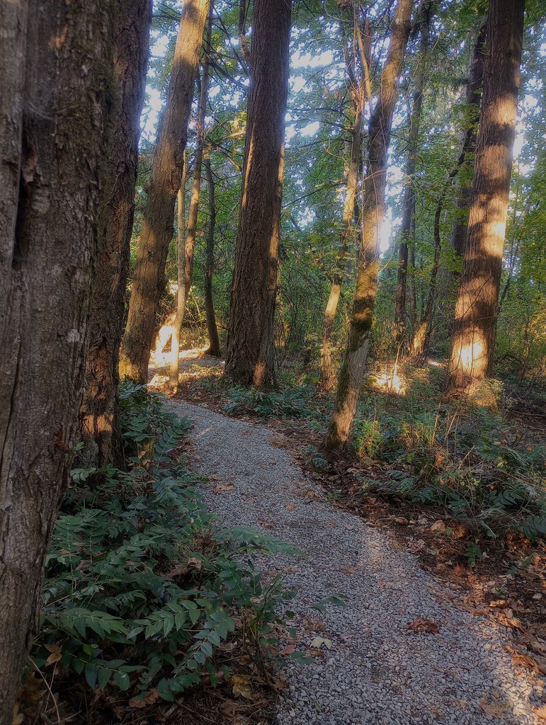
These trails provide a pleasant way to enjoy the cedars, Douglas firs, maples, and many other plants Behrens Woods has to offer. There are four access points to the trail, but the primary entrance is located at the corner of SE Bella Vista Ave and SE Bella Vista Rd.

Your journey begins to the left of the large “Behrens Woods” sign where you’ll first see a station to brush off your shoes, an important step to avoid carrying invasive plants into the woods. 

As you enter, you’ll be greeted by the sights, sounds, and smells of nature. You’ll still be able to hear the highway, but as you progress down the trail it gets easier to tune out. As you enjoy your time here, keep an eye out for the occasional small interpretive signs listing the names of the plants you’ll see!

While there are many ways to navigate the short trail system in this park, you can form a nice loop by taking your first left at the signed osoberry (Indian plum) plant. Traverse gently uphill as the trail curves to the right and passes an offshoot on the left to an alternative access point before returning to the main trail. 

Take a left and then immediately head to your right to continue the loop.  A hard left leads to another alternative access point while a right takes you back to the trailhead.  As you continue up the trail, you’ll pass a tree marked with graffiti followed quickly by an interesting hollowed out stump before reaching another intersection.

Turn right here to stay on the loop, passing a large, cracked rock before reconnecting with the main trail.  From here, you can continue wandering the woods or take a left to head back to the trailhead.

Toilet Information

  • No toilet at trailhead

More information about toilets

Wheelchair Accessibility

The trailhead itself has no curb and is mostly covered in wood chips before the packed gravel trail begins.  There is no reserved accessible parking, only general street parking, and no restroom.

WTA worked here in 2024, 2023 and 2019!

Hike Description Written by
Rosemary Perkins, WTA Correspondent

Behrens Woods

Map & Directions

Trailhead
Co-ordinates: 45.5999, -122.5263 Open in Google Maps

Before You Go

See weather forecast

Parking Pass/Entry Fee

None

WTA Pro Tip: Save a copy of our directions before you leave! App-based driving directions aren't always accurate and data connections may be unreliable as you drive to the trailhead.

Getting There

From Highway 14, take exit 8 onto SE 164th Ave. Turn left onto SE Cascade Park Dr and right onto SE Bella Vista Rd, a small road that takes you uphill as you wind past houses. Behrens Woods will be on your left as you approach the intersection with SE Bella Vista Ave.

There is no designated parking, so please be respectful to the neighbors and park on the street somewhere close-by. 

More Hike Details

Trailhead

Southwest Washington > Vancouver Area

City of Vancouver

You can improve or add to this guidebook entry!

Behrens Woods

2 Trip Reports

Hiked here recently?

Submit a trip report!
 
Loading trip reports...
Trip Reports