Trails for everyone, forever

Home Go Hiking Hiking Guide Big Butte Lookout

Alert: On Oct. 1 the federal government began a partial shutdown that will impact National Parks, National Wildlife Refuges and U.S. Forest Service lands in Washington. Here's the latest information we have for hikers and campers


Big Butte Lookout

Eastern Washington > Palouse and Blue Mountains
46.1106, -117.2571 Map & Directions
Length
1.2 miles, roundtrip
Elevation Gain
222 feet
Highest Point
5,010 feet
Calculated Difficulty About Calculated Difficulty
Easy
Visit a former fire lookout tower at Big Butte. Photo by Mary Hartman. Full-size image
  • Dogs allowed on leash
  • Fall foliage
  • Mountain views
  • Summits
  • Wildflowers/Meadows
  • Wildlife

Parking Pass/Entry Fee

None
Saved to My Backpack

Although the lookout tower has been deconstructed, the hike up Big Butte offers spectacular vistas of the Umatilla National Forest. Continue reading

Rating
4.00 out of 5

Hiking Big Butte Lookout

Walk up Forest Road 170 from the junction with Forest Road 4304. The track climbs into a clearing where you can turn and see glorious views to the south and west.

At about 0.5 mile you’ll reach a gate. The barbed wire fence on either side is down, so you can carefully step over it and proceed another 0.1 mile to the top of the butte.

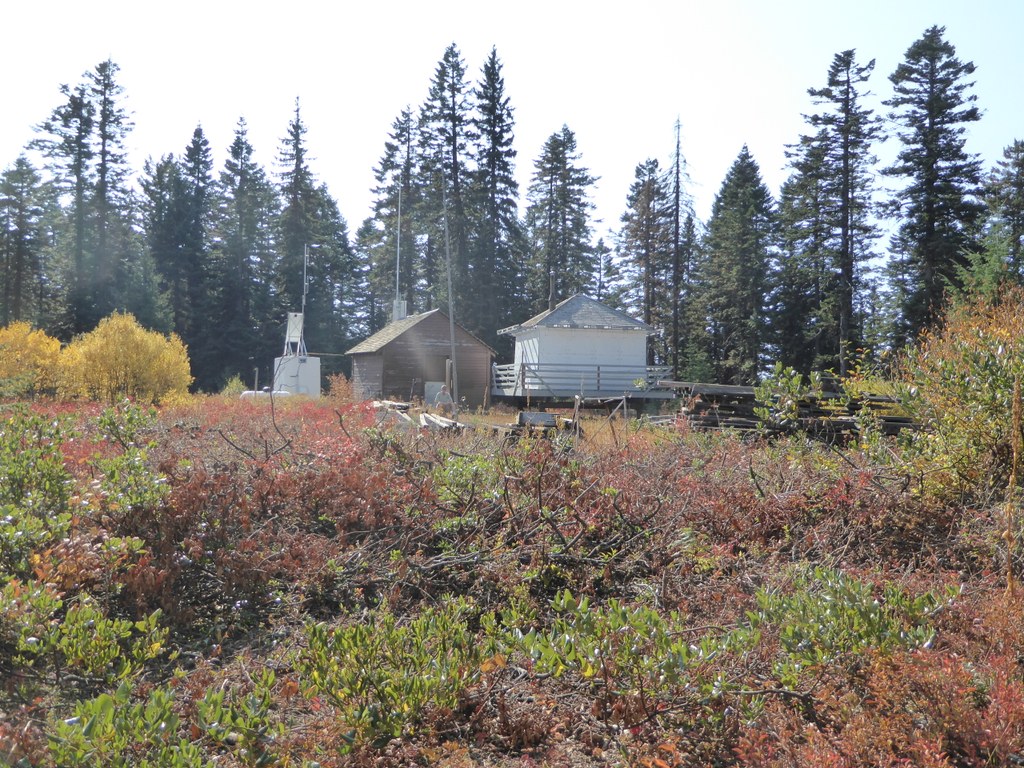
There you’ll find the cap of the lookout tower on the ground, along with stacked lumber and hardware from the legs, and some outbuildings… including a white-painted outhouse tucked discreetly amongst the trees.

Tall evergreens obstruct any distant views from the ground, but spring wildflowers, autumn color, and wildlife surround you. Return to the trailhead via the same route.

This trail would make a nice snowshoe or ski ramble if you have a vehicle that can get you there, but note that this is a dry trail and there is no camping allowed.

Toilet Information

  • No toilet at trailhead

More information about toilets

Hike Description Written by
Mary Hartman, WTA Correspondent

Big Butte Lookout

Map & Directions

Trailhead
Co-ordinates: 46.1106, -117.2571 Open in Google Maps

Before You Go

See weather forecast

Parking Pass/Entry Fee

None

WTA Pro Tip: Save a copy of our directions before you leave! App-based driving directions aren't always accurate and data connections may be unreliable as you drive to the trailhead.

Getting There

From Anatone, turn west on Mill Road (paved) and drive 1.7 miles. Turn left on West Mountain Road, which is a wide gravel road that’s easily passable in a passenger car. This road becomes Forest Road 4304. At about 5.3 miles there’s a sign for “Mount Misery Rd." as you enter the Umatilla National Forest.  

About 0.4 mile farther, you’ll see a spur road on the right (Forest Road 170). Parts of this road are very rough, so you may want to pull off at a wide spot near the junction and proceed on foot.

More Hike Details

Trailhead

Eastern Washington > Palouse and Blue Mountains

Umatilla National Forest, Pomeroy Ranger District

Guidebooks & Maps

USGS Fields Spring

You can improve or add to this guidebook entry!

Big Butte Lookout

3 Trip Reports

Hiked here recently?

Submit a trip report!
 
Trip Reports