Trails for everyone, forever

Home Go Hiking Hiking Guide Big Rock Garden

Big Rock Garden

Puget Sound and Islands > Bellingham Area
48.7687, -122.4209 Map & Directions
Length
1.0 miles, roundtrip
Elevation Gain
60 feet
Highest Point
520 feet
Calculated Difficulty About Calculated Difficulty
Easy
Art and nature mix at the Big Rock Garden. Photo by PJ Heusted. Full-size image
  • Dogs not allowed
  • Fall foliage
  • Good for kids
  • Wildflowers/Meadows

Parking Pass/Entry Fee

None
Saved to My Backpack

The Big Rock Garden allows visitors to slow down and enjoy a bit of quiet solitude without having to trek far from home. The park features 37 permanent sculptures, over 100 species of maple and dozens of rhododendrons and azaleas which promise enjoyable walking at any time of year. Continue reading

Rating
0.00 out of 5

(0 votes) Log in to rate

Hiking Big Rock Garden

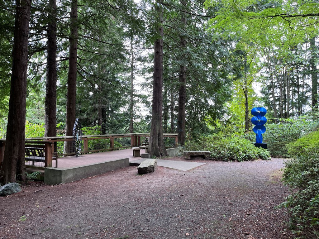
Hiking through the Big Rock Garden is not about power hiking through the park nor looking for expansive views — instead, the trail invites visitors to slowly meander through the several dozen permanent sculptures that decorate the landscape. The trail itself consists of one perimeter loop with a number of smaller connecting trails that allow the user to wander throughout the sculptures in whatever order they desire.

There are a number of memorial benches spread throughout the park as well as a small pavilion that provides visitors with a place to pause, sit and take in the calm that the park provides. 

Information about the sculptures is available through scannable QR codes within the park and a full guide can be found on the City of Bellingham’s Public Art Collections page. And while the sculptures serve as the park’s main attraction, this small parcel boasts over 100 species of maple, dozens of native flowering shrubs, and numerous towering conifers that make it feel like the perfect blend of the natural world and stunning sculpture which is sure to inspire any visitor.

Toilet Information

  • Toilet at trailhead
  • Toilet has running water

More information about toilets

Wheelchair Accessibility

The trail through the park is wide and well-graded gravel that provides access for users in wheelchairs, depending on comfort with the terrain, and allows for easy strolling for all visitors.

Hike Description Written by
PJ Heusted, WTA Correspondent

Big Rock Garden

Map & Directions

Trailhead
Co-ordinates: 48.7687, -122.4209 Open in Google Maps

Before You Go

See weather forecast

Parking Pass/Entry Fee

None

WTA Pro Tip: Save a copy of our directions before you leave! App-based driving directions aren't always accurate and data connections may be unreliable as you drive to the trailhead.

Getting There

From I-5, take exit 254 for Iowa St. Follow Iowa St for 0.7 mile before taking a slight left onto Yew St at the light. Continue down Yew St for 0.5 mile and then turn right onto Alabama St. Drive straight down Alabama St for almost 1 mile before turning left onto Sylvan St. Follow the road for 0.5 mile until seeing the sign for Big Rock Garden, where you’ll turn right onto Balsam Ln and dead end at the parking lot.

Take transit

The 525 and 540 bus routes both run to stops less than a 1-mile walk to the Big Rock Garden. These leave consistently from the Cordata and Downtown Station with transfers at other points on the route throughout Bellingham.

More Hike Details

Trailhead

Puget Sound and Islands > Bellingham Area

City of Bellingham

Guidebooks & Maps

https://cob.org/wp-content/uploads/Park-Map-Big-Rock-Park.pdf

You can improve or add to this guidebook entry!

Big Rock Garden

3 Trip Reports

Hiked here recently?

Submit a trip report!
 
Trip Reports