Trails for everyone, forever

Home Go Hiking Hiking Guide Bishop Ridge

Alert: Major flooding has prompted evacuations and is impacting communities and public lands across Western Washington. Landslide risk and related hazards are very high and have closed trails and roads, including major highways and forest roads.

Check forecasts, consider delaying your hiking or camping plans, and stay safe out there. 


Bishop Ridge

South Cascades > Dark Divide
46.4355, -121.7660 Map & Directions
Length
14.0 miles, roundtrip
Elevation Gain
4,400 feet
Highest Point
5,200 feet
Calculated Difficulty About Calculated Difficulty
Hard
  • Ridges/passes
  • Rivers
  • Wildflowers/Meadows
  • Wildlife

Parking Pass/Entry Fee

Northwest Forest Pass
Saved to My Backpack

Primarily used by motorized users, this trail climbs gradually to a scenic sub-alpine ridge, with views of Mount St. Helens, Mount Rainier, and the Goat Rocks. Shaded from top to bottom, but still quite strenuous, Bishop Ridge makes for a unique trip in a seldom-hiked part of Washington. Continue reading

Rating
3.00 out of 5

(4 votes) Log in to rate

Hiking Bishop Ridge

From the parking lot, cross the road and start up the well-signed trail, turning right almost immediately onto the Valley Trail. Continue through pleasant forest for 0.5 miles, passing several streams, then turn left at a clearly marked intersection onto the Bishop Ridge Trail, where the climb begins in earnest. Note that there are no reliable water sources beyond this point.

From here, climb steadily up a well-graded trail for 4 miles and 3,200 feet, enjoying occasional views of the impressive faces of Tongue Mountain and Tower Rock to the west.

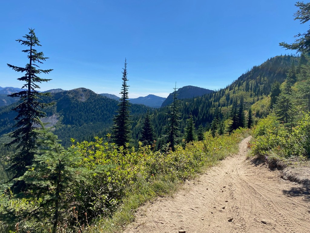
The trail is well-maintained and not at all overgrown, but it is occasionally quite eroded, dusty, and rocky through this section due to motorized use.

Once the climb is completed, the payoff begins, with 2.5 rolling miles of scenic sub-alpine ridge walking. Though still mostly below tree line, there are numerous spots along the ridge to stop and enjoy sweeping views of the surrounding mountains, including Mount Rainier, the Goat Rocks Wilderness and Mount St. Helens. Take the time to appreciate the Cispus River flowing along the valley floor where the day began, 3,600 feet below.

Continue through rolling meadows and a very pretty stretch of burned forest to the intersection with the Yoozoo Trail and Blue Lake Ridge Trail, then either retrace your steps or loop back to the trailhead.

Toilet Information

  • No toilet at trailhead

More information about toilets

Hike Description Written by
Xander Uyttendaele, WTA Correspondent

Bishop Ridge

Map & Directions

Trailhead
Co-ordinates: 46.4355, -121.7660 Open in Google Maps

Before You Go

See weather forecast

Parking Pass/Entry Fee

Northwest Forest Pass

WTA Pro Tip: Save a copy of our directions before you leave! App-based driving directions aren't always accurate and data connections may be unreliable as you drive to the trailhead.

Getting There

From Randle, head south on Highway 131 for 1 mile, then turn left onto Cispus Road (NF-23). Continue along the well-paved Cispus Road for 12 miles, passing the North Fork Campground, until you reach a gravel parking lot on the right side of the road, with a sign marking the start of the Bishop Ridge Trail on the left. Note that this trailhead is not labeled on any major mapping apps, including Google Maps, Apple Maps, Caltopo, or Gaia.

More Hike Details

Trailhead

South Cascades > Dark Divide

Bishop Ridge (#272)

Gifford Pinchot National Forest, Cowlitz Valley Ranger District

Guidebooks & Maps

Day Hiking South Cascades, Dan A. Nelson, Mountaineers Books

Green Trails No. McCoy Peak No. 334 Blue Lake

You can improve or add to this guidebook entry!

Bishop Ridge

2 Trip Reports

Hiked here recently?

Submit a trip report!
 
Loading trip reports...
Trip Reports