Trails for everyone, forever

Home Go Hiking Hiking Guide Blue Creek

Alert: On Oct. 1 the federal government began a partial shutdown that will impact National Parks, National Wildlife Refuges and U.S. Forest Service lands in Washington. Here's the latest information we have for hikers and campers


Blue Creek

Central Cascades > Blewett Pass
47.3045, -120.7400 Map & Directions
Length
4.0 miles, roundtrip
Elevation Gain
1,700 feet
Highest Point
5,360 feet
Calculated Difficulty About Calculated Difficulty
Moderate
Mountain views from Blue Creek trail. Photo by Chris Burke. Full-size image
  • Dogs allowed on leash
  • Mountain views
  • Old growth
  • Rivers
  • Wildflowers/Meadows

Parking Pass/Entry Fee

None
Saved to My Backpack

Hike steeply up a scenic and little-used trail to Red Top Lookout. Continue reading

Rating
2.75 out of 5

(8 votes) Log in to rate

Hiking Blue Creek

This hiker-only trail is a great early-season hike, when you can't yet drive to Red Top Lookout. The trail starts steep and stays steep. 

Climb to a side ridge coming off Teanaway Ridge, then ascend this ridge to the main ridge. The forest is pleasant Ponderosa pine interspersed with small meadows.  Wildflowers are abundant in season. You never come close to Blue Creek itself, though there is a seasonal spring next to the trail near the top. 

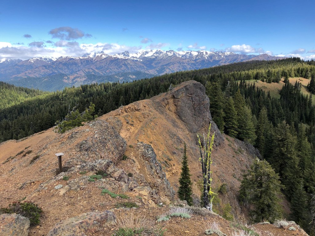
After 1.6 miles, reach a four-way junction. To the right, the Teanaway Ridge trail leads to agate beds. A hard left turn takes you on a lower trail below Red Top Lookout, about half a mile to a road and trailhead. A softer left leads uphill on a thrilling bit of trail, through cliffs above the treeline, 0.2 mile to Red Top Lookout. Excellent views abound, north to the Stuart Range, east to Table Mountain, southwest into the Teanaway River Valley. If you've come early in the season, congratulate yourself on making a nearly snow-free ascent to a high viewpoint while all the other nearby mountains are still covered in snow.

You can make a small loop near the top by continuing south on the lookout trail to a junction with the lower trail, then turning left back to the first junction.  There is an outhouse near the lookout.

Hike Description Written by
Chris Burke, WTA Correspondent

Blue Creek

Map & Directions

Trailhead
Co-ordinates: 47.3045, -120.7400 Open in Google Maps

Before You Go

See weather forecast

Parking Pass/Entry Fee

None

WTA Pro Tip: Save a copy of our directions before you leave! App-based driving directions aren't always accurate and data connections may be unreliable as you drive to the trailhead.

Getting There

On Highway 97, just north of Mineral Springs Resort and Group Campground, turn west onto Road 9738. Climb on this road for 2.6 miles to the intersection with Road 9702. Keep left (really straight) onto 9702, a much bumpier road. Drive about 0.5 mile, reaching the marked trailhead on the right just after crossing unmarked Blue Creek. There is room for two cars; more parking can be found at turnouts along the road before and after the trailhead.

More Hike Details

Trailhead

Central Cascades > Blewett Pass

Blue Creek (#1364.2)

Okanogan-Wenatchee National Forest, Cle Elum Ranger District

You can improve or add to this guidebook entry!

Blue Creek

24 Trip Reports

Hiked here recently?

Submit a trip report!
 
Trip Reports