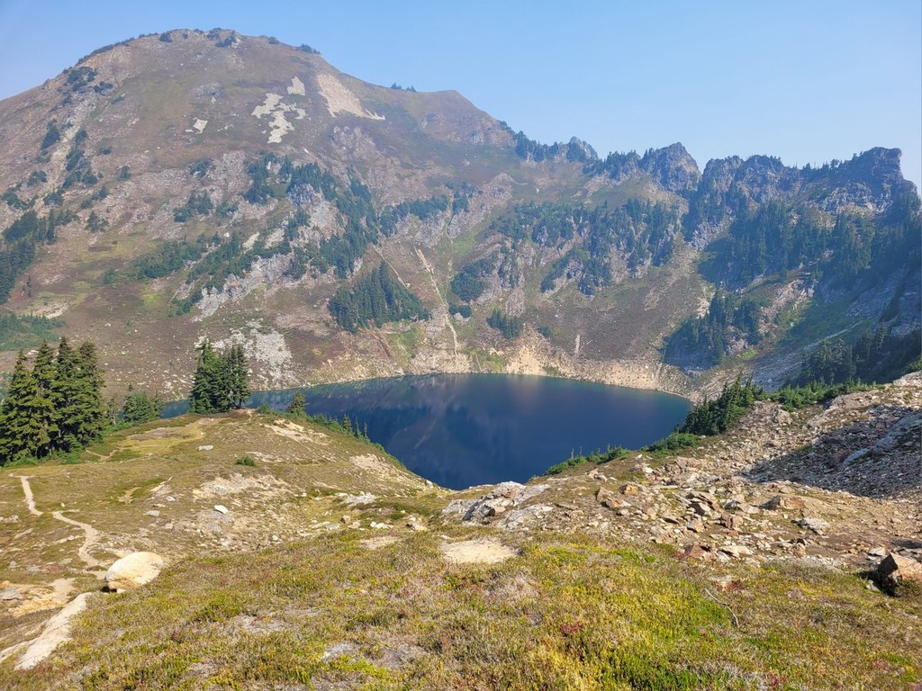

The Blue Lakes High Route ascends a steep, cairn-dotted trail to a high pass with a beautiful view across to Johnson Mountain and down to a sometimes frozen Blue Lake in a rocky basin below. The trail down from this notch to the lake can contain a very steep snow slope in early season. If you think you'll be uncomfortable on it, stick to the Pilot Ridge Trail to access Blue Lakes.
Blue Lake is spectacular, and a wonderful place to camp. There is a good toilet near the campsites. Blue Lake also offers the last reliable source of water before the North Sauk.
To continue onto the Pilot Ridge Trail, take the trail northeast from the lake outlet that descends to the Pilot Ridge Trail junction.
Blue Lake High

The Blue Lakes High Route ascends a steep, cairn-dotted trail to a high pass with a beautiful view across to Johnson Mountain and down to a sometimes frozen Blue Lake in a rocky basin below.
Continue reading
Hiking Blue Lake High
Blue Lake High
Map & Directions
 Trailhead


