Trails for everyone, forever

Home Go Hiking Hiking Guide Antoine Peak Conservation Area - Canfield Gulch

Antoine Peak Conservation Area - Canfield Gulch

Eastern Washington > Spokane Area/Coeur d'Alene
47.7292, -117.1430 Map & Directions
Length
3.46 miles of trails
Elevation Gain
670 feet
Highest Point
2,920 feet
Leland Pond on Canfield Gulch. Photo by Holly Weiler. Full-size image
  • Wildflowers/Meadows
  • Mountain views
  • Wildlife
  • Good for kids
  • Dogs allowed on leash
  • Fall foliage

Parking Pass/Entry Fee

None
Saved to My Backpack

Antoine Peak's Canfield Gulch is the east side access to this 1,296 acre conservation area. Continue reading

Rating
4.00 out of 5

Hiking Antoine Peak Conservation Area - Canfield Gulch

Antoine Peak Conservation Area now consists of 1,296 acres and three different trailhead access locations. Canfield Gulch is the best access for the east side of the conservation area. 

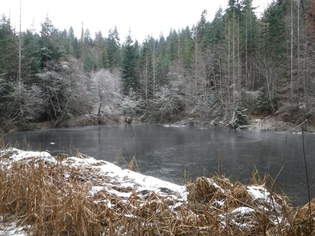
Canfield Gulch forms a loop route with a mixture of double track and singletrack. From the parking lot there is a short connector trail to a Conservation Area kiosk where the loop begins. The trail to the right is the double track portion along an old logging road. This part of the loop climbs 2.34 miles and is the more gradual option. It passes Leland Pond along the way, which is among the best locations for spotting the Conservation Area's resident moose population. The trail near the pond also boasts some of the most diverse plant communities of the entire Conservation Area, including locally-rare Pacific yew trees. At 2.34 miles visitors will meet a marked intersection where the main Canfield Gulch loop descends back to the parking lot and the Antoine's Summit Trail continues to climb to toward the rest of the Conservation Area. The trail to the left of the entrance kiosk begins as double track but soon turns to singletrack and ascends just shy of one mile to the same marked intersection. 

From the point where the two halves of Canfield Gulch meet, visitors have the option of continuing the trek up to the rest of the trail system via the Antoine's Summit Trail. This trail meets the Emerald Necklace Trail in 0.78 miles, at which point there are numerous options for different routes and mileage, as the greater trail system has two additional trailheads and several other intersecting trails. 

Antoine Peak's trails are accessible year-round. The area is popular with hikers, runners, mountain bikers and equestrians in the warmer months, and with snowshoers, skiers, and fatbikers in the winter. Please keep in mind that the trails should be considered closed to access during the shoulder season whenever the mud is deep enough to leave a 1" or greater depression.

Toilet Information

  • Toilet at trailhead

More information about toilets

Wheelchair Accessibility

Due to steep grades out of the parking lot on the east side of the conservation area, Canfield Gulch is likely not a good wheelchair access location. Portions of the west trailhead and Trentwood trailhead may have limited wheelchair access with moderate grades along old road beds and packed gravel surfaces. None of the trails at Antoine Peak meet ADA accessibility guidelines, however. 

WTA worked here in 2022, 2022, 2021, 2020, 2019, 2018, 2017 and 2016!

Hike Description Written by
Holly Weiler, WTA Correspondent

Antoine Peak Conservation Area - Canfield Gulch

Map & Directions

Trailhead
Co-ordinates: 47.7292, -117.1430 Open in Google Maps

Before You Go

See weather forecast

Parking Pass/Entry Fee

None

WTA Pro Tip: Save a copy of our directions before you leave! App-based driving directions aren't always accurate and data connections may be unreliable as you drive to the trailhead.

Getting There

Antoine Peak East Trailhead at Canfield Gulch is located at 19516 E. Lincoln Road in Otis Orchards. From the Spokane Valley take Trent Road east to Campbell Road. Turn north on Campbell Road and travel 1.6 miles. Take a slight left onto Lincoln Road and continue another 0.5 miles to the Antoine Peak East Trailhead, which is located on the left.

More Hike Details

Trailhead

Eastern Washington > Spokane Area/Coeur d'Alene

Antoine Peak Conservation Area

Guidebooks & Maps

https://www.spokanecounty.org/DocumentCenter/View/4070/Antoine-Peak-ConservationArea-Trail-Map-PDF?bidId=

You can improve or add to this guidebook entry!

Antoine Peak Conservation Area - Canfield Gulch

16 Trip Reports

Hiked here recently?

Submit a trip report!
 
Trip Reports