

Nestled between Spiral Butte and Cramer Mountain on the Tumac Plateau, Cramer Lake draws experienced snowshoers north into the backcountry for peace and solitude just east of White Pass. Although the distance is moderate, a section of steep terrain and creek crossings can make for an adventuresome outing.
If the Dog Lake campground itself is not accessible, you can park in plowed pullouts just east or west on Highway 12 and walk to the trailhead. Your goal is to make it to the reader board for Dog Lake at 4240 feet elevation located behind the privies. From here you can walk up to the back of the campground and find a sign for the Cramer Lake Trail under the branches on a tree.
The route starts comfortably along the contour of Dog Lake heading northwest. A second sign for Cramer presents itself in 500 feet or so where the Dark Meadows Trail comes in from the left. Keep straight and follow around the lake, soon passing into William O. Douglas Wilderness.
Negligible gain is attained as you wander left of North Fork Clear Creek. Impressive Spiral Butte looms over Dog Lake, its winter white stripes evidence of avalanche risk. There may be a small stream at 0.6 miles in to navigate across when snow berms are deep before being able to carry on.
Views of Spiral Butte and the creek drainage continue until 1 mile in when you intersect the North Fork Clear and turn west to follow its dark gash as it cuts through your milky surroundings. You have gained less than 50 feet elevation at this point and the blanketed terrain is mellow as you undulate over snowdrifts and around tall hemlock and cedar.
You will cross the North Fork Clear at a shallow ford 1.5 miles from the trailhead. If fresh snow is piled high, it can be a steep drop down and then back up the banks of the creek to resume your journey. The water is not deep and poles would discourage a slip.
Continuing northwest through the trees, you soon arrive upon a maze of snowbridges over the marshy feed of the North Fork Creek at 1.7 miles and 4,350 feet. The summer trail continues further before taking an angled switchback to the northeast towards Spiral Butte to gain a couple hundred feet of elevation on the slope of the Tumac Plateau.
If snow levels are moderate, it may be possible to follow that route. But with deeper snow conditions, turning northeast at the base of the climb first helps avoid a small ravine that can be tricky to navigate higher up. Snowshoes with traction and experience on more vertical terrain will come in handy either way.
At 4800 feet and 2.4 miles, your trek levels out and takes a direct turn north besides a shallow stream gully on your right to make for Cramer Lake through straightforward terrain. Patches of open meadow on opposite sides tease you through lanky pines draped with moss as you trod your anticipated final steps.
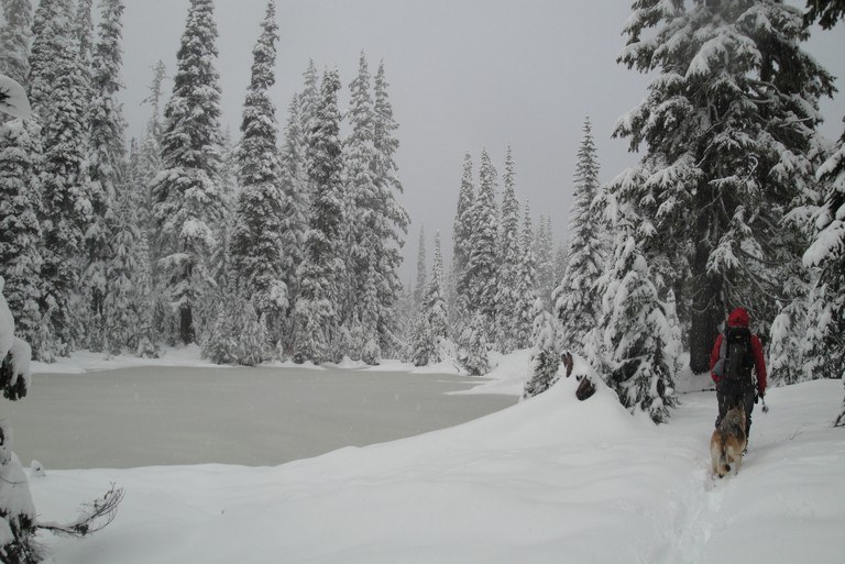
Approaching the forested southern shore of Cramer Lake at 3.5 miles, there is plenty of room to take in the tranquil views of this ski boot shaped body of water. On a bright day, the summit of Tumac Mountain where a fire lookout once perched is revealed over the trees on the horizon. Ample clothing layers and daylight will help you fully revel in the stillness of this winter backdrop.
Hardy travelers prepared for a longer day or overnight can travel further. Circumnavigating on the left around the lake, explore neighboring Otter and Dancing Lady to make a loop of the three lakes. A turn left at the northern shore of Cramer puts you at Dumbbell Lake and the Pacific Crest Trail. Otherwise, return back the way you came for a strenuous yet satisfying day trip.
 Trailhead


