Trails for everyone, forever

Home Go Hiking Hiking Guide Creekside Loop Trail
link

Creekside Loop Trail

North Cascades > North Cascades Highway - Hwy 20
48.5968, -120.5148 Map & Directions
Length
0.5 miles, roundtrip
Elevation Gain
50 feet
Highest Point
3,000 feet
Calculated Difficulty About Calculated Difficulty
Easy

Highway 20 is closed from Ross Dam trailhead (milepost 134) to Early Winters (milepost 178) for the season.

Creekside Loop Trail trail map at Klipchuck Campground. Photo by Austin Smith.

"Loop Trail" may be a misnomer but this "Creekside" trail delivers. Even on the hottest Eastern Washington days, this trail delivers cool comfort. Continue reading

Rating
0.00 out of 5

(0 votes) Log in to rate

Hiking Creekside Loop Trail

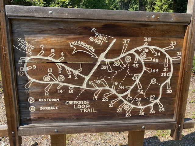
"Loop Trail" may be a misnomer, but this "Creekside" trail delivers. Even on the hottest Eastern Washington days, this trail delivers cool comfort.

Watch closely for the small trailhead sign between campsites #15 and #18 at Klipchuck Campground. There is no formal parking but there is enough room across the road to tuck a small car. The trail descends quickly to Early Winters Creek. A loop could be constructed from the wanderings alongside this creek. Conversely, you have the option of just wandering alongside this beautiful creek.

Soak up the peacefulness. Bring your lawn chair on a hot day and actually sit in the creek. Let the kids play along the creekside, and lose yourself in the afternoon. There is no finer place to while away a few hours. 

Hike Description Written by
Austin Smith, WTA Correspondent

Creekside Loop Trail

Map & Directions

Trailhead
Co-ordinates: 48.5968, -120.5148 Open in Google Maps

Before You Go

Highway 20 is closed from Ross Dam trailhead (milepost 134) to Early Winters (milepost 178) for the season.

See weather forecast

WTA Pro Tip: Save a copy of our directions before you leave! App-based driving directions aren't always accurate and data connections may be unreliable as you drive to the trailhead.

Getting There

Enter the Klipchuck Campground off of Highway 20 five miles east of Mazama, WA. When you pass the entry billboard stay straight for 100 yards. At a T intersection, the trailhead will be straight ahead. Look carefully for a small trail sign. Be sure to park off the roadway.

More Hike Details

Trailhead

North Cascades > North Cascades Highway - Hwy 20

Okanogan-Wenatchee National Forest

You can improve or add to this guidebook entry

Creekside Loop Trail

0 Trip Reports

Hiked here recently?

Submit a trip report!
 
There aren't any trip reports for this hike yet.