

Stunning alpine meadows and peak views, Dishpan Gaps charming trail leads you to a gateway of more trails.
Beginning at the North Fork Skykomish Trailhead, you can take any of the three trails and return the same route or continue to another trail and complete a loop varying in mileage. Having a map (Green Trails Map #143 Monte Cristo) is highly advised with this network of trails.
However, the most direct route for Dishpan Gap via North Fork Skykomish trail. This is 9 miles one-way with 3200 feet o elevation gain.
The moderate grade of this trail will take you through old growth forests for a majority of the beginning of the hike, and at 3.5 miles arrive at a junction with the Pass Creek trail. Here, the Pass Creek trail turns east and reaches the Pacific Crest Trail (PCT) via Cady Pass in about 3.5 miles, with just 1000 feet of elevation gain.
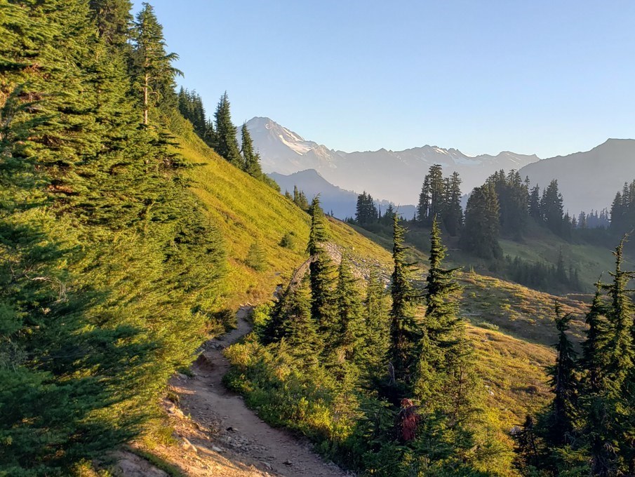
You however, will turn left, headed toward Dishpan Gap. The trail winds through forest and small stream crossings leading you to your destination. 4 miles beyond the trail intersection, switchbacks will crank up your elevation gain as you reach the final miles, taking you into the subalpine meadows and infinite wild blueberry shrubs. Continue on the trail while admiring the peaks now visible around you, even on a cloudy day the scenery nearby is charming.
Dishpan Gap continues up to intersect the PCT and many trails and routes are accessible, you can return the way you came or have any of a number of routes in varying miles, peaks, lakes to take you back to the North Fork Skykomish Trailhead- whichever route taken will leave you amazed by the beauty.

 Trailhead


