Trails for everyone, forever

Home Go Hiking Hiking Guide Ahtanum State Forest - Eagle's Nest
link

Ahtanum State Forest - Eagle's Nest

South Cascades > White Pass/Cowlitz River Valley
46.5110, -121.1756 Map & Directions
Length
0.1 miles, roundtrip
Elevation Gain
17 feet
Highest Point
6,183 feet
Calculated Difficulty About Calculated Difficulty
Easy
Looking toward Mount Rainier from ridge east of Eagle's Nest. Photo by Kim Hull Full-size image
  • Wildflowers/Meadows
  • Mountain views
  • Dogs allowed on leash
  • Summits
  • Ridges/passes

Parking Pass/Entry Fee

Discover Pass

This hike is along the road to Darland Mountain in the Ahtanum area. Along the way, you'll enjoy magnificent views and wildflower areas. Continue reading

Rating
2.00 out of 5

Hiking Ahtanum State Forest - Eagle's Nest

Eagle's Nest is more of a viewpoint than a hike, but you can make it into a hike if you feel adventurous. There is a sign when you reach the turnoff for the viewpoint so it isn't hard to find. At the trailhead, there is a pit toilet. There is a signboard with no information on it at the beginning of the trail.

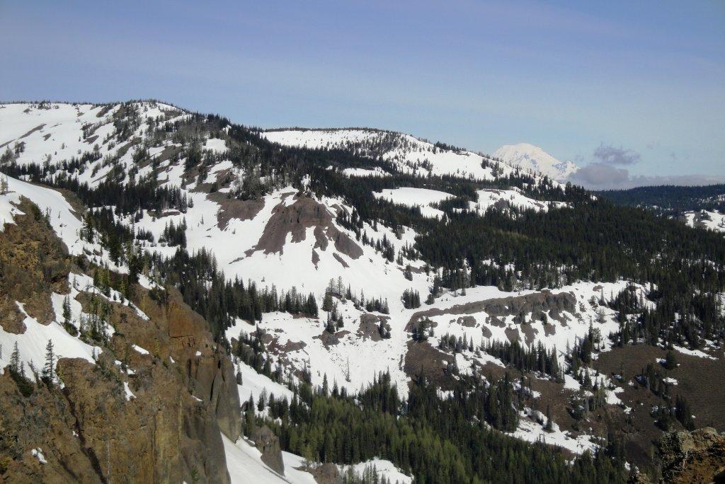
At the viewpoint, there is a rock wall that acts as a barrier from the steep drop-off. From here, enjoy a vista of the valley that houses the north fork of Ahtanum Creek and across to Foundation Ridge. There is a trail that follows the barrier in either direction. The rock barrier eventually turns into a wire chain barrier.

If you head west, the trail meanders along the barrier until the barrier ends. The trail peters out at the edge of a large talus field.

Heading east, the trail again follows the barrier until it ends. Then the trail largely disappears. Though there are signs of boot paths, please stay to the true trail, and avoid going off-trail. 

Ahtanum State Forest - Eagle's Nest

Map & Directions

Trailhead
Co-ordinates: 46.5110, -121.1756 Open in Google Maps

Before You Go

See weather forecast

Parking Pass/Entry Fee

Discover Pass

WTA Pro Tip: Save a copy of our directions before you leave! App-based driving directions aren't always accurate and data connections may be unreliable as you drive to the trailhead.

Getting There

Drive Ahtanum Road from West Valley in Yakima to Tampico. Take the North Fork Road (right at the Tampico church and General Store). Continue for ten miles to the Ahtanum Meadows Campgrounds and Ranger Station. Travel left beyond the Ranger Station and snow park parking for approximately another ten miles. At Tree Phones Campground, turn right and follow the road until the snow prohibits you any further. Eagle's Nest Viewpoint is 2.5 miles from Tree Phones... and Clover Flats CG is another .5 mile or so beyond that.

More Hike Details

Trailhead

South Cascades > White Pass/Cowlitz River Valley

Washington State Department of Natural Resources

You can improve or add to this guidebook entry

Ahtanum State Forest - Eagle's Nest

4 Trip Reports

Hiked here recently?

Submit a trip report!
 
Trip Reports