
The East Tiger trail intersects many other trails on the East Side of Tiger Mountain. From the DOT chain link fence, along the Powerline Trail, across the East Fork of Issaquah Creek and Lower Bootleg Trail. There is a junction with West Tiger 1 Trail, as well as the Pawprint Connector.
The trail begins partway up Tiger Mountain, so you'll need to use the Tiger Mountain Trail and the Pawprint Connector, or the Bootleg Trail to arrive at its beginning.
The trail goes past a DNR section marker, a new trail sign pointing to Road 70XX and the lower section of the Preston RR Trail. It crosses a new logging road, and a clearcut where there is a nice view. Finally, arrive at an unmarked junction with the Preston Railroad mountain bike trail.
Intercepting the new engineered mountain bike trail, follow it around to the right. It soon emerges onto the East Tiger service road at a seasonal barrier and an East Tiger trail sign.
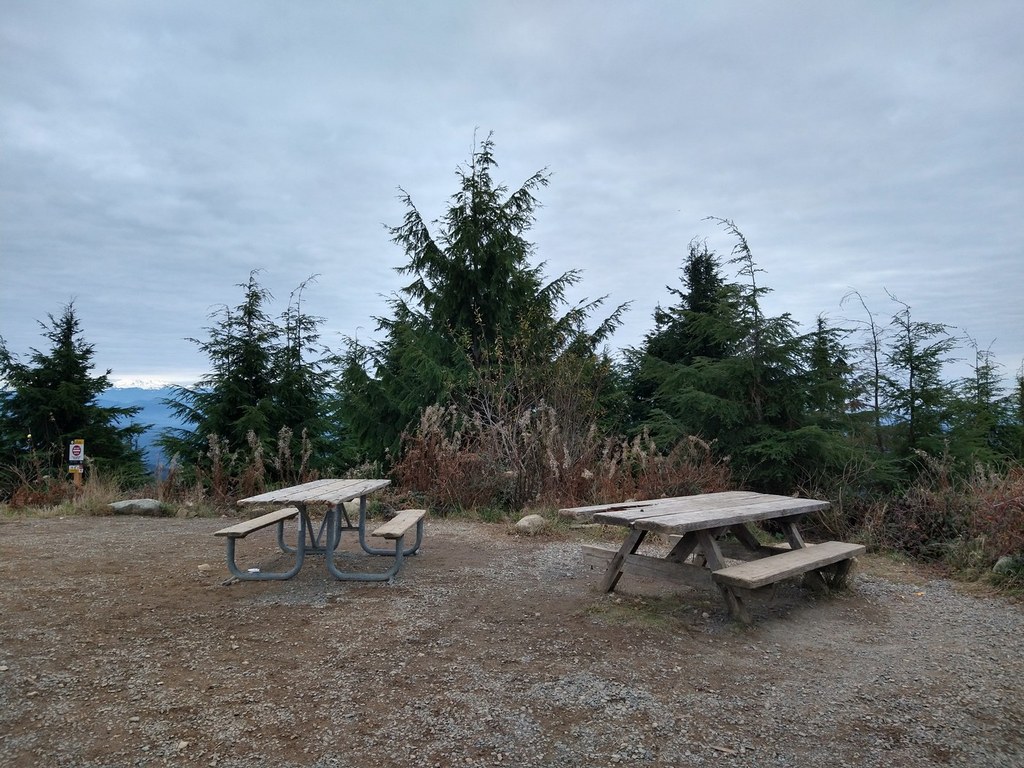
A new mountain bike trail continues on the other side of the road spiraling its way up to the summit, emerging at the two picnic tables. You can take either the new trail or follow the road to the summit.
East Tiger

-
 Length
- 10.6 miles, roundtrip
-
 Elevation Gain
- 2,940 feet
-
 Highest Point
- 3,004 feet
Parking Pass/Entry Fee
Discover Pass
Branch off from the Paw Print Connector to the east side of Tiger Mountain and explore this trail with many access points.
Continue reading
Hiking East Tiger
East Tiger
Map & Directions
 Trailhead
Before You Go
Parking Pass/Entry Fee
Discover PassWTA Pro Tip: Save a copy of our directions before you leave! App-based driving directions aren't always accurate and data connections may be unreliable as you drive to the trailhead.


