Trails for everyone, forever

Home Go Hiking Hiking Guide Eruption Trail

Eruption Trail

South Cascades > Mount St. Helens
46.2765, -122.2165 Map & Directions
Length
0.5 miles, roundtrip
Elevation Gain
25 feet
Highest Point
4,200 feet
Calculated Difficulty About Calculated Difficulty
Easy

This trail is currently inaccessible due to a landslide on SR 504. The road is expected to be closed through 2027.

Mt. St. Helens peeping out from the clouds. Photo by Marbsydo. Full-size image
  • Dogs not allowed
  • Good for kids
  • Mountain views
  • Wildflowers/Meadows

Parking Pass/Entry Fee

National Monument Fee
Saved to My Backpack

A barrier-free, paved hike of less than one mile from the Johnston Ridge Observatory. The trail includes interpretive kiosks and 360-degree views of Mount St. Helens and the surrounding blast zone. Continue reading

Rating
3.00 out of 5

(5 votes) Log in to rate

Hiking Eruption Trail

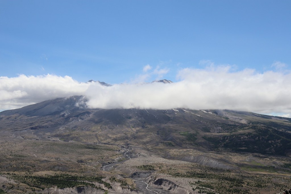
The views from the Eruption Trail are unparalleled on a sunny day. The mountain looms on the horizon with a carpet of wildflowers giving way to the rugged landscape of the blast zone at her feet.

Start from the parking area, and first take the wide paved pathway between two raised walls toward the visitor center. You won't see St. Helens immediately, but the reveal is certainly worth it.

Rounding a gentle curve, the mountain comes into view at the base of the true trail. Turn left, away from the visitor center and continue up a moderately-graded path to an interpretive sign. This outlines the features of St. Helens and the surrounding horizon with labels, to better help you understand what you're looking at.

Past this interpretive area, you can continue for about another quarter mile on paved trail before it becomes graveled. It remains relatively flat and wide for a time, before narrowing down and continuing on as Harry's Ridge trail.

Toilet Information

  • Toilet at trailhead
  • Accessible toilet

More information about toilets

Wheelchair Accessibility

This wide, flat, paved trail switchbacks up at about a 5% grade from the Johnston Ridge Visitor Center to an overlook of the mountain. Past the overlook, the trail grade becomes gentler (between 1 and 2%) for about a half mile before it transitions into a graveled path, becoming uneven and narrow.

Hike Description Written by
Anna Roth, WTA Correspondent

Eruption Trail

Map & Directions

Trailhead
Co-ordinates: 46.2765, -122.2165 Open in Google Maps

Before You Go

This trail is currently inaccessible due to a landslide on SR 504. The road is expected to be closed through 2027.

See weather forecast

Parking Pass/Entry Fee

National Monument Fee

WTA Pro Tip: Save a copy of our directions before you leave! App-based driving directions aren't always accurate and data connections may be unreliable as you drive to the trailhead.

Getting There

From Castle Rock, drive 43 miles east on Highway 504 to the Coldwater Visitor Center, then continue on to the Johnston Ridge Observatory. A $8 per adult fee is required to hike this trail.

More Hike Details

Trailhead

South Cascades > Mount St. Helens

Mount St. Helens National Volcanic Monument

Guidebooks & Maps

Green Trails 332 Spirit Lake

Buy the Green Trails Spirit Lake No. 332 map

You can improve or add to this guidebook entry!

Eruption Trail

27 Trip Reports

Hiked here recently?

Submit a trip report!
 
Trip Reports