Trails for everyone, forever

Home Go Hiking Hiking Guide Farrell's Marsh Wildlife Area

Farrell's Marsh Wildlife Area

Puget Sound and Islands > Seattle-Tacoma Area
47.1646, -122.5960 Map & Directions
Length
2.0 miles, roundtrip
Elevation Gain
63 feet
Highest Point
260 feet
Calculated Difficulty About Calculated Difficulty
Easy
The log hop in Farrell's Marsh is a highlight of your visit to the area. Photo by Tiffany Chou. Full-size image
  • Wildlife
  • Good for kids
  • Dogs allowed on leash

Parking Pass/Entry Fee

None
Saved to My Backpack

Explore a network of trails through a wooded marshy wetland, sprinkled with poems and quotes on small placards along the way. Continue reading

Rating
0.00 out of 5

(0 votes) Log in to rate

Hiking Farrell's Marsh Wildlife Area

Explore a network of trails through a wooded marshy wetland, sprinkled with poems and quotes on small placards along the way.

The trail is gravel or dirt throughout, and there are many different paths you can take to create your own hike. Some paths will bring you right up to the edge of the marsh, where you can take a break as you look out on the wetlands. Keep your eyes peeled for ducks, geese, and great blue herons.

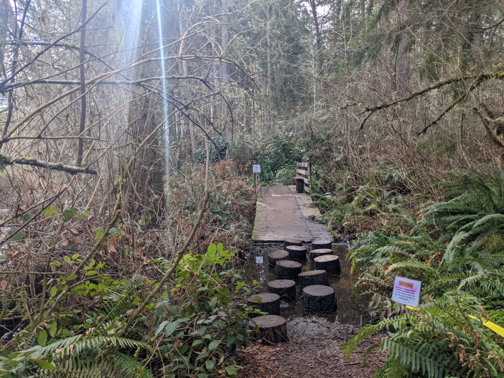
The marsh is quiet and serene, but it also causes the trail to be wet or even flooded in places, so waterproof shoes or careful stepping is recommended.

Throughout your adventure, you’ll likely come across several poems and quotes on small placards, as well as informational placards about the nature in the area. Learn about Himalayan blackberry, salal, stinging nettle, and low bush Oregon grape as you walk around the nature area.

Route Suggestion

A highlight of the trail is a log hop “bridge” over the marsh. Start at the north trailhead and walk along the wide gravel path for a few hundred feet before arriving at a junction. Turn right and continue in a lush forest for about 0.1 miles to another junction. Turn left here to hop over some short stumps for fun! Turn right at the junction instead, and walk uphill for about 0.1 miles for some elevation gain to a spot with a view of the sound in the distance.

WTA Pro Tip: Bring a copy of the map of the area on your trek. There is also reliable cell phone reception here. It’s very easy to get lost in this labyrinthine network of trails and it can be difficult to find your way back to your vehicle without a guide.

Toilet Information

  • No toilet at trailhead

More information about toilets

Hike Description Written by
Tiffany Chou, WTA Correspondent

Farrell's Marsh Wildlife Area

Map & Directions

Trailhead
Co-ordinates: 47.1646, -122.5960 Open in Google Maps

Before You Go

See weather forecast

Parking Pass/Entry Fee

None

WTA Pro Tip: Save a copy of our directions before you leave! App-based driving directions aren't always accurate and data connections may be unreliable as you drive to the trailhead.

Getting There

There are several entry points to the trail network, but only some have space for parking.

One entry point with parking space for parking is at the north trailhead, at the corner of Chambers Street and Beech Avenue in Steilacoom. There is space for about 4 cars in the small paved parking area, and some space on the side of the street next to the trailhead.

Take Transit

To reach the north trailhead by bus from Tacoma, take bus 48 toward Lakewood to the end of the line at the Lakewood Transit Center. From here, take bus 212 toward Steilacoom to the Sequalish Street & Chambers Street stop in Steilacoom. Upon deboarding the bus, head southeast on Chambers Street for 0.4 miles, and the north trailhead will be on your right.

Another entry point with some parking space is at the corner of Farrell Drive and Randolph Drive in Steilacoom. There is space for about 2 or 3 cars.

Other entry points to the trail are shortly to the west of Oak Drive and Randolph Avenue, a little south of Birch Street and Short Street, and just south of Beech Avenue and Randolph Court.

The nature area opens half an hour before sunrise and closes half an hour after sunset. There are no amenities other than informational bulletin boards at any of the trailheads. All entry points are marked by green “Welcome to Farrell’s Marsh Wildlife Area” signs.

More Hike Details

Trailhead

Puget Sound and Islands > Seattle-Tacoma Area

Town of Steilacoom

Guidebooks & Maps

https://townofsteilacoom.org/DocumentCenter/View/2203/Farrells-Marsh-Map---Final-V6

You can improve or add to this guidebook entry!

Farrell's Marsh Wildlife Area

0 Trip Reports

Hiked here recently?

Submit a trip report!
 
There aren't any trip reports for this hike yet.