Trails for everyone, forever

Home Go Hiking Hiking Guide Fish Lake

Alert: On Oct. 1 the federal government began a partial shutdown that will impact National Parks, National Wildlife Refuges and U.S. Forest Service lands in Washington. Here's the latest information we have for hikers and campers


Fish Lake

Eastern Washington > Okanogan Highlands/Kettle River Range
48.5067, -118.8077 Map & Directions
Length
1.0 miles, roundtrip
Elevation Gain
85 feet
Highest Point
3,281 feet
Calculated Difficulty About Calculated Difficulty
Easy
Evening reflections on calm Fish Lake. Photo by Mary Hartman. Full-size image
  • Established campsites
  • Lakes
  • Wildflowers/Meadows
  • Wildlife

Parking Pass/Entry Fee

None
Saved to My Backpack

Stretch your legs on this easy jaunt between two peaceful mountain lakes or use the trail for access to fly fishing locations along the west side of Fish Lake. Continue reading

Rating
3.00 out of 5

Hiking Fish Lake

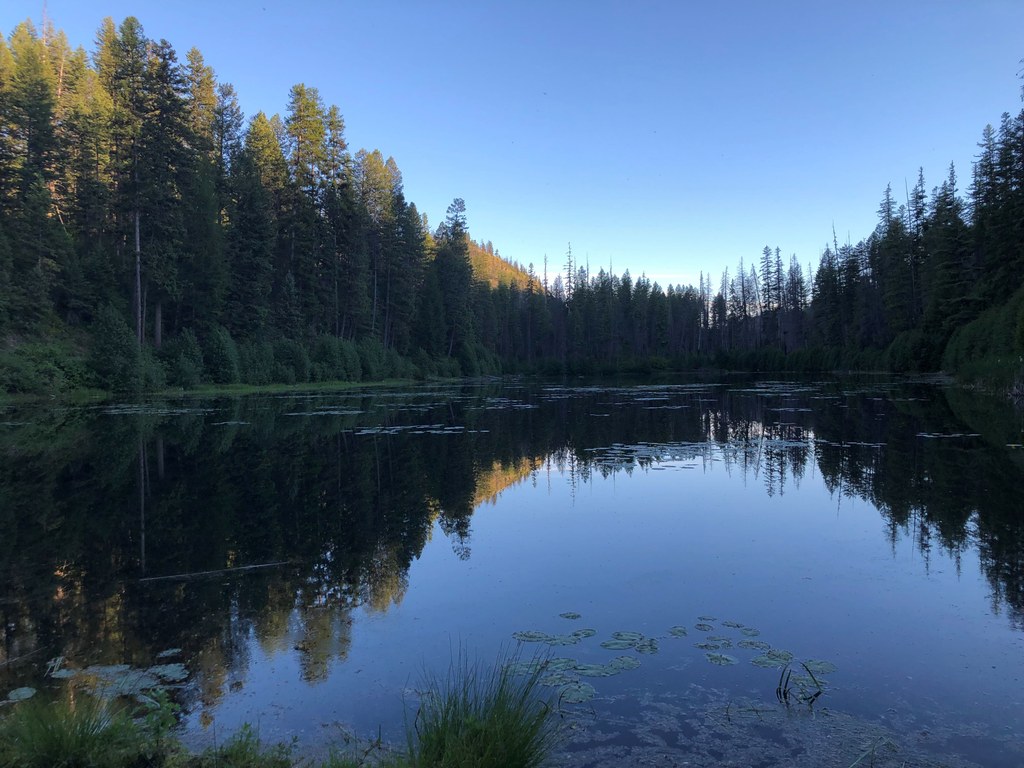
Fish Lake and its neighbor, Long Lake are in a quiet, narrow canyon between steep cliffs and talus slopes. You’re likely to hear loon calls echoing off the canyon walls. The Fish Lake Trail follows the western shore of Fish Lake and leads to the Long Lake Campground.

The north trailhead is at a small gravel pull-out that’s also a boat launch (non-motorized craft only). The trail proceeds through the woods along the scenic lakeshore, with easy lake access for fishing. When you get to the south end of the lake, the trail disappears into some fallen trees and undergrowth.

Do a little bushwhacking and work your way east, along the southern lakeshore. Pick up the trail again and walk south, ending up at the Long Lake Campground. You can either return the way you came or walk on the gravel road back to the north trailhead.

WTA Pro-Trip: Drinking water is available from an old-style hand pump in the Long Lake Campground. Fish Lake and Long Lake are good fishing spots (fly fishing only, no motorized boats). Because this area is brushy, hikers should watch for ticks.

Toilet Information

  • Toilet at trailhead

More information about toilets

Hike Description Written by
Mary Hartman, WTA Correspondent

Fish Lake

Map & Directions

Trailhead
Co-ordinates: 48.5067, -118.8077 Open in Google Maps

Before You Go

See weather forecast

Parking Pass/Entry Fee

None

WTA Pro Tip: Save a copy of our directions before you leave! App-based driving directions aren't always accurate and data connections may be unreliable as you drive to the trailhead.

Getting There

From Republic, take Washington Highway 21 south 7 miles to Forest Road 53 (Scatter Creek). Turn right and follow Scatter Creek for 6 miles. Turn left on forest road 5300-400.

Follow this road 0.5 mile to a gravel pullout on the right, adjacent to Fish Lake. There is another trailhead in Long Lake Campground near campsite 1. There’s also a trail sign along the gravel road at the midpoint of the hike, but there is no parking at that location.

More Hike Details

Trailhead

Eastern Washington > Okanogan Highlands/Kettle River Range

Fish Lake (#2)

Colville National Forest, Republic Ranger District

Guidebooks & Maps

100 Hikes in the Inland Northwest (Landers)

USGS Swan Lake

DNR Republic

You can improve or add to this guidebook entry!

Fish Lake

0 Trip Reports

Hiked here recently?

Submit a trip report!
 
There aren't any trip reports for this hike yet.