Trails for everyone, forever

Home Go Hiking Hiking Guide Forest Park - Everett

Forest Park - Everett

Puget Sound and Islands > Seattle-Tacoma Area
47.9621, -122.2194 Map & Directions
Length
4.9 miles of trails
Elevation Gain
1,100 feet
Highest Point
370 feet
Explore the miles of wooded trails at Forest Park – Everett which is the largest park in the city of Everett. Photo by Burger22. Full-size image
Saved to My Backpack

With several miles of wooded trails, a self-guided nature tour plus hill climb and orienteering courses, Forest Park gives you plenty of reasons to get outdoors without leaving the city. Continue reading

  • Wildlife
  • Good for kids
  • Dogs allowed on leash
  • Fall foliage

Parking Pass/Entry Fee

None
Rating
3.50 out of 5

(2 votes) Log in to rate

Hiking Forest Park - Everett

With several miles of wooded trails, a self-guided nature tour plus hill climb and orienteering courses, Forest Park gives you plenty of reasons to get outdoors without leaving the city.

Forest Park is the largest park in the City of Everett with 197 acres to explore. Built in the 1930s by the Works Progress Administration of Roosevelt’s New Deal, you can still admire their well-built structures today as you navigate trails on the terraced hillside in North Everett. 

The trail system is a mix of soft wooded trail, moss-lined stairs, aged service road and boot path. Design your own route a la a 'Choose Your Own Adventure' book, or follow a combination of the 13 hill climb courses in the park for up to 4.9 miles and 1,105 feet of gain. 

There are mapped kiosks that show the routes, all designated with numbered markers. If you want a more relaxed outing, you can wander instead on the upper ridge trail, learning about nature aspects noted by a local Boy Scout troop. For the more adventurous, use the wooden posts marked with orienteering control descriptions on the two permanent courses the park offers to practice navigation skills for any upcoming wilderness escapades.

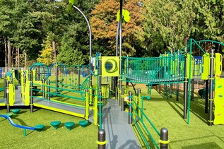
If the variety of trails isn't enough for you, use the playground monkey bars for upper body strength and the lengthy parking lot curbs for balance training. And if your timing is right, you can take a swim in the indoor pool or summer offers a spray park for cooling down. Whether you only have a short amount of time or want to stretch your legs before or after a ride on the Mukilteo Ferry, Forest Park is the perfect urban option!

WTA Pro Tip: Make it easier to work in a visit to your local park after work, before you get home and become distracted with other tasks. It's easier when you keep trail shoes in the car, too!

Hike Description Written by
Shannon Leader, WTA Correspondent

Forest Park - Everett

Map & Directions

Trailhead
Co-ordinates: 47.9621, -122.2194 Open in Google Maps

Before You Go

See weather forecast

Parking Pass/Entry Fee

None

WTA Pro Tip: Save a copy of our directions before you leave! App-based driving directions aren't always accurate and data connections may be unreliable as you drive to the trailhead.

Getting There

Forest Park is located at 802 E. Mukilteo Boulevard, Everett, 98203.

From I-5, take the exit 192 (for 41st St), and cross over the freeway heading towards 41st and the Mukilteo Ferry.

41st soon turns into Mukilteo Blvd and you take the first left into the park just after you pass under an old pedestrian overpass. You can park in the small parking lot just in on the left or follow the road up into the main area of the park. The park is open during daylight hours.

take transit

This trailhead is accessible by bus! Plan your visit by bus using TOTAGO, or consult the schedules for Everett Transit route number 3 or route number 18.

More Hike Details

Trailhead

Puget Sound and Islands > Seattle-Tacoma Area

City of Everett

Guidebooks & Maps

https://myeverettnews.com/wp-content/uploads/2014/08/Forest-Park-Map-300x224.jpg

You can improve or add to this guidebook entry!

Forest Park - Everett

24 Trip Reports

Hiked here recently?

Submit a trip report!
 
Trip Reports