Trails for everyone, forever

Home Go Hiking Hiking Guide Friends Landing

Friends Landing

Southwest Washington > Long Beach Area
46.9479, -123.6368 Map & Directions
Length
1.7 miles, roundtrip
Elevation Gain
15 feet
Highest Point
20 feet
Calculated Difficulty About Calculated Difficulty
Easy
Alders arching over the paved trail at Friends Landing put you up close and personal with nature. Photo by Anna Roth. Full-size image
  • Wildflowers/Meadows
  • Wildlife
  • Dogs allowed on leash
  • Good for kids
  • Lakes
  • Fall foliage
  • Rivers

Parking Pass/Entry Fee

None
Saved to My Backpack

Built by a Trout Unlimited board member who wanted to give a newly wheelchair-bound friend a way to enjoy fishing and the outdoors, Friends Landing provides a delightful outing around Quigg Lake, which is stocked with a variety of fish, so it’s good for folks who want to bring a rod and relax, too. Continue reading

Rating
0.00 out of 5

(0 votes) Log in to rate

Hiking Friends Landing

Built by a Trout Unlimited board member who wanted to give a newly wheelchair-bound friend a way to enjoy fishing and the outdoors, Friends Landing provides a delightful outing around Quigg Lake, which is stocked with a variety of fish, so it’s good for folks who want to bring a rod and relax, too.

Formerly a gravel pit, the acreage here was donated by the Friend family in 1988 to David Hamilton of Trout Unlimited, who proposed an accessible area for all users. Trout Unlimited supported the project, along with Columbia Pacific RC&D and Grays Harbor County.

Begin from the parking area along Katon Road and walk counterclockwise through a camping area and playground, passing a floating fishing dock and the first of a few interpretive signs. A road on the other side of the Chehalis River provides background noise, but that will fade as the route bends right, turning into a more forested walk as it parallels Quigg Lake and the Chehalis River.

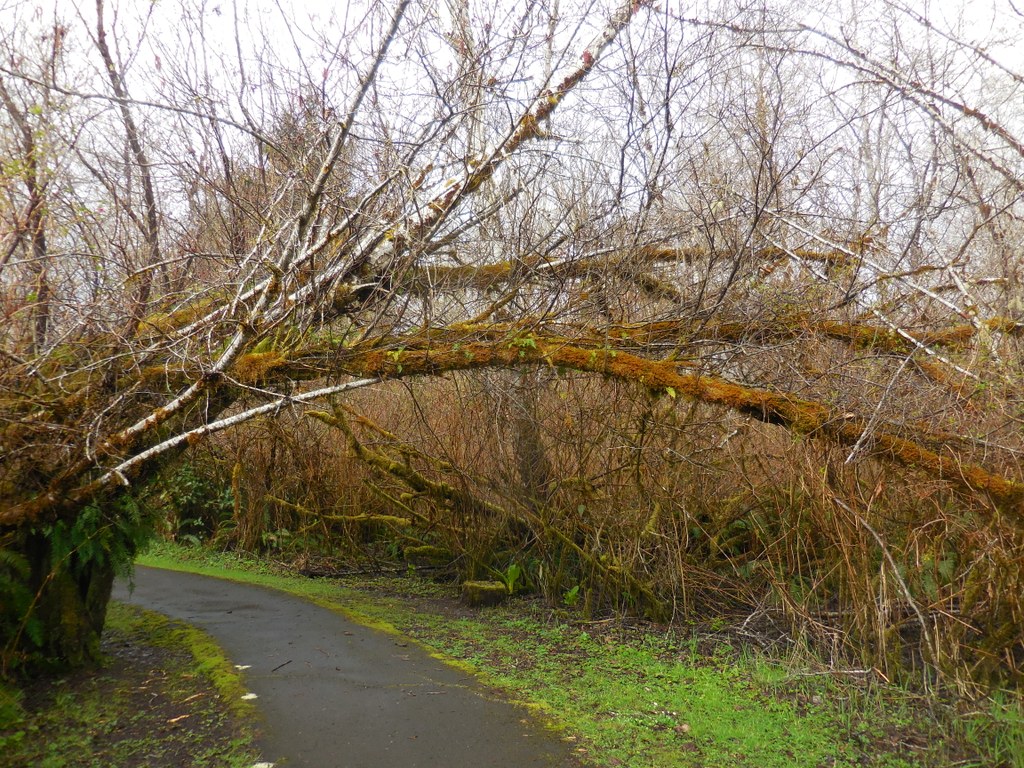
Loop around the west edge of Quigg Lake, crossing a boardwalk that may be slippery in wet weather and a bridge over a wide stream that drains the lake and feeds the Chehalis River. On the north side of the lake, the trail becomes a bit more rugged, with greenery growing closer, and sometimes right over the trail.

Alder, ferns and moss are here, as well as one or two benches for folks who want to sit and contemplate the area. Two spur trails also offer opportunities to get a bit closer to the quiet water before you reach the parking area. 

Toilet Information

More information about toilets

Wheelchair Accessibility

The boardwalk may become slippery when wet and can flood completely in particularly wet weather. If this occurs simply come back the way you came rather than completing the loop

Hike Description Written by
Anna Roth, WTA Staff

Friends Landing

Map & Directions

Trailhead
Co-ordinates: 46.9479, -123.6368 Open in Google Maps

Before You Go

See weather forecast

Parking Pass/Entry Fee

None

WTA Pro Tip: Save a copy of our directions before you leave! App-based driving directions aren't always accurate and data connections may be unreliable as you drive to the trailhead.

Getting There

From Highway 12 heading west, proceed through Montesano and take the Devonshire Road exit, signed for Friends Landing. Take a right at the intersection signed for Wynoochee Valley Road, merging onto Highway 410 and then an immediate right onto Devonshire Road. Cross back over Highway 12 and continue for a little more than 1 mile to the turn onto Katon Road.

Katon Road is a residential road, so be mindful of neighbors here as you drive 1.3 miles to the trailhead, signed for Friends Landing.

More Hike Details

Trailhead

Southwest Washington > Long Beach Area

Port of Grays Harbor

Guidebooks & Maps

Day Hiking: Olympic Peninsula (Romano - Mountaineers Books)

Download a map to plan your hike

You can improve or add to this guidebook entry!

Friends Landing

5 Trip Reports

Hiked here recently?

Submit a trip report!
 
Trip Reports