Trails for everyone, forever

Home Go Hiking Hiking Guide Goat Creek
WTA is a nonprofit that needs you

We're just as excited as you to get the summer hiking season started. We're psyched our website, app and work for trails help you get outside.

But we're a nonprofit that runs on donations from regular people. If everyone who visited this site this holiday weekend donated $9/month, it would fully fund our work for the next 2 years. Time spent outdoors is priceless, but every donation large or small helps us support those experiences for everyone. Thank you and happy hiking!


Please take 2 minS to chip in $9

link

Goat Creek

Mount Rainier Area > Chinook Pass - Hwy 410
46.9169, -121.2337 Map & Directions
Length
9.8 miles, roundtrip
Elevation Gain
3,400 feet
Highest Point
6,473 feet
Calculated Difficulty About Calculated Difficulty
Hard
See breathtaking mountain views on the Goat Creek trail. Photo by Lisa Black.
  • Ridges/passes
  • Dogs allowed on leash
  • Established campsites
  • Summits
  • Lakes
  • Rivers

Parking Pass/Entry Fee

Northwest Forest Pass
Saved to My Backpack

The Goat Creek trail ascends at a moderate pace from the Bumping River valley up to American Ridge and Goat Peak. The trail can be accessed via the Cougar Flat Campground. Continue reading

Rating
4.00 out of 5

(2 votes) Log in to rate

Hiking Goat Creek

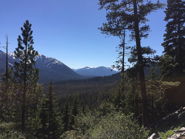
Once the site of a U.S. Forest Service lookout, Goat Peak’s 6,473-foot summit showcases such impressive gems as the Goat Rocks, Bumping Lake, Mount Rainier, Fife’s Peak, and the Stuart Range.

The Goat Creek trail ascends at a moderate pace from the Bumping River valley up to American Ridge and Goat Peak. This approach to the ridge and peak offers much more solitude than the more popular trails from the north.  Goat Peak offers expansive views into the William O. Douglas Wilderness and beyond.

WTA worked here in 2022, 2020 and 2018!

Goat Creek

Map & Directions

Trailhead
Co-ordinates: 46.9169, -121.2337 Open in Google Maps

Before You Go

See weather forecast

Parking Pass/Entry Fee

Northwest Forest Pass

WTA Pro Tip: Save a copy of our directions before you leave! App-based driving directions aren't always accurate and data connections may be unreliable as you drive to the trailhead.

Getting There

From Naches travel west on Highway 12 for 4.4 miles. Continue straight onto Highway 410 for 27.5 miles. Turn left onto Bumping River Road/Forest Road 1800 and travel 5.9 miles to trailhead which is on right side of road, near Cougar Flat Campground.

More Hike Details

Trailhead

Mount Rainier Area > Chinook Pass - Hwy 410

Goat Creek (#959)

Okanogan-Wenatchee National Forest, Naches Ranger District

Guidebooks & Maps

Green Trails Bumping Lake No. 271

Green Trails Old Scab Mountain No. 272

Buy the Green Trails Bumping Lake No. 271 map

Buy the Green Old Scab Mtn No. 272 map

You can improve or add to this guidebook entry!

Goat Creek

25 Trip Reports

Hiked here recently?

Submit a trip report!
 
Trip Reports