
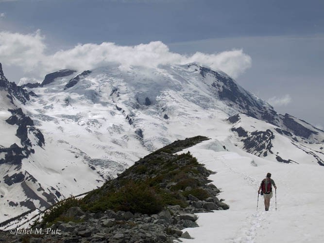
Goat Island Mountain is an off-trail scramble in Mount Rainier National Park. Routefinding and scrambling skills are necessary for this route.
Goat Island Mountain

-
 Highest Point
- 7,288 feet
Sunrise Road and White River Road have closed for the winter season.
Parking Pass/Entry Fee
National Park Pass
The route to the top of Goat Island Mountain is not on true trail but is more of a scramble.
Continue reading
Hiking Goat Island Mountain
Goat Island Mountain
Map & Directions
 Trailhead
Before You Go
Sunrise Road and White River Road have closed for the winter season.
Parking Pass/Entry Fee
National Park PassWTA Pro Tip: Save a copy of our directions before you leave! App-based driving directions aren't always accurate and data connections may be unreliable as you drive to the trailhead.
Getting There
Learn how to secure your timed-entry permit for Mount Rainier National Park here.
From Enumclaw, take Highway 410 east to the White River Entrance of Mt. Rainier National Park. Veer right on Sunrise Park Road (White River Road) and stop and park at the first sharp bend in the road just across the bridge over Fryingpan Creek.


