Trails for everyone, forever

Home Go Hiking Hiking Guide Golden Gate

Golden Gate

Mount Rainier Area > SW - Longmire/Paradise
46.7860, -121.7350 Map & Directions
Length
3.2 miles, roundtrip
Elevation Gain
1,000 feet
Highest Point
6,400 feet
Calculated Difficulty About Calculated Difficulty
Moderate
  • Wildflowers/Meadows
  • Mountain views
  • Wildlife
  • Waterfalls
  • Dogs not allowed
  • Fall foliage

Parking Pass/Entry Fee

National Park Pass
Saved to My Backpack

The Golden Gate trail provides a quick route to amazing panoramas of Mount Rainier and the craggy peaks of the Tatoosh Range. Pass through wildflower-studded alpine meadows, a clear sparkling stream, and up a steep, well-maintained trail. You can even make it a loop, if you want to explore the lush parkland at the foot of Washington's tallest mountain. Continue reading

Rating
4.14 out of 5

(7 votes) Log in to rate

Hiking Golden Gate

The Golden Gate trail provides a quick route to amazing panoramas of Mount Rainier and the craggy peaks of the Tatoosh Range. Pass through wildflower-studded alpine meadows, a clear sparkling stream, and up a steep, well-maintained trail. You can even make it a loop, if you want to explore the lush parkland at the foot of Washington's tallest mountain.

Begin at the Paradise Inn. This first section of trail is paved, but don't be misled -- it quickly turns to dirt with many steps. Strollers are best left at the car.

Within less than a quarter mile, arrive at a bridge over picturesque Myrtle Falls, where you have a great photo opportunity. Snap a picture, then continue on.

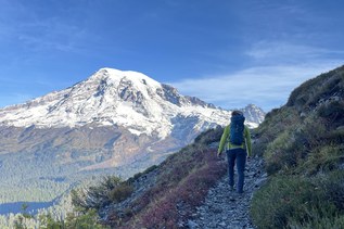
The trail becomes dirt and rocks here, and while the tread is pretty flat and wide, it can be uneven in places. As you look up ahead you may glimpse the trail switchbacking up the emerald-green slopes in front of you -- yes, you're headed up there.

About three-quarters of a mile in, you'll reach the base of those switchbacks and head up. Take your time and enjoy the ever-improving view of the Tatoosh Range. You'll begin to see the Paradise Inn and Visitors Center as well, and of course, the massif of Rainier looming ever larger.

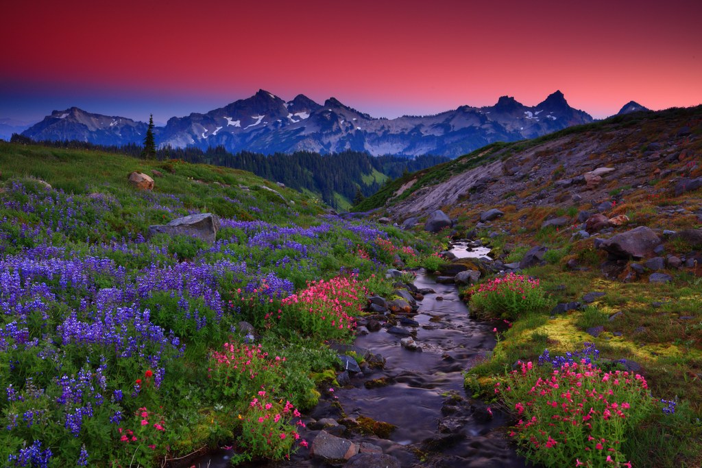
The "golden gate" that this hike is named for is the viewpoint at the junction with the Skyline Trail. Here there is a flat spot where you can sit and enjoy the views, but they only improve if you continue up the Skyline Trail. It is possible to create a loop hike with the Skyline Trail in either direction -- see WTA's entry for the Golden Gate Loop for more details on this.

If you are satisfied with your hike here, take a rest and head back to the parking lot the way you came.

Hike Description Written by
Anna Roth, WTA Staff

Golden Gate

Map & Directions

Trailhead
Co-ordinates: 46.7860, -121.7350 Open in Google Maps

Before You Go

See weather forecast

Parking Pass/Entry Fee

National Park Pass

WTA Pro Tip: Save a copy of our directions before you leave! App-based driving directions aren't always accurate and data connections may be unreliable as you drive to the trailhead.

Getting There

From Elbe, drive Highway 706 into Mount Rainier National Park to enter the park at the Nisqually entrance. Continue on this road to Paradise Lodge and parking area. If you require a bathroom stop before Paradise, there are restrooms at Longmire, or pit toilets at the Kautz Creek trailhead, 3 miles past the park boundary.

More Hike Details

Trailhead

Mount Rainier Area > SW - Longmire/Paradise

Mount Rainier National Park

Guidebooks & Maps

Green Trails Paradise No. 270S

You can improve or add to this guidebook entry!

Golden Gate

110 Trip Reports

Hiked here recently?

Submit a trip report!
 
Trip Reports