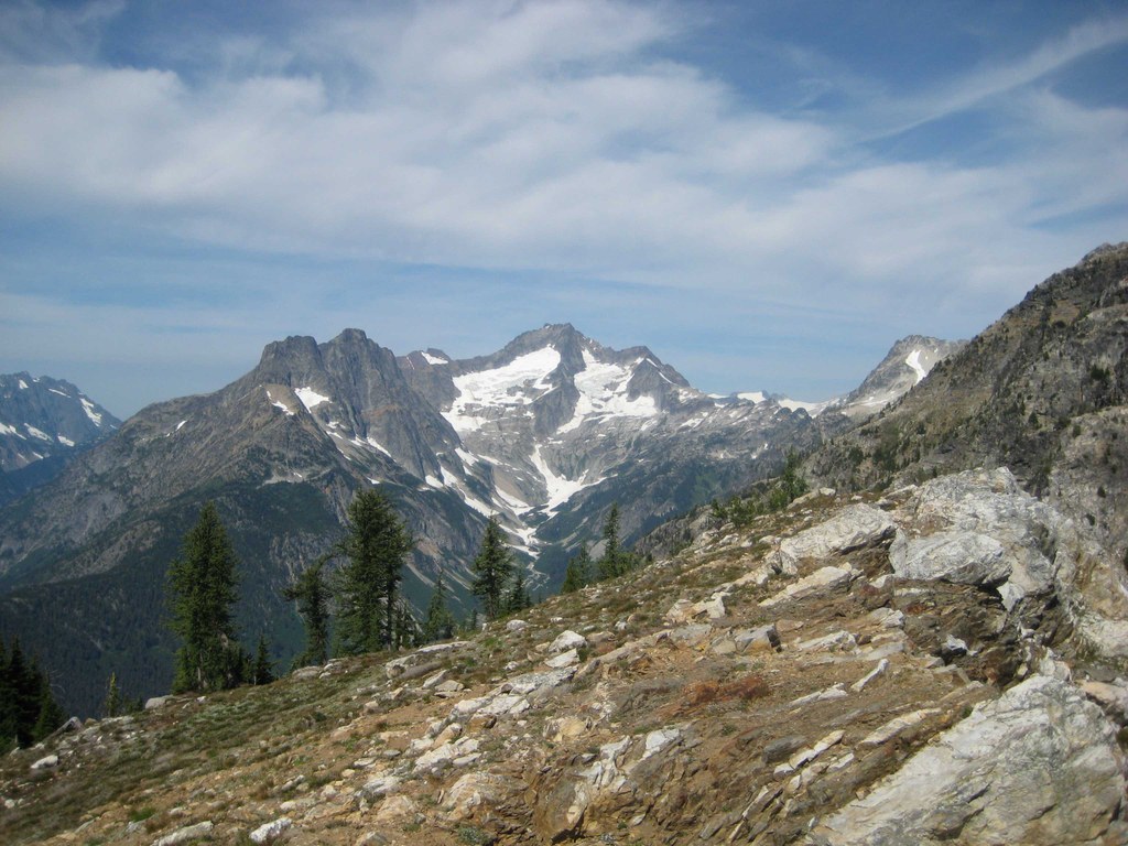

A fine trail for those willing to climb to get to great views in a remote part of the North Cascades National Park. Best done as a side trip off an overnight trip from Rainy Pass to Stehekin, or something similar.
The trail switchbacks 5 miles up to the old Goode Ridge Lookout site from the Stehekin River. There is regular brush and blow down on the lower half of the trail but neither is a show-stopper. No bugs or other problems. The upper half is in open meadows with great views. The last spring water is at around 3300' elevation. This is a well designed and well built but little visited trail.
Goode Ridge

-
 Length
- 10.0 miles, roundtrip
-
 Elevation Gain
- 4,400 feet
-
 Highest Point
- 6,600 feet
Parking Pass/Entry Fee
None
A fine trail for those willing to climb to get to great views in a remote part of the North Cascades National Park. Best done as a side trip off an overnight trip from Rainy Pass to Stehekin, or something similar.
Continue reading
Hiking Goode Ridge
Goode Ridge
Map & Directions
 Trailhead
Before You Go
A backcountry permit is required to camp overnight in the North Cascades National Park Complex (incl. Ross Lake National Rec Area and Lake Chelan National Rec Area). They are $10 per person plus a $6 non-refundable reservation fee. Permits must be picked up at the Wilderness Information Center in Marblemount. See the National Park Service website for more details on permits.
Parking Pass/Entry Fee
NoneWTA Pro Tip: Save a copy of our directions before you leave! App-based driving directions aren't always accurate and data connections may be unreliable as you drive to the trailhead.
Getting There
Drive the North Cascades Highway 20 to Rainy Pass (PCT south trailhead). Then hike 11 miles south on the PCT to the Stehekin River. Or, take a boat up Lake Chelan, then the shuttle bus to High Bridge, then 5 miles on the PCT north to the bridge over Bridge Creek. The trailhead is 100 yards up the Stehekin River Road from this bridge.


