
Looking for the perfect first hike for young kids? Eaten too much bratwurst in Leavenworth and need a walk in the woods to settle your stomach? Want a moderate flat snowshoe with a beautiful winter destination?
The short trail to Hidden Lake adjacent to Lake Wenatchee is the answer to all of these requests. Quite popular in summer, especially when the state park campground is full and the wind is up on the lake. About five years ago the trailhead for this trail was moved up off the Cedar Brae Road from Glacier View Campground and a new trail was constructed with a wide tread, and an easy grade.
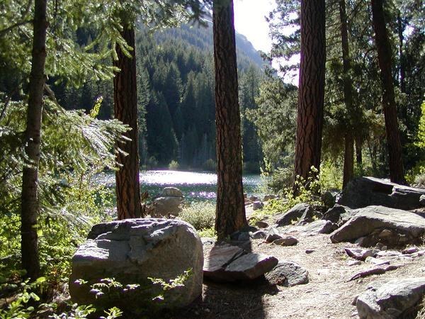
The first half-mile is ADA-accessible, as the trail winds up through old-growth fir and large cedars. Challenge kids to find to the two “cave trees”, old cedars where lightning long ago burned out caves into their bases. The trail traverses west providing peek-a-boo views of Lake Wenatchee and Dirty Face Mountain.
Just before reaching the lake you will cross an outlet stream with a few old logs used as a bridge. There are a number of picnic spots left of the outlet stream, the main access to the lake is up a small knob after crossing the outlet stream,
On the knob there are a half dozen very large ponderosa pines above the lake edge. If you turn around, back to the lake, and look north, you will see a trail marked by a large ponderosa which has been cut to let the trail pass through. This is the original trail, which goes down to Glacier View campground.
By following this trail down you can turn the hike into a loop, and stretch out the mileage to 2.5 miles total. Glacier view, as the name implies, has an incredible view of Glacier Peak, across Lake Wenatchee and up the White River valley.
You re-cross the outlet stream just above the campground on rocks in the stream, (not recommended early in the season). The only downside to this addition is a short road walk. To get back to the parking lot it is fastest to just walk up the road, about a half a mile, as opposed to retracing your steps. The trail down to Glacier View drops you below the parking area so you will climb an additional 200 feet back for a total of 400 feet.
If you are looking for more, there is a very nice out and back trail that follows the lake edge for roughly three-quarters of a mile, below the forest service cabins along the lakeshore. This trail can be found at the east end of the campground.
WTA Pro Tip: This trail is snowshoe-able! In winters, Cedar Brae Road is plowed to the end of the pavement. Park here and snowshoe out along the dirt section of the road for a mile, watch for the sign to the parking area on the left, the trail is popular enough that you will often find tracks to follow.
Hidden Lake (Lake Wenatchee)

-
 Length
- 1.6 miles, roundtrip
-
 Elevation Gain
- 220 feet
-
 Highest Point
- 2,320 feet
Looking for the perfect first hike for young kids? Eaten too much bratwurst in Leavenworth and need a walk in the woods to settle your stomach? Want a moderate flat snowshoe with a beautiful winter destination? The short trail to Hidden Lake adjacent to Lake Wenatchee is the answer to all of these requests.
Continue reading
Hiking Hidden Lake (Lake Wenatchee)
Map & Directions
 Trailhead
Before You Go
Parking Pass/Entry Fee
Northwest Forest PassWTA Pro Tip: Save a copy of our directions before you leave! App-based driving directions aren't always accurate and data connections may be unreliable as you drive to the trailhead.
Getting There
From Seattle, drive east on Highway 2. Proceed to the junction of 207. This is the Lake Wenatchee Highway, at Coles Corner. This is 20 miles east of Stevens Pass, 15 miles west of Leavenworth.
Turn north on 207. In 3.6 miles turn left on to Cedar Brae Road, also signed as the turn off for Lake Wenatchee State Park. Proceed 0.4 mile. Just before the entrance to the park turn left, go west for 3.1 miles to where the paved road ends in a bus turn around.
Continue for one mile on a dirt road to a left turn into a signed parking area.
From Leavenworth, proceed west on Highway 2. 15 miles west of Leavenworth to Coles Corner, Turn north on 207. In 3.6 miles, turn left on to Cedar Brae Road, also signed as the turn off for Lake Wenatchee State Park. Proceed 0.4 mile, just before the entrance to the park turn left, go west for 3.1 to where the paved road ends in a bus turn around, continue for one mile on dirt to a left turn into a signed parking area.


