
Hike a valley trail through old growth forest to the base of a peak, then take an off trail class 2 scramble to the summit.
Park just to the east of Rainy Pass at the Bridge Creek PCT trailhead. Cross to the southern side of Highway 20 to the PCT, and follow it to a junction with the Stiletto Spur trail.
Take the Stiletto Spur trail. At the junction with the Stiletto Peak trail, stay right. Stay right again at the junction with the Twisp Pass trail, then almost immediately take a left onto the McAlester trail. Just after the North Cascades National Park Boundary, look up at Hock Mountain which will be on your left. Twin avalanche paths give a great view.
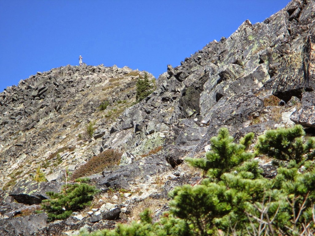
Choose a path up the west slope, eventually following the southwest ridge to the summit. You may find it easiest to look for animal trails to follow, but the west side has no cliffs so many different routes will work. At the summit the views are huge, including Jack Mountain, Silverstar, Bonanza, Glacier peak, Goode Mountain, McAlester, McGregor, Dome, Black.... The cliff on the north side is almost too scary to look over.
Bring a map of the North Cascades and play "name that peak". If you do this hike in October you will enjoy the fall color of red blueberries and golden larches, and lots of mushrooms along the forest trail. Some of the creek crossings may be difficult due to broken bridges and slippery logs.
Hock Mountain

-
 Length
- 16.0 miles, roundtrip
-
 Elevation Gain
- 5,000 feet
-
 Highest Point
- 7,750 feet
Highway 20 is closed between the Ross Dam trailhead (milepost 134) and Silver Star gate (milepost 171) for the winter season.
Parking Pass/Entry Fee
Northwest Forest Pass
Hike a valley trail through old growth forest to the base of a peak, then an off trail class 2 scramble to the summit.
Continue reading
Hiking Hock Mountain
Map & Directions
 Trailhead
Before You Go
A backcountry permit is required to camp overnight in the North Cascades National Park Complex (incl. Ross Lake National Rec Area and Lake Chelan National Rec Area). They are $10 per person plus a $6 non-refundable reservation fee. Permits must be picked up at the Wilderness Information Center in Marblemount. See the National Park Service website for more details on permits.
Highway 20 is closed between the Ross Dam trailhead (milepost 134) and Silver Star gate (milepost 171) for the winter season.
Parking Pass/Entry Fee
Northwest Forest PassWTA Pro Tip: Save a copy of our directions before you leave! App-based driving directions aren't always accurate and data connections may be unreliable as you drive to the trailhead.


